Old Maps of Portage Township, Ohio for Genealogy
Trace your family roots with 36 historic maps of Portage Township. These high-res maps reveal old neighborhoods, homesites, landmarks, and streets — helping you uncover where your ancestors lived and how the area evolved over time.
- Explore historic neighborhoods: Identify where your relatives may have lived in the 1800s or 1900s.
- Compare maps over time: Trace the changes in streets, buildings, and landmarks for multi-generational research.
- Perfect for genealogy & ancestry research: Used by family historians and researchers to map out lineage and migration.
These maps are an incredible resource for exploring your personal connection to Portage Township's past.
Portage Township, OH maps
(36)- 1901 Map of Put-In-Bay, 1958 Print
 1901 Put-In-Bay1958 Print · USGSOttawa County's shoreline and the famous Lake Erie islands are captured at the start of the twentieth century, before modern development reshaped the coast. Genealogists and historians can trace the rail lines of the Lakeside and Sandusky Line and locate early settlements like Gypsum and St. George.
 - 1901 Map of Bellevue, 1958 Print
 1901 Bellevue1958 Print · USGSAcross the marshy lowlands and limestone springs of Erie and Sandusky counties at the turn of the century, a massive railroad network dominates the landscape. Genealogists can trace family footprints in Clyde and Bellevue or locate vanished rail stops at Thames and Parkertown.
 - 1903 Map of Bellevue
 1903 Bellevue1903 Print · USGSNear the dawn of the twentieth century, the junction of Erie and Sandusky counties was a bustling corridor of rail and water transport. Genealogists and historians can trace the early footprints of Bellevue and Clyde, or find specific local landmarks like the Blue Hole and the Connecticut Western Reserve Boundary Line.5 unique versions available
 - 1903 Map of Put In Bay, 1939 Print
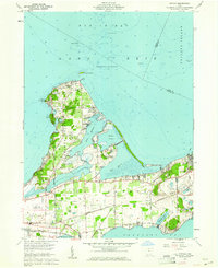
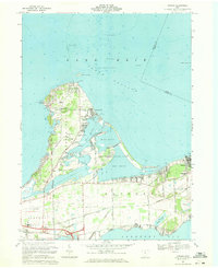
 1903 Put In Bay1939 Print · USGSOttawa County's shoreline and islands are captured in the early twentieth century, showing a world of maritime transit and early rail. Genealogists can trace the early layout of Port Clinton and the distinct settlements of Put in Bay, Gypsum, and Lakeside.
 - 1956 Map of Toledo, 1968 Print
 1956 Toledo1968 Print · USGSNorthwest Ohio and the Lake Erie shoreline are shown in detail during the late fifties, showcasing a landscape of heavy industry, railroads, and island communities. Genealogists and historians can trace rail networks like the Chesapeake & Ohio RR or locate landmarks such as the Erie Proving Ground and Kelleys Island.4 unique versions available
 - 1957 Map of Vickery, 1960 Print
 1957 Vickery1960 Print · USGSCoastal Sandusky Bay was a mix of marshy wetlands and emerging industry in the late fifties. Genealogists and historians can trace family roots through markers like Township Sch, Riley Grange, and the waterfront at Whites Landing.
 - 1959 Map of Port Clinton, 1960 Print
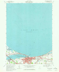
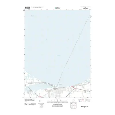
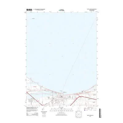
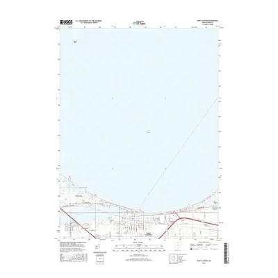
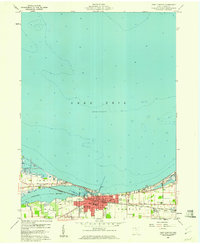 1959 Port Clinton1960 Print · USGSPort Clinton and the industrial shoreline of Lake Erie are captured here during the late fifties as the lakefront economy hummed. Local researchers can trace family plots at Lakeview Cem or locate lost landmarks like the Drive-in Theater and the New York Central rail line.
 - 1959 Map of Gypsum, 1961 Print
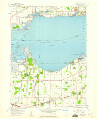
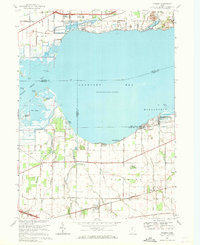
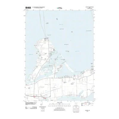
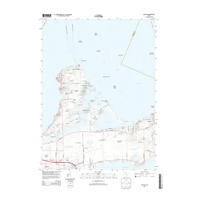
 1959 Gypsum1961 Print · USGSThe Lake Erie shoreline in the late fifties shows a fascinating overlap of limestone industry and growing vacation communities. Local historians can trace the massive Marblehead Quarry operations alongside established settlements like Lakeside and Danbury.
 - 1959 Map of Castalia, 1965 Print
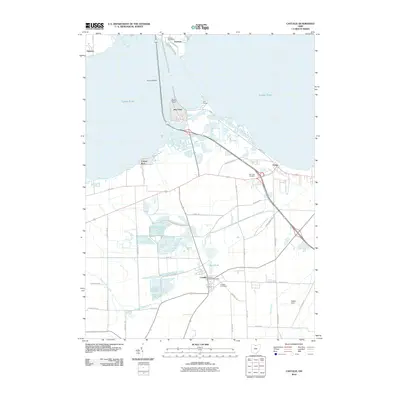
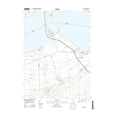
 1959 Castalia1965 Print · USGSCoastal Erie County and the Sandusky Bay shoreline are captured here in the late fifties as rail lines and industrial quarries defined the local economy. Genealogists and researchers can locate the Trinity Ch, trace the Pennsylvania Railroad, or find the Blue Hole and Township Sch.
 - 1961 Map of Toledo
 1961 Toledo1961 Print · USGSThe western basin of Lake Erie and the industrial heart of Northern Ohio are captured here during the post-war era. Researchers can trace historical rail lines like the New York Central or locate landmarks like the Erie Ordnance Depot and Pelee Island.
 - 1969 Map of Vickery, 1971 Print
 1969 Vickery1971 Print · USGSCoastal Sandusky Bay and the interior marshlands are frozen in time just before the 1970s, showing a landscape shaped by water and industry. Genealogists and historians can trace old community anchors like Good Shepherd Ch, the Gypsum Quarry, and the small lakeside settlement at Whites Landing.
 - 1969 Map of Gypsum, 1971 Print
 1969 Gypsum1971 Print · USGSCatawba Island and the Marblehead Peninsula are shown here in the late sixties as both a vacation destination and an industrial hub. Researchers can trace family sites at Sackett Cem, the massive Marblehead Quarry, and the community of Lakeside.3 unique versions available
 - 1969 Map of Castalia, 1971 Print
 1969 Castalia1971 Print · USGSCoastal Erie County and the southern shores of Sandusky Bay come into focus in the late sixties, showcasing a landscape defined by water and industry. Genealogists and local historians can trace the foundations of Venice and Castalia, or locate the Oak Lawn Cem and Bogart Sch.2 unique versions available
 - 1969 Map of Port Clinton, 1971 Print
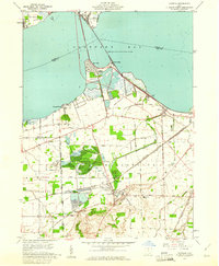
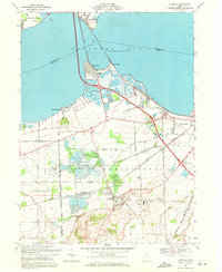
 1969 Port Clinton1971 Print · USGSPort Clinton sits at the mouth of the Portage River during a period of steady shoreline growth and industrial activity. Genealogists and local historians can trace family markers at Lakeview Cem, explore the rail layout of the Penn Central, or locate the old Drive-in Theater.
 - 1986 Map of Put-In-Bay
 1986 Put-In-Bay1986 Print · USGSThe Lake Erie archipelago and Ohio shoreline are documented here in the mid-eighties, showing the region's unique maritime and rail connectivity. Trace island life and landmarks like the Marblehead Lighthouse, Put-in-Bay, and Kelleys Island.2 unique versions available
 - 1986 Map of Lorain
 1986 Lorain1986 Print · USGSThe Lake Erie shoreline and North Central Ohio interior are shown in detail during the mid-eighties, from the industrial docks of Lorain to the peninsulas of Sandusky. Researchers can trace historic transport routes like the Baltimore and Ohio Railroad or locate significant landmarks like Oberlin College and Cedar Point.2 unique versions available
 - 2010 Map of Gypsum, 2010 Print
 2010 Gypsum2010 Print · USGSCovers Portage Township, including Catawba Island, Put-in-Bay Township, and other nearby areas
 - 2010 Map of Castalia, 2010 Print
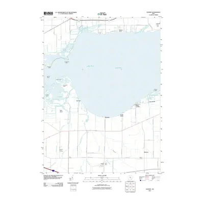
 2010 Castalia2010 Print · USGSCovers Portage Township, including Sandusky, Danbury, and other nearby areas
 - 2010 Map of Port Clinton, 2010 Print
 2010 Port Clinton2010 Print · USGSCovers Portage Township, including Port Clinton, Put-in-Bay Township, and other nearby areas
 - 2010 Map of Vickery, 2010 Print
 2010 Vickery2010 Print · USGSCovers Portage Township, including Port Clinton, Whitmore, and other nearby areas
 - 2013 Map of Vickery, 2013 Print
 2013 Vickery2013 Print · USGSCovers Portage Township, including Port Clinton, Whitmore, and other nearby areas
 - 2013 Map of Port Clinton, 2013 Print
 2013 Port Clinton2013 Print · USGSCovers Portage Township, including Port Clinton, Put-in-Bay Township, and other nearby areas
 - 2013 Map of Castalia, 2013 Print
 2013 Castalia2013 Print · USGSCovers Portage Township, including Sandusky, Danbury, and other nearby areas
 - 2013 Map of Gypsum, 2013 Print
 2013 Gypsum2013 Print · USGSCovers Portage Township, including Catawba Island, Put-in-Bay Township, and other nearby areas
 - 2016 Map of Port Clinton, 2016 Print
 2016 Port Clinton2016 Print · USGSCovers Portage Township, including Port Clinton, Put-in-Bay Township, and other nearby areas
Showing maps 1-25 of 36
Top cities near Portage Township
- Sandusky historical maps
- Fremont historical maps
- Green Creek historical maps
- Clyde historical maps
- Port Clinton historical maps
- Danbury historical maps
See more
Top neighborhoods of Portage Township
Frequently asked questions
- What are the different types of historical maps available for Portage Township?
- What is the oldest map of Portage Township?
- Where can I purchase historical maps of Portage Township for my home or office?
- Where can I download high-res historical maps of Portage Township?
- Are there historical topographic maps available for Portage Township?
- Is there historical aerial imagery available for Portage Township?
- Where are historical maps of Portage Township sourced from?