Old Maps of Darby Township, Ohio
Explore 30 old maps of Darby Township, spanning from 1906 to today. These high-resolution historic maps reveal how streets, neighborhoods, landmarks, and natural features evolved over time — perfect for genealogy, metal detecting, research, and local history exploration.
What you can do with these maps:
- See how Darby Township changed over time: Compare historical maps to modern-day views to trace roads, homesites, rail lines & more.
- View detailed metadata: Each map includes creators, publishers, year, scale, and archive source.
- Overlay maps with satellite & LiDAR: Visualize the past alongside modern tools to explore terrain & human change.
- Trusted historical sources: Maps sourced from the USGS, Library of Congress, and other archives.
- Access maps your way: View online, download high-res files, or order prints for personal or research use.
Start exploring old maps of Darby Township to uncover forgotten places, hidden landmarks, and the deep history beneath your feet.
Darby Township, OH maps
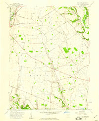
(30)- 1906 Map of Mt Sterling, 1946 Print
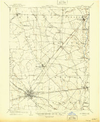 1906 Mt Sterling1946 Print · USGSCentral Ohio at the start of the twentieth century is a landscape of thriving rail hubs and rural townships. Trace the convergence of five railroads at Washington Courthouse and find family landmarks like the County Infirmary or Bloomingburg.
 - 1911 Map of Era, 1952 Print
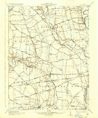
 1911 Era1952 Print · USGSPickaway County at the start of the 1900s is a landscape of established farmsteads and creekside milling. Genealogists can trace family footprints through numerous rural school sites like Tick Ridge School or Locust Grove School and find early commerce hubs like Crownover Mill and Williamsport.
 - 1913 Map of Era, 1936 Print
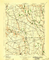
 1913 Era1936 Print · USGSPickaway County agricultural life and early transport networks are preserved here in the years before the Great War. Genealogists and local historians can locate dozens of country schoolhouses like Dublin Hill School and river crossings such as Becks Ford and Gulicks Ford.
 - 1923 Map of West Columbus, 1955 Print
 1923 West Columbus1955 Print · USGSFranklin County in the early twenties shows the growing western edge of Columbus and its surrounding rural townships. Genealogists and historians can trace the paths of the National Road and find landmarks like Camp Chase, Urbancrest, and Pisgah School.
 - 1925 Map of West Columbus, 1946 Print
 1925 West Columbus1946 Print · USGSFranklin and Pickaway counties are shown here in the mid-twenties, when the growing state capital met a landscape of electric railways and rural schoolhouses. Researchers can trace the National Road and locate sites like the Pisgah School, Mt Calvary Cemetery, and the State Hospital.
 - 1943 Map of Era
 1943 Era1943 Print · USGSPickaway and Ross Counties are shown in the early 1940s, a period when rural education and river-based land divisions still shaped the Ohio countryside. Genealogists can locate dozens of country schoolhouses like Frogeye Sch and trace the Pennsylvania rail line through Williamsport and Atlanta.
 - 1947 Map of Columbus, 1948 Print
 1947 Columbus1948 Print · USGSCentral Ohio in the late 1940s is captured in this survey, showing the post-war transition of its rail hubs and military airfield expansions. Genealogists and historians can trace the paths of the Ohio Canal, the Pennsylvania RR lines, and the Camp Sherman Military Reservation.
 - 1955 Map of Harrisburg, 1956 Print
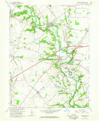
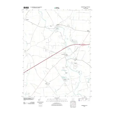
 1955 Harrisburg1956 Print · USGSThe rural borderlands of Franklin, Pickaway, and Madison counties come to life in the mid-fifties as the Baltimore and Ohio Railroad connects the towns of Orient and Derby. Researchers can trace the grounds of the Orient State Institute or locate family plots at Little Pennsylvania Cem and McKinley Cem.
 - 1958 Map of Five Points, 1959 Print
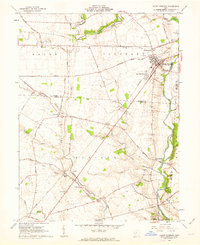
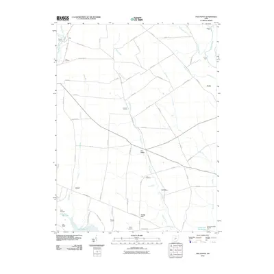
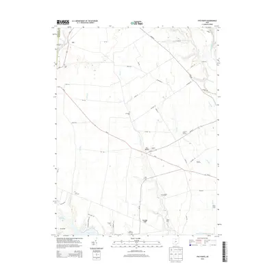
 1958 Five Points1959 Print · USGSPickaway County farming life is captured in the late fifties as a network of rural roads connects local hubs like Five Points and Era. Genealogists and historians can trace family-named landmarks and routes like Whiteside-Lister Mill Road and Thomas Cem.4 unique versions available
 - 1961 Map of Columbus
 1961 Columbus1961 Print · USGSCentral and Southern Ohio are captured here in the early sixties, as the region's industrial rail hubs and military bases reached their peak. Genealogists and historians can trace the transition from urban Columbus to rural townships along the Scioto River, locating Lockbourne USAF and old junctions like Washington Court House.
 - 1961 Map of Mount Sterling, 1963 Print
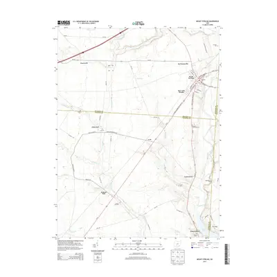
 1961 Mount Sterling1963 Print · USGSMadison and Fayette counties come into focus during the early sixties as a network of rail and river commerce. Genealogists can trace family names at McClimansville Cemetery or Madison Mills Cem, and locate the Covered Bridge on Deer Creek.2 unique versions available
 - 1962 Map of Columbus
 1962 Columbus1962 Print · USGSCentral Ohio during the early sixties reveals a transition from the industrial corridors of Columbus to the forested ridges of the south. Genealogists and historians can trace the rail networks of the Baltimore & Ohio RR and find local landmarks like Washington Court House and Camp Sherman Military Reservation.
 - 1966 Map of Harrisburg, 1968 Print
 1966 Harrisburg1968 Print · USGSCentral Ohio farmland meets institutional history in the mid-1960s at the intersection of Franklin, Madison, and Pickaway counties. Genealogists can trace family names at Fitzgerald Cem or locate former residences in Harrisburg, Darbydale, and the Orient State Institute.3 unique versions available
 - 1967 Map of Columbus, 1969 Print
 1967 Columbus1969 Print · USGSCentral Ohio during the late sixties serves as a vital corridor of rail and aviation, from the industrial streets of Springfield to the hangar lines of Lockbourne Air Force Base. Genealogists and researchers can trace the growth of towns like Circleville and London or locate rural landmarks such as St Paul church and the London Correctional Institution.2 unique versions available
 - 1986 Map of Springfield
 1986 Springfield1986 Print · USGSCentral Ohio in the mid-1980s shows the bustling rail-and-road network connecting Springfield and Xenia to the western outskirts of Columbus. Researchers can trace old family sites and transit routes through Glen Haven Mem Cem, Madison Lake State Park, and the CONRAIL line.2 unique versions available
 - 2010 Map of Mount Sterling, 2010 Print
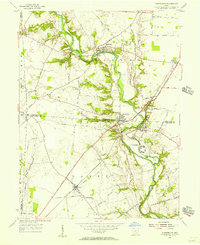
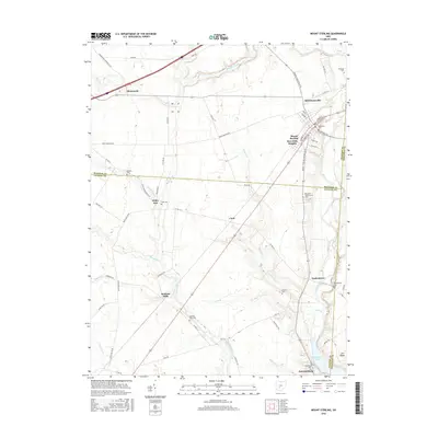
 2010 Mount Sterling2010 Print · USGSCovers Darby Township, including Mount Sterling, Madison Mills, and other nearby areas
 - 2010 Map of Five Points, 2010 Print
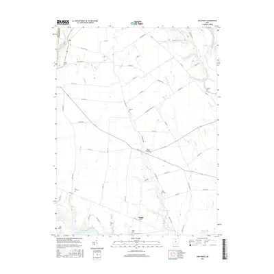
 2010 Five Points2010 Print · USGSCovers Darby Township, including Five Points, Monroe Township, and other nearby areas
 - 2010 Map of Harrisburg, 2010 Print
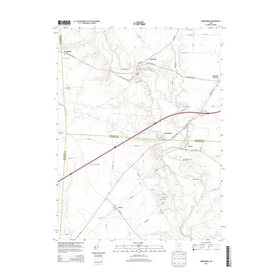
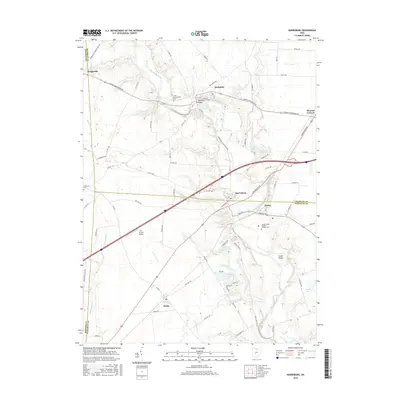
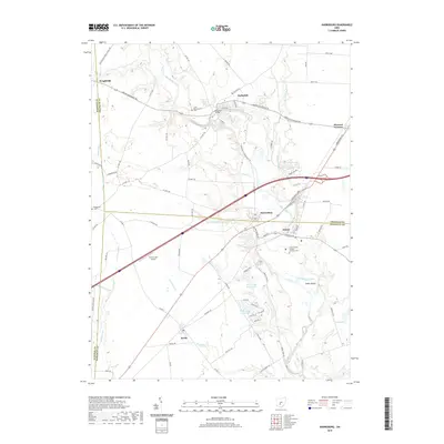
 2010 Harrisburg2010 Print · USGSCovers Darby Township, including Orient, Pleasant Township, and other nearby areas
 - 2013 Map of Five Points, 2013 Print
 2013 Five Points2013 Print · USGSCovers Darby Township, including Five Points, Monroe Township, and other nearby areas
 - 2013 Map of Mount Sterling, 2013 Print
 2013 Mount Sterling2013 Print · USGSCovers Darby Township, including Mount Sterling, Madison Mills, and other nearby areas
 - 2013 Map of Harrisburg, 2013 Print
 2013 Harrisburg2013 Print · USGSCovers Darby Township, including Orient, Pleasant Township, and other nearby areas
 - 2016 Map of Harrisburg, 2016 Print
 2016 Harrisburg2016 Print · USGSCovers Darby Township, including Orient, Pleasant Township, and other nearby areas
 - 2016 Map of Mount Sterling, 2016 Print
 2016 Mount Sterling2016 Print · USGSCovers Darby Township, including Mount Sterling, Madison Mills, and other nearby areas
 - 2016 Map of Five Points, 2016 Print
 2016 Five Points2016 Print · USGSCovers Darby Township, including Five Points, Monroe Township, and other nearby areas
 - 2019 Map of Harrisburg, 2019 Print
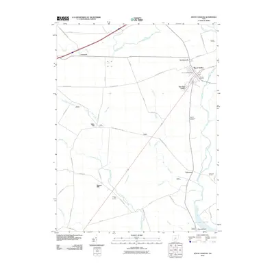
 2019 Harrisburg2019 Print · USGSCovers Darby Township, including Orient, Pleasant Township, and other nearby areas
Showing maps 1-25 of 30
Top cities near Darby Township
- Columbus historical maps
- Grove City historical maps
- London historical maps
- Grandview Heights historical maps
- West Jefferson historical maps
- Obetz historical maps
See more
Top neighborhoods of Darby Township
Frequently asked questions
- What are the different types of historical maps available for Darby Township?
- What is the oldest map of Darby Township?
- Where can I purchase historical maps of Darby Township for my home or office?
- Where can I download high-res historical maps of Darby Township?
- Are there historical topographic maps available for Darby Township?
- Is there historical aerial imagery available for Darby Township?
- Where are historical maps of Darby Township sourced from?