Old Maps of Pickaway Township, Ohio for Genealogy
Trace your family roots with 47 historic maps of Pickaway Township. These high-res maps reveal old neighborhoods, homesites, landmarks, and streets — helping you uncover where your ancestors lived and how the area evolved over time.
- Explore historic neighborhoods: Identify where your relatives may have lived in the 1800s or 1900s.
- Compare maps over time: Trace the changes in streets, buildings, and landmarks for multi-generational research.
- Perfect for genealogy & ancestry research: Used by family historians and researchers to map out lineage and migration.
These maps are an incredible resource for exploring your personal connection to Pickaway Township's past.
Pickaway Township, OH maps
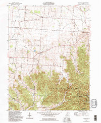
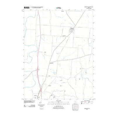
(47)- 1906 Map of Chillicothe, 1954 Print
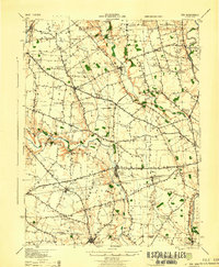
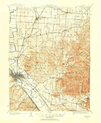 1906 Chillicothe1954 Print · USGSIn the early 1900s, this area of south-central Ohio was defined by a complex intersection of major railroads and river valleys. Researchers can trace the development of Chillicothe or locate ancestral sites at Londonderry, Bethel Chapel, and the County Infirmary.
 - 1908 Map of Chillicothe, 1943 Print
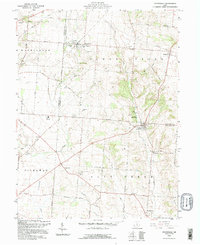
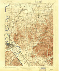 1908 Chillicothe1943 Print · USGSChillicothe and its surrounding rural townships thrive at a turn-of-the-century crossroads of river and rail. Trace old family landmarks and institutions like Mount Logan, Bethel Chapel, and the County Infirmary across Ross and Pickaway counties.
 - 1911 Map of Era, 1952 Print
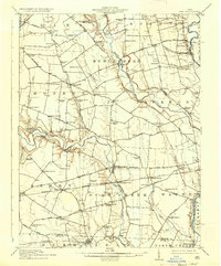
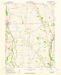
 1911 Era1952 Print · USGSPickaway County at the start of the 1900s is a landscape of established farmsteads and creekside milling. Genealogists can trace family footprints through numerous rural school sites like Tick Ridge School or Locust Grove School and find early commerce hubs like Crownover Mill and Williamsport.
 - 1913 Map of Era, 1936 Print
 1913 Era1936 Print · USGSPickaway County agricultural life and early transport networks are preserved here in the years before the Great War. Genealogists and local historians can locate dozens of country schoolhouses like Dublin Hill School and river crossings such as Becks Ford and Gulicks Ford.
 - 1914 Map of Circleville, 1948 Print
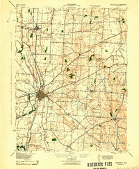
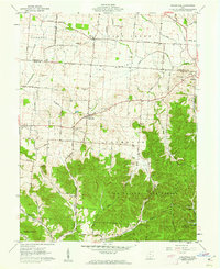
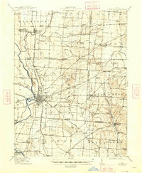 1914 Circleville1948 Print · USGSThe Scioto River valley and Pickaway Plains are captured here during a period of thriving rail commerce and rural schoolhouse districts. Researchers can find ancestral sites from the Reber Hill Cemetery to vanished stops along the Scioto Valley and New England RR.
 - 1943 Map of Era
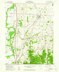
 1943 Era1943 Print · USGSPickaway and Ross Counties are shown in the early 1940s, a period when rural education and river-based land divisions still shaped the Ohio countryside. Genealogists can locate dozens of country schoolhouses like Frogeye Sch and trace the Pennsylvania rail line through Williamsport and Atlanta.
 - 1943 Map of Circleville
 1943 Circleville1943 Print · USGSMid-century Pickaway County is defined here by its intersection of rail power and ancient landmarks along the Scioto River. Genealogists and historians can trace dozens of rural schoolhouses like Bushwhack Sch, the county Infirmary, and the site of the Logan Elm.
 - 1947 Map of Columbus, 1948 Print
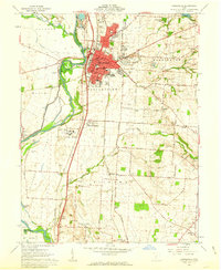
 1947 Columbus1948 Print · USGSCentral Ohio in the late 1940s is captured in this survey, showing the post-war transition of its rail hubs and military airfield expansions. Genealogists and historians can trace the paths of the Ohio Canal, the Pennsylvania RR lines, and the Camp Sherman Military Reservation.
 - 1961 Map of Columbus
 1961 Columbus1961 Print · USGSCentral and Southern Ohio are captured here in the early sixties, as the region's industrial rail hubs and military bases reached their peak. Genealogists and historians can trace the transition from urban Columbus to rural townships along the Scioto River, locating Lockbourne USAF and old junctions like Washington Court House.
 - 1961 Map of Kingston, 1962 Print
 1961 Kingston1962 Print · USGSRoss and Pickaway counties in the early sixties reveal a landscape defined by the winding Scioto River and bustling rail lines. Genealogists and historians can trace family landmarks like Mt Pleasant Cem, Centralia Sch, and the rural community of Kinnikinnick.4 unique versions available
 - 1961 Map of Stoutsville, 1962 Print
 1961 Stoutsville1962 Print · USGSStoutsville and the rural townships of Pickaway and Fairfield counties are shown here just after the turn of the decade. Genealogists can trace family names through sites like the County Infirmary, Bunker Hill Cem, and the old Dresbach Ch.3 unique versions available
 - 1961 Map of Hallsville, 1962 Print
 1961 Hallsville1962 Print · USGSNorthern Ross County in the early sixties is captured here as a landscape of rural villages and timbered ridges. Genealogists can locate family landmarks like Maple Grove Cem and Prairieview Cem or trace the early paths of the Kingston Whisler Road.3 unique versions available
 - 1961 Map of Williamsport, 1963 Print
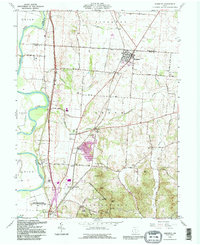
 1961 Williamsport1963 Print · USGSCentral Ohio farm life and transit are preserved here during the early sixties, as the region’s agricultural roots remain firmly tied to the river valleys. Genealogists can trace family heritage through local burial sites like Peck Farm Cem or explore the historic path of the Erie Canal near Yellowbud.2 unique versions available
 - 1961 Map of Circleville, 1963 Print
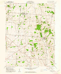
 1961 Circleville1963 Print · USGSCircleville and the surrounding Pickaway Plains are captured in the early sixties, showing a landscape shaped by the Scioto River and major rail lines. Genealogists and historians can trace family farmsteads and numerous burial sites including Shortridge Farm Cem, St Joseph Cemetery, and the Logan Elm State Memorial.5 unique versions available
 - 1962 Map of Columbus
 1962 Columbus1962 Print · USGSCentral Ohio during the early sixties reveals a transition from the industrial corridors of Columbus to the forested ridges of the south. Genealogists and historians can trace the rail networks of the Baltimore & Ohio RR and find local landmarks like Washington Court House and Camp Sherman Military Reservation.
 - 1967 Map of Columbus, 1969 Print
 1967 Columbus1969 Print · USGSCentral Ohio during the late sixties serves as a vital corridor of rail and aviation, from the industrial streets of Springfield to the hangar lines of Lockbourne Air Force Base. Genealogists and researchers can trace the growth of towns like Circleville and London or locate rural landmarks such as St Paul church and the London Correctional Institution.2 unique versions available
 - 1980 Map of Wellston, 1982 Print
 1980 Wellston1982 Print · USGSThe hill country of south-central Ohio in the early eighties shows a landscape of expansive state forests and deep-rooted river towns. Genealogists and historians can trace rural heritage through sites like Buckeye Furnace State Memorial and Mount Zion Cemetery.
 - 1984 Map of Lancaster, 1985 Print
 1984 Lancaster1985 Print · USGSCentral Ohio and the Hocking Valley come into focus during the mid-eighties as suburban growth meets the wooded ridges of the southeast. Researchers can trace transportation networks through Buckeye Lake or locate landmarks like Flint Ridge State Memorial and Moxahala Park.
 - 1986 Map of Springfield
 1986 Springfield1986 Print · USGSCentral Ohio in the mid-1980s shows the bustling rail-and-road network connecting Springfield and Xenia to the western outskirts of Columbus. Researchers can trace old family sites and transit routes through Glen Haven Mem Cem, Madison Lake State Park, and the CONRAIL line.2 unique versions available
 - 1992 Map of Kingston, 1995 Print
 1992 Kingston1995 Print · USGSNear the northern edge of Ross County in the early nineties, this area showcases the confluence of historical earthworks and modern transit. Researchers can trace ancestral sites at Mt Pleasant Cem, explore the grounds of Hopewell Culture National Historical Park, or locate the old Centralia Sch.
 - 1992 Map of Hallsville, 1995 Print
 1992 Hallsville1995 Print · USGSThe borderlands of Ross and Pickaway counties are revealed in the 1990s as a landscape of wooded ridges and open prairies. Genealogists can trace family names through sites like Green Summit Cem or locate rural meeting places such as Union Chapel.
 - 1992 Map of Stoutsville, 1995 Print
 1992 Stoutsville1995 Print · USGSFairfield and Pickaway counties are shown in the early nineties, centered on the railroad crossing at Stoutsville. Genealogists can trace family names through landmarks like Maple Hill Cem, Imler Cem, and the old Township Sch near Stringtown.
 - 2010 Map of Hallsville, 2010 Print
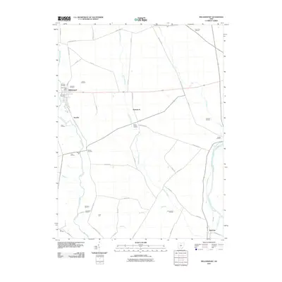
 2010 Hallsville2010 Print · USGSCovers Pickaway Township, including Adelphi, Hallsville, and other nearby areas
 - 2010 Map of Williamsport, 2010 Print
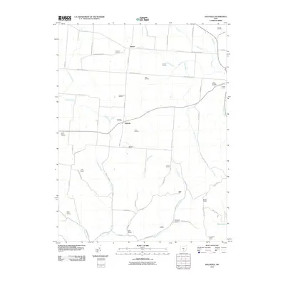
 2010 Williamsport2010 Print · USGSCovers Pickaway Township, including Williamsport, Yellowbud, and other nearby areas
 - 2010 Map of Kingston, 2010 Print
 2010 Kingston2010 Print · USGSCovers Pickaway Township, including Kingston, Kinnikinnick, and other nearby areas
Showing maps 1-25 of 47
Top cities near Pickaway Township
- Chillicothe historical maps
- Circleville historical maps
- Ashville historical maps
- Walnut historical maps
- South Bloomfield historical maps
- Kingston historical maps
See more
Top neighborhoods of Pickaway Township
- Jefferson Estates historical maps
- Meade historical maps
- Circle Hills historical maps
- Thacher historical maps
- Elmwood historical maps
- Hayesville historical maps
Frequently asked questions
- What are the different types of historical maps available for Pickaway Township?
- What is the oldest map of Pickaway Township?
- Where can I purchase historical maps of Pickaway Township for my home or office?
- Where can I download high-res historical maps of Pickaway Township?
- Are there historical topographic maps available for Pickaway Township?
- Is there historical aerial imagery available for Pickaway Township?
- Where are historical maps of Pickaway Township sourced from?