2020s Maps of Camden, Ohio
Explore 2 historic maps of Camden from the 2020s. These maps offer a rare glimpse into what life looked like during the 2020s — showing old roads, neighborhoods, homes, and landmarks that have changed or disappeared over time.
Whether you're researching your family's past, planning a metal detecting trip, or studying how Camden's landscape evolved across the 2020s, these high-resolution maps are a powerful tool for exploring the history of this region.
- Focus on a specific era: All maps on this page are from the 2020s, giving you a focused view of this time period.
- See what’s changed: Compare century-old streets, trails, and buildings to today's modern landscape using overlays and satellite layers.
- Research with precision: Use these maps for genealogy, historical research, land use analysis, or educational projects.
- View, download, or print: Maps are fully viewable online in high resolution, and can be downloaded or printed for your own records.
Start exploring Camden's history through authentic maps from the 2020s. This is your window into the past.
Camden, OH maps
(2)- 2023 Map of Oxford, 2023 Print
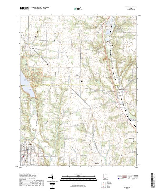 2023 Oxford2023 Print · USGSOxford and its surrounding townships are shown here as the university's footprint meets the rural reaches of Butler County. Genealogists can trace family lines through Ramsey Cem and Teague Cem, or locate landmarks like Deep Ford and Joe Cimprich Airport.
 - 2023 Map of Eaton South, 2023 Print
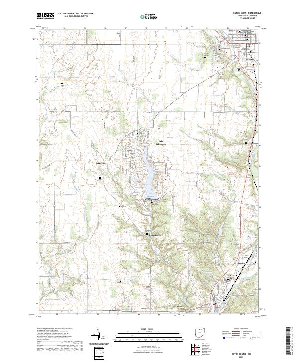 2023 Eaton South2023 Print · USGSPreble County comes into focus in this contemporary survey, capturing the region from the seat of Eaton south toward Camden. Genealogists can trace numerous historical burial sites such as Mound Hill Cem, Antioch Cem, and the family plots of the Sugar Valley area.
End of results
Showing maps 1-2 of 2
Top cities near Camden
- Hamilton historical maps
- Middletown historical maps
- Richmond historical maps
- Oxford historical maps
- Lemon Township historical maps
- Monroe historical maps
See more
Frequently asked questions
- What are the different types of historical maps available for Camden?
- What is the oldest map of Camden?
- Where can I purchase historical maps of Camden for my home or office?
- Where can I download high-res historical maps of Camden?
- Are there historical topographic maps available for Camden?
- Is there historical aerial imagery available for Camden?
- Where are historical maps of Camden sourced from?