1960s Maps of Putnam County, Ohio
Explore 19 historic maps of Putnam County from the 1960s. These maps offer a rare glimpse into what life looked like during the 1960s — showing old roads, neighborhoods, homes, and landmarks that have changed or disappeared over time.
Whether you're researching your family's past, planning a metal detecting trip, or studying how Putnam County's landscape evolved across the 1960s, these high-resolution maps are a powerful tool for exploring the history of this region.
- Focus on a specific era: All maps on this page are from the 1960s, giving you a focused view of this time period.
- See what’s changed: Compare century-old streets, trails, and buildings to today's modern landscape using overlays and satellite layers.
- Research with precision: Use these maps for genealogy, historical research, land use analysis, or educational projects.
- View, download, or print: Maps are fully viewable online in high resolution, and can be downloaded or printed for your own records.
Start exploring Putnam County's history through authentic maps from the 1960s. This is your window into the past.
Putnam County, OH maps
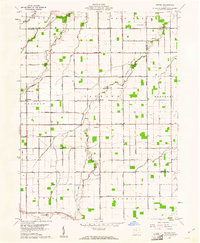
(19)- 1960 Map of Deshler, 1961 Print
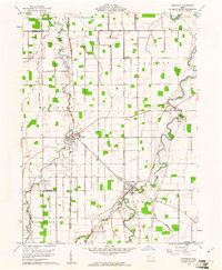
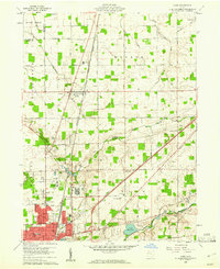
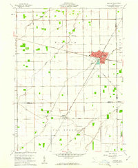 1960 Deshler1961 Print · USGSDeshler and Belmore are captured at the height of their rail-era significance in the early 1960s. Researchers can trace the Baltimore and Ohio rail lines, find community landmarks like Oakdale Ch, and locate family plots at Woodlawn Cem.3 unique versions available
 - 1960 Map of Columbus Grove, 1961 Print
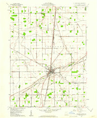 1960 Columbus Grove1961 Print · USGSColumbus Grove in the early sixties sits at a busy tri-rail junction where the landscape is still marked by the Old Indian Treaty Boundary. Genealogists can trace family lands along Trumbo Road and locate several burial sites like Bogart Cem and Truro Cem.2 unique versions available
 - 1960 Map of Bluffton, 1961 Print
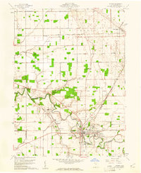
 1960 Bluffton1961 Print · USGSAgricultural life in Allen and Putnam counties reached a mid-century peak when rail lines and country roads still defined the local economy. Genealogists and historians can trace family-named landmarks like Hilty Cem and institutional hubs such as Bluffton College.4 unique versions available
 - 1960 Map of Ottawa, 1961 Print
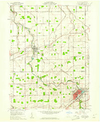
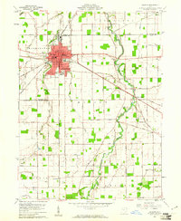
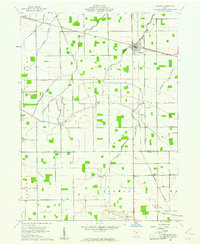
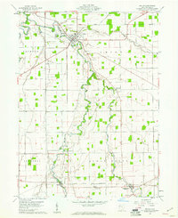
 1960 Ottawa1961 Print · USGSOttawa and Glandorf appear at a mid-century crossroads in this Putnam County survey, where modern developments meet historical land boundaries. Genealogists can locate family sites at SS Peter and Paul Cem or Crow Cem, while rail enthusiasts can trace the Baltimore and Ohio line.3 unique versions available
 - 1960 Map of Ottoville, 1961 Print
 1960 Ottoville1961 Print · USGSNorthwestern Ohio's agricultural landscape is seen here in the early sixties, defined by the winding Auglaize River and the old canal route. Genealogists can trace family landmarks and burial sites like St Marys Cem, Antioch Ch, and the hamlet of Muntanna.2 unique versions available
 - 1960 Map of Delphos, 1961 Print
 1960 Delphos1961 Print · USGSDelphos and the surrounding farm townships of Allen and Van Wert counties are captured here at the start of the 1960s. Researchers can trace the legacy of the Miami and Erie Canal (Abandoned) alongside active rail lines and rural landmarks like Morris Chapel and Landeck.3 unique versions available
 - 1960 Map of New Bavaria, 1961 Print
 1960 New Bavaria1961 Print · USGSNorthwest Ohio at the start of the sixties reveals a landscape of tight-knit farming communities and family-named roads. Genealogists can trace property proximity through landmarks like St Stephens Cem, Pleasant Bend, and the Sacred Heart Sch.3 unique versions available
 - 1960 Map of Ayersville, 1961 Print
 1960 Ayersville1961 Print · USGSNorthwest Ohio at the dawn of the sixties shows a landscape of steady agricultural life across three bordering counties. Genealogists can trace family roots at Taylor Cem and Mansfield Cem, or locate landmarks like Arthur and Bauer Landing Field.4 unique versions available
 - 1960 Map of Cairo, 1961 Print
 1960 Cairo1961 Print · USGSAllen County farmland meets the industrial expansion of Lima during the early sixties, showing a landscape defined by heavy rail and institutional grounds. Genealogists can trace family sites like Altstaetter Cem, the crossroads at Cairo, and the Lima State Hospital.4 unique versions available
 - 1960 Map of Hamler, 1961 Print
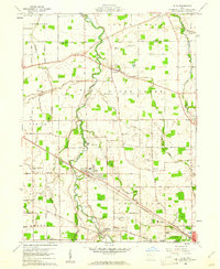
 1960 Hamler1961 Print · USGSNorthwest Ohio at the start of the 1960s was a landscape defined by its rail junctions and extensive drainage systems. You can trace the intersecting lines of the Baltimore and Ohio through Hamler and locate rural landmarks like St Pauls Cem and Zion Ch.2 unique versions available
 - 1960 Map of Miller City, 1961 Print
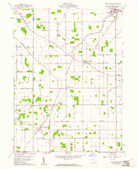
 1960 Miller City1961 Print · USGSMiller City and the surrounding Putnam County townships are captured here in the early sixties, showing a landscape of precise section lines and river meanders. Researchers can locate vanished landmarks and family sites like Kieferville, Varner Cem, and the Forest Grove Ch.2 unique versions available
 - 1960 Map of Leipsic, 1961 Print
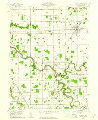
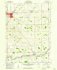 1960 Leipsic1961 Print · USGSPutnam County's rail-and-river landscape is clearly defined in the early sixties at the junction of several major freight lines. Genealogists and local historians can locate early family landmarks such as Cholera Cem, Maidlow Cem, and the County Home.2 unique versions available
 - 1960 Map of Wetsel, 1961 Print
 1960 Wetsel1961 Print · USGSVan Wert and Paulding Counties at the start of the 1960s show a structured rural landscape defined by straight section-line roads and family-named landmarks. Researchers can trace the exact locations of Harmony Ch, the Tri-County Airport, and small settlements like Wetsel and Seamersville.3 unique versions available
 - 1960 Map of Kalida, 1961 Print
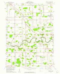
 1960 Kalida1961 Print · USGSPutnam County's agricultural heartland is captured here at the start of the 1960s, centered on the confluence of the Ottawa River and Plum Creek. Genealogists can trace family footprints across several rural burial grounds like Hughes Cem and Reynolds Cem or along the southern Akron Canton and Youngstown rail line.2 unique versions available
 - 1960 Map of Elida, 1961 Print
 1960 Elida1961 Print · USGSAllen County at the dawn of the 1960s shows a landscape of river-valley villages and productive farmland on the edge of a growing industrial center. Genealogists and researchers can map the specific locations of Christian Mennonite Sch, Greenlawn Cem, and Gomer.3 unique versions available
 - 1960 Map of Continental, 1961 Print
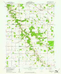
 1960 Continental1961 Print · USGSContinental and the surrounding Putnam County townships are documented here during the early sixties as the rail and river networks shaped local life. Researchers can locate the Miami and Erie Canal (Abandoned), trace family names at Dickey Cemetery, and see the rail junctions at Hartsburg.4 unique versions available
 - 1961 Map of Toledo
 1961 Toledo1961 Print · USGSThe western basin of Lake Erie and the industrial heart of Northern Ohio are captured here during the post-war era. Researchers can trace historical rail lines like the New York Central or locate landmarks like the Erie Ordnance Depot and Pelee Island.
 - 1962 Map of Marion
 1962 Marion1962 Print · USGSCentral Ohio during the post-war era showcases a dense network of railroad towns and emerging interstate highways. Genealogists can trace family roots in smaller settlements like Houcktown and Marseilles or locate landmarks near Indian Lake.
 - 1966 Map of Marion, 1968 Print
 1966 Marion1968 Print · USGSCentral Ohio in the mid-sixties is captured during a period of rapid highway expansion and industrial connectivity. Genealogists and historians can trace rail-and-river networks through towns like Marion, Urbana, and Mount Vernon, or locate landmarks such as Malabar Farm and Black Hand Rock.3 unique versions available
End of results
Showing maps 1-19 of 19
Frequently asked questions
- What are the different types of historical maps available for Putnam County?
- What is the oldest map of Putnam County?
- Where can I purchase historical maps of Putnam County for my home or office?
- Where can I download high-res historical maps of Putnam County?
- Are there historical topographic maps available for Putnam County?
- Is there historical aerial imagery available for Putnam County?
- Where are historical maps of Putnam County sourced from?