Old Maps of Putnam County, Ohio for Metal Detecting
Plan your next treasure hunt with 116 historic maps of Putnam County. Find old homesites, ghost towns, trails, and gathering spots that may be lost to time — perfect for identifying promising metal detecting locations.
- Locate forgotten sites: Uncover places like long-lost settlements, abandoned rail lines, or gathering spots.
- Plan better hunts: Use map overlays combined with LiDAR or satellite views to narrow in on historically rich areas.
- Made for detectorists: Thousands of hobbyists use these maps to discover relics, coins, and hidden history.
Use these historic maps to boost your research and find new opportunities beneath the surface of Putnam County.
Putnam County, OH maps
(116)- 1906 Map of Columbus Grove, 1956 Print
 1906 Columbus Grove1956 Print · USGSIn the early twentieth century, Putnam and Allen Counties were centers of Ohio's rail and pike expansion. Researchers can trace historic transportation lines like the Ohio Electric Railway and locate long-standing community landmarks such as Leatherwood Church, Kalida, and Slabtown.
 - 1907 Map of Bluffton
 1907 Bluffton1907 Print · USGSNorthwestern Ohio at the height of the steam and electric rail era shows a landscape of growing college towns and productive farmland. Trace the intersection of the Ohio Northern RR and Lake Erie and Western RR, or find vanished community hubs like Lafayette Herring PO and the Hillsville School.3 unique versions available
 - 1908 Map of Columbus Grove, 1932 Print
 1908 Columbus Grove1932 Print · USGSNorthwestern Ohio at the start of the century reveals a landscape undergoing a rapid rail-driven expansion. Researchers can trace the path of the Lima and Pittsburg Electric RR and locate rural landmarks like the Leatherwood Church or the County Infirmary.
 - 1908 Map of Ottawa, 1936 Print
 1908 Ottawa1936 Print · USGSNorthwest Ohio's agricultural landscape is seen here in the early twentieth century as a complex network of drainage ditches and competing rail lines. Genealogists can trace family roots in settlements like Glandorf, Miller City, and the rural hub of Ottawa.2 unique versions available
 - 1909 Map of Continental, 1943 Print
 1909 Continental1943 Print · USGSNorthwest Ohio at the start of the twentieth century shows a landscape transitioning from the canal era to a rail-heavy industrial economy. Genealogists can trace family roots in Continental, Oakwood, and Cloverdale, or locate the path of the Miami and Erie Canal alongside the Auglaize River.
 - 1911 Map of Delphos, 1942 Print
 1911 Delphos1942 Print · USGSNorthwest Ohio at the height of the steam and electric rail era shows a landscape deeply organized by section lines and turnpikes. Genealogists can trace rural family life through dozens of named sites like Eickholt School, Horeb Church, and the town of Landeck.
 - 1944 Map of Delphos
 1944 Delphos1944 Print · USGSThe rail-and-river landscape of West-Central Ohio is captured here during the mid-forties, showing the intersection of three counties. Genealogists can locate family roots via dozen of named schools like Raabe Sch and churches such as Morris Chapel or the Mennonite Cem.
 - 1950 Map of Marion
 1950 Marion1950 Print · USGSCentral Ohio was a powerhouse of rail and river industry at the mid-century point, serving as a vital corridor between the Great Lakes and the Ohio River valley. Genealogists and rail historians can trace the paths of the Erie RR and Nickel Plate Road through towns like Bucyrus, Galion, and Upper Sandusky.
 - 1953 Map of Fort Wayne, 1963 Print
 1953 Fort Wayne1963 Print · USGSNortheast Indiana and its neighboring borderlands in Michigan and Ohio appear here during a peak era of rail and road expansion. Researchers can trace the massive rail networks of the Nickel Plate Road and Wabash or locate lakeside landmarks like Lake Wawasee and Clear Lake.4 unique versions available
 - 1953 Map of Muncie, 1966 Print
 1953 Muncie1966 Print · USGSIndiana and Ohio borderlands thrive in the early fifties, showing a landscape defined by manufacturing cities and an intensive railroad network. Genealogists can trace family roots across the Indiana-Ohio line through Muncie, Celina, and Portland via the Pennsylvania railroad.5 unique versions available
 - 1956 Map of Muncie
 1956 Muncie1956 Print · USGSEastern Indiana and western Ohio are shown at a peak of rail-driven industry in the mid-fifties. Genealogists and rail historians can trace the paths of the Pennsylvania RR through Muncie or locate landmarks like Lake Saint Marys (Grand Lake Reservoir) and Frances Slocum State Forest.
 - 1956 Map of Fort Wayne
 1956 Fort Wayne1956 Print · USGSThe tri-state borderlands of Indiana, Michigan, and Ohio are captured here in the mid-fifties, centered on the growing industrial hub of Fort Wayne. Researchers can trace the heavy rail lines of the New York Central and Pennsylvania alongside prominent water features like Lake Wawasee and the Maumee River.2 unique versions available
 - 1956 Map of Toledo, 1968 Print
 1956 Toledo1968 Print · USGSNorthwest Ohio and the Lake Erie shoreline are shown in detail during the late fifties, showcasing a landscape of heavy industry, railroads, and island communities. Genealogists and historians can trace rail networks like the Chesapeake & Ohio RR or locate landmarks such as the Erie Proving Ground and Kelleys Island.4 unique versions available
 - 1960 Map of Deshler, 1961 Print
 1960 Deshler1961 Print · USGSDeshler and Belmore are captured at the height of their rail-era significance in the early 1960s. Researchers can trace the Baltimore and Ohio rail lines, find community landmarks like Oakdale Ch, and locate family plots at Woodlawn Cem.3 unique versions available
 - 1960 Map of Columbus Grove, 1961 Print
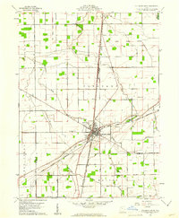 1960 Columbus Grove1961 Print · USGSColumbus Grove in the early sixties sits at a busy tri-rail junction where the landscape is still marked by the Old Indian Treaty Boundary. Genealogists can trace family lands along Trumbo Road and locate several burial sites like Bogart Cem and Truro Cem.2 unique versions available
 - 1960 Map of Bluffton, 1961 Print
 1960 Bluffton1961 Print · USGSAgricultural life in Allen and Putnam counties reached a mid-century peak when rail lines and country roads still defined the local economy. Genealogists and historians can trace family-named landmarks like Hilty Cem and institutional hubs such as Bluffton College.4 unique versions available
 - 1960 Map of Ottawa, 1961 Print
 1960 Ottawa1961 Print · USGSOttawa and Glandorf appear at a mid-century crossroads in this Putnam County survey, where modern developments meet historical land boundaries. Genealogists can locate family sites at SS Peter and Paul Cem or Crow Cem, while rail enthusiasts can trace the Baltimore and Ohio line.3 unique versions available
 - 1960 Map of Ottoville, 1961 Print
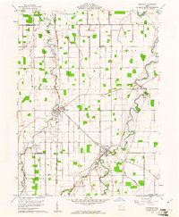 1960 Ottoville1961 Print · USGSNorthwestern Ohio's agricultural landscape is seen here in the early sixties, defined by the winding Auglaize River and the old canal route. Genealogists can trace family landmarks and burial sites like St Marys Cem, Antioch Ch, and the hamlet of Muntanna.2 unique versions available
 - 1960 Map of Delphos, 1961 Print
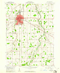 1960 Delphos1961 Print · USGSDelphos and the surrounding farm townships of Allen and Van Wert counties are captured here at the start of the 1960s. Researchers can trace the legacy of the Miami and Erie Canal (Abandoned) alongside active rail lines and rural landmarks like Morris Chapel and Landeck.3 unique versions available
 - 1960 Map of New Bavaria, 1961 Print
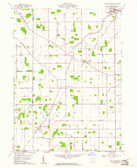 1960 New Bavaria1961 Print · USGSNorthwest Ohio at the start of the sixties reveals a landscape of tight-knit farming communities and family-named roads. Genealogists can trace property proximity through landmarks like St Stephens Cem, Pleasant Bend, and the Sacred Heart Sch.3 unique versions available
 - 1960 Map of Ayersville, 1961 Print
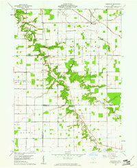 1960 Ayersville1961 Print · USGSNorthwest Ohio at the dawn of the sixties shows a landscape of steady agricultural life across three bordering counties. Genealogists can trace family roots at Taylor Cem and Mansfield Cem, or locate landmarks like Arthur and Bauer Landing Field.4 unique versions available
 - 1960 Map of Cairo, 1961 Print
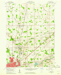 1960 Cairo1961 Print · USGSAllen County farmland meets the industrial expansion of Lima during the early sixties, showing a landscape defined by heavy rail and institutional grounds. Genealogists can trace family sites like Altstaetter Cem, the crossroads at Cairo, and the Lima State Hospital.4 unique versions available
 - 1960 Map of Hamler, 1961 Print
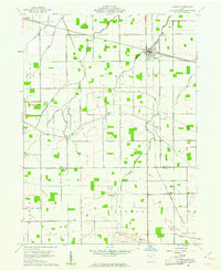 1960 Hamler1961 Print · USGSNorthwest Ohio at the start of the 1960s was a landscape defined by its rail junctions and extensive drainage systems. You can trace the intersecting lines of the Baltimore and Ohio through Hamler and locate rural landmarks like St Pauls Cem and Zion Ch.2 unique versions available
 - 1960 Map of Miller City, 1961 Print
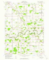 1960 Miller City1961 Print · USGSMiller City and the surrounding Putnam County townships are captured here in the early sixties, showing a landscape of precise section lines and river meanders. Researchers can locate vanished landmarks and family sites like Kieferville, Varner Cem, and the Forest Grove Ch.2 unique versions available
 - 1960 Map of Leipsic, 1961 Print
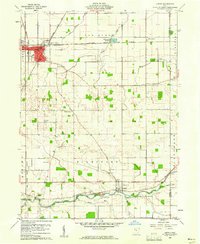 1960 Leipsic1961 Print · USGSPutnam County's rail-and-river landscape is clearly defined in the early sixties at the junction of several major freight lines. Genealogists and local historians can locate early family landmarks such as Cholera Cem, Maidlow Cem, and the County Home.2 unique versions available
Showing maps 1-25 of 116
Frequently asked questions
- What are the different types of historical maps available for Putnam County?
- What is the oldest map of Putnam County?
- Where can I purchase historical maps of Putnam County for my home or office?
- Where can I download high-res historical maps of Putnam County?
- Are there historical topographic maps available for Putnam County?
- Is there historical aerial imagery available for Putnam County?
- Where are historical maps of Putnam County sourced from?