Old Maps of Mifflin Township, Ohio for Genealogy
Trace your family roots with 21 historic maps of Mifflin Township. These high-res maps reveal old neighborhoods, homesites, landmarks, and streets — helping you uncover where your ancestors lived and how the area evolved over time.
- Explore historic neighborhoods: Identify where your relatives may have lived in the 1800s or 1900s.
- Compare maps over time: Trace the changes in streets, buildings, and landmarks for multi-generational research.
- Perfect for genealogy & ancestry research: Used by family historians and researchers to map out lineage and migration.
These maps are an incredible resource for exploring your personal connection to Mifflin Township's past.
Mifflin Township, OH maps
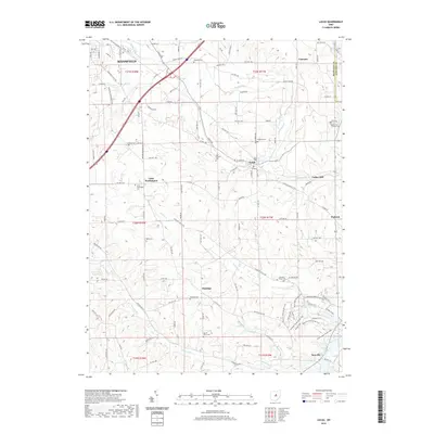
(21)- 1908 Map of Ashland
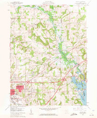
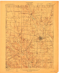 1908 Ashland1908 Print · USGSAshland and its surrounding townships are captured in 1908 at the height of the steam and electric rail era. Researchers can trace the path of the Erie Electric line or locate family-named landmarks like Anderson School and Dickey Church.4 unique versions available
 - 1912 Map of Perrysville, 1959 Print
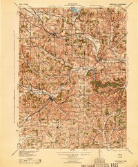
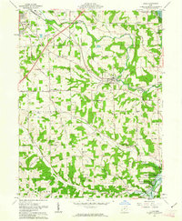
 1912 Perrysville1959 Print · USGSRichland and Ashland counties were thriving agricultural and rail hubs during this era of rural development. Genealogists and local historians can trace the specific locations of many vanished schools and landmarks, from Black Swamp School to the prominent Gatton Rock.
 - 1915 Map of Perrysville, 1944 Print
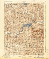 1915 Perrysville1944 Print · USGSAshland and Richland counties are captured here just before the First World War, when the landscape was a patchwork of small school districts and river-bottom farms. Genealogists can locate family landmarks such as St James School, the Treaty 1795 Line, and the rural village of Newville.
 - 1944 Map of Perrysville
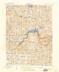
 1944 Perrysville1944 Print · USGSThe Mohican River valley in the mid-1940s reveals a transition from traditional milling to modern water management with the Pleasant Hill Reservoir. Genealogists can trace family footprints across dozens of country school sites like Knotty Oak Sch and the vanished crossroads of Black Swamp.
 - 1950 Map of Marion
 1950 Marion1950 Print · USGSCentral Ohio was a powerhouse of rail and river industry at the mid-century point, serving as a vital corridor between the Great Lakes and the Ohio River valley. Genealogists and rail historians can trace the paths of the Erie RR and Nickel Plate Road through towns like Bucyrus, Galion, and Upper Sandusky.
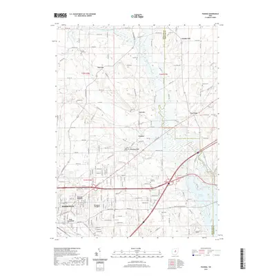
 - 1960 Map of Pavonia, 1962 Print
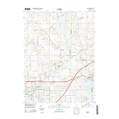
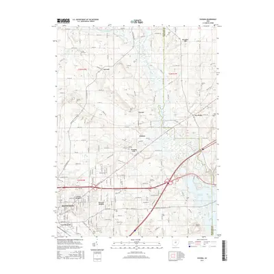
 1960 Pavonia1962 Print · USGSRichland and Ashland counties are captured during a period of mid-century suburban growth and water management. Genealogists can trace family names at Smeltzer Cem and Pittenger Cem or locate old landmarks like Pavonia and Windsor.3 unique versions available
 - 1961 Map of Lucas, 1963 Print
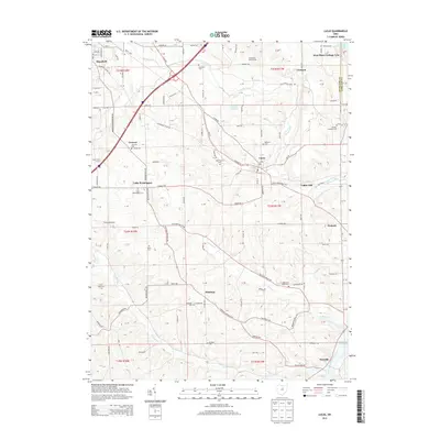
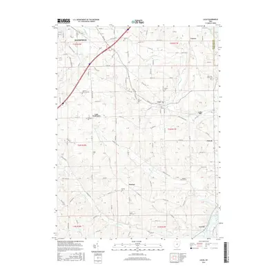
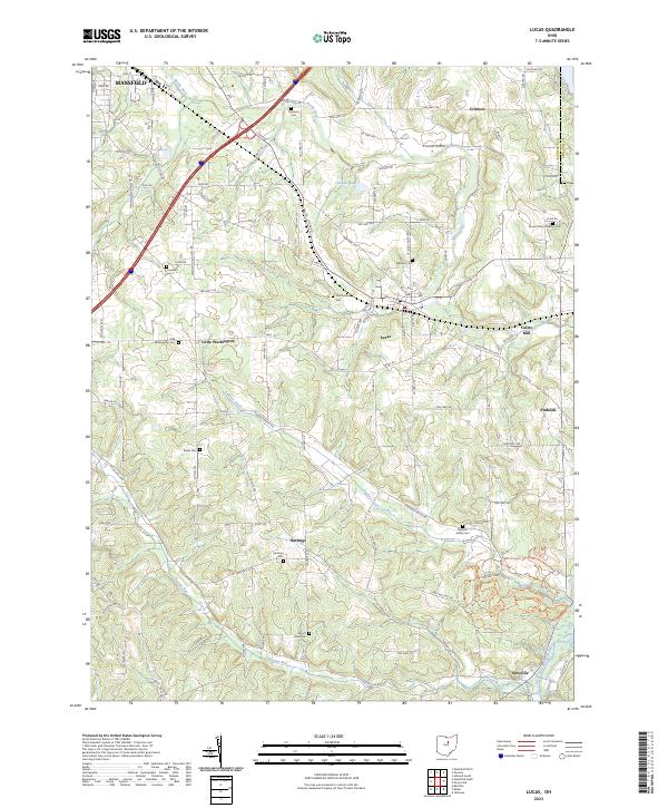
 1961 Lucas1963 Print · USGSRichland County at the start of the 1960s reveals a landscape of watershed management and traditional rail-bound commerce. Genealogists and historians can trace family locations through numerous small burying grounds like Mt Olive Cem and historic sites such as Culler Mill near Lucas.3 unique versions available
 - 1962 Map of Marion
 1962 Marion1962 Print · USGSCentral Ohio during the post-war era showcases a dense network of railroad towns and emerging interstate highways. Genealogists can trace family roots in smaller settlements like Houcktown and Marseilles or locate landmarks near Indian Lake.
 - 1966 Map of Marion, 1968 Print
 1966 Marion1968 Print · USGSCentral Ohio in the mid-sixties is captured during a period of rapid highway expansion and industrial connectivity. Genealogists and historians can trace rail-and-river networks through towns like Marion, Urbana, and Mount Vernon, or locate landmarks such as Malabar Farm and Black Hand Rock.3 unique versions available
 - 1986 Map of Mansfield
 1986 Mansfield1986 Print · USGSNorth-central Ohio in the mid-eighties shows a landscape of industrial towns and large-scale water management projects. Researchers can trace historic sites like the Mansfield Reformatory, Malabar Farm State Park, and the racing grounds at Mid-Ohio Race Course.
 - 1994 Map of Mansfield
 1994 Mansfield1994 Print · USGSThe Mansfield and Ashland corridor of the 1990s reveals a landscape of industrial rail junctions and extensive state forests. You can trace the drainage of the Mohican River through reservoirs like Charles Mill Lake or locate sites such as Malabar Farm State Park.
 - 2010 Map of Lucas, 2010 Print
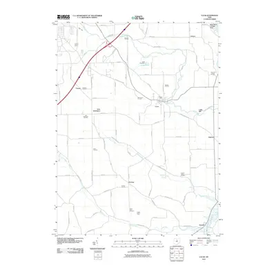 2010 Lucas2010 Print · USGSCovers Mifflin Township, including Mansfield, Lucas, and other nearby areas
 - 2010 Map of Pavonia, 2010 Print
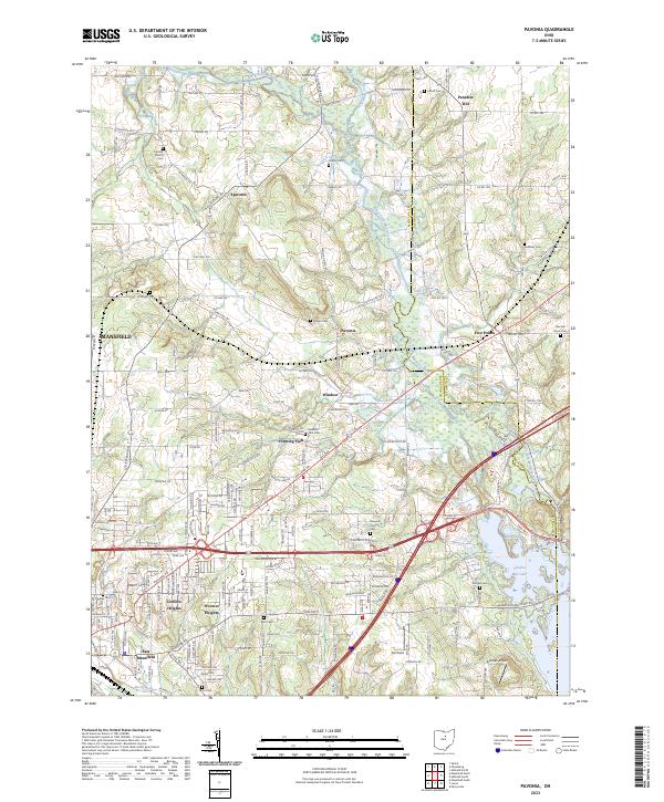
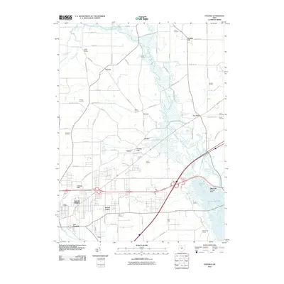 2010 Pavonia2010 Print · USGSCovers Mifflin Township, including Mansfield, Madison Township, and other nearby areas
 - 2013 Map of Lucas, 2013 Print
 2013 Lucas2013 Print · USGSCovers Mifflin Township, including Mansfield, Lucas, and other nearby areas
 - 2013 Map of Pavonia, 2013 Print
 2013 Pavonia2013 Print · USGSCovers Mifflin Township, including Mansfield, Madison Township, and other nearby areas
 - 2016 Map of Pavonia, 2016 Print
 2016 Pavonia2016 Print · USGSCovers Mifflin Township, including Mansfield, Madison Township, and other nearby areas
 - 2016 Map of Lucas, 2016 Print
 2016 Lucas2016 Print · USGSCovers Mifflin Township, including Mansfield, Lucas, and other nearby areas
 - 2019 Map of Lucas, 2019 Print
 2019 Lucas2019 Print · USGSCovers Mifflin Township, including Mansfield, Lucas, and other nearby areas
 - 2019 Map of Pavonia, 2019 Print
 2019 Pavonia2019 Print · USGSCovers Mifflin Township, including Mansfield, Madison Township, and other nearby areas
 - 2023 Map of Lucas, 2023 Print
 2023 Lucas2023 Print · USGSRichland County's agricultural heartland is captured here in the twenty-first century, centered on the village of Lucas. Researchers can trace old family lines and local history through landmarks like Culler Mill, Pinhook, and the Odd Fellows Cem.
 - 2023 Map of Pavonia, 2023 Print
 2023 Pavonia2023 Print · USGSRichland and Ashland counties are shown in this contemporary study of the area east of Mansfield. Researchers can trace rural cemeteries and community centers like Pavonia, Paradise Hill, and the Franklin Church alongside the waters of Charles Mill Lake.
End of results
Showing maps 1-21 of 21
Top cities near Mifflin Township
- Mansfield historical maps
- Ashland historical maps
- Shelby historical maps
- Ontario historical maps
- Lexington historical maps
- Loudonville historical maps
See more
Top neighborhoods of Mifflin Township
- Crimson historical maps
- Sites Lake Cottage Area historical maps
- West Shore Cottage Area historical maps
- Fleming Falls historical maps
- Windsor historical maps
Frequently asked questions
- What are the different types of historical maps available for Mifflin Township?
- What is the oldest map of Mifflin Township?
- Where can I purchase historical maps of Mifflin Township for my home or office?
- Where can I download high-res historical maps of Mifflin Township?
- Are there historical topographic maps available for Mifflin Township?
- Is there historical aerial imagery available for Mifflin Township?
- Where are historical maps of Mifflin Township sourced from?