Old Maps of Tomlison Addition, Lucasville for Hiking & Exploration
Hike through history with 11 historic maps of Tomlison Addition. Explore old trails, ghost towns, and forgotten backroads — perfect for outdoor adventurers and local explorers.
- Rediscover forgotten places: Map out old mining camps, roads, and footpaths that no longer exist on modern maps.
- Layer with modern tools: Combine with LiDAR or satellite views to plan hikes through historical terrain.
- Made for exploration: Popular among hikers, overlanders, and local history lovers.
Use these maps to find adventure and explore the hidden past of Tomlison Addition.
Tomlison Addition, Lucasville maps
(11)- 1911 Map of Sciotoville, 1952 Print
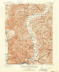 1911 Sciotoville1952 Print · USGSThe industrial riverfronts and rural hollows of southern Ohio are shown here in the early twentieth century before modern development. Genealogists and historians can trace numerous rural landmarks like Davis Sta George PO, Harrison Furnace School, and the brickyards near New Boston.2 unique versions available
 - 1913 Map of Sciotoville, 1924 Print
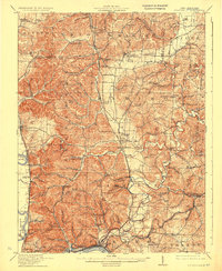 1913 Sciotoville1924 Print · USGSScioto County during the early twentieth century shows a landscape of river-front industry and deep-hollow settlements. Genealogists can trace family footprints across dozens of local school sites like Noel School and early industrial markers such as Scioto Furnace and Star Brickyard.2 unique versions available
 - 1957 Map of Huntington, 1966 Print
 1957 Huntington1966 Print · USGSThe industrial heart of the Ohio River valley is captured here in the mid-sixties, showing the growth of Huntington and Ashland. Researchers can trace the extensive rail networks of the Chesapeake and Ohio RR and locate sites like the Chief Cornstalk Hunting Ground.3 unique versions available
 - 1960 Map of Huntington
 1960 Huntington1960 Print · USGSThe tri-state river valley thrived in the late fifties as a hub of heavy industry and Appalachian rail transit. Genealogists and historians can trace the connection between river towns like Ashland and Portsmouth or locate family homesteads near Coleman Ridge.
 - 1961 Map of Lucasville, 1962 Print
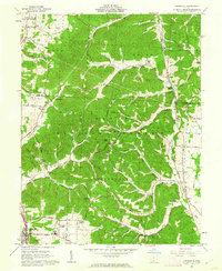 1961 Lucasville1962 Print · USGSLucasville and the surrounding Scioto County timberlands are captured here in the early sixties, showing the expansion of residential additions along the valley floor. Genealogists can locate family burial grounds like Slavens Cem and Bennett Cem or trace the Chesapeake and Ohio rail line through the hills.3 unique versions available
 - 1981 Map of Ironton, 1982 Print
 1981 Ironton1982 Print · USGSThe tri-state river valley at the start of the eighties shows a landscape shaped by heavy industry, atomic energy, and sprawling national forests. Researchers can trace the legacy of iron production at Harrison Furnace or follow the historic rail lines of the C & O RR and N & W RR.
 - 2010 Map of Lucasville, 2010 Print
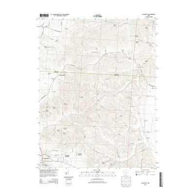
 2010 Lucasville2010 Print · USGSCovers Tomlison Addition, including Lucasville, Scioto County, and other nearby areas
 - 2013 Map of Lucasville, 2013 Print
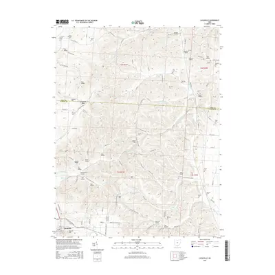
 2013 Lucasville2013 Print · USGSCovers Tomlison Addition, including Lucasville, Scioto County, and other nearby areas
 - 2016 Map of Lucasville, 2016 Print
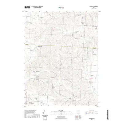
 2016 Lucasville2016 Print · USGSCovers Tomlison Addition, including Lucasville, Scioto County, and other nearby areas
 - 2019 Map of Lucasville, 2019 Print
 2019 Lucasville2019 Print · USGSCovers Tomlison Addition, including Lucasville, Scioto County, and other nearby areas
 - 2023 Map of Lucasville, 2023 Print
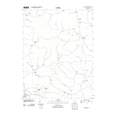
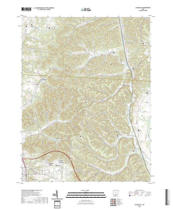 2023 Lucasville2023 Print · USGSLucasville and its surrounding residential additions are shown at the edge of the Scioto River valley as they appeared in the early 2020s. Genealogists can trace family-named hollows and landmarks like Brigner Hollow, Gravel Hill, and Haystack Knob.
End of results
Showing maps 1-11 of 11
Frequently asked questions
- What are the different types of historical maps available for Tomlison Addition?
- What is the oldest map of Tomlison Addition?
- Where can I purchase historical maps of Tomlison Addition for my home or office?
- Where can I download high-res historical maps of Tomlison Addition?
- Are there historical topographic maps available for Tomlison Addition?
- Is there historical aerial imagery available for Tomlison Addition?
- Where are historical maps of Tomlison Addition sourced from?