Old Maps of Thompson Township, Ohio for Academic Research
Study the evolution of Thompson Township with 32 high-resolution historic maps. Whether you're teaching, researching, or modeling changes in land use, these maps provide essential visual documentation of urban, environmental, and geographic change.
- Analyze long-term change: Track patterns in development, transportation, and natural features.
- Ideal for environmental or urban studies: Support academic projects with primary historical map data.
- Use in the classroom or lab: Educators and researchers rely on these maps to bring historical context to life.
These maps are a powerful tool for teaching, research, and visualizing how Thompson Township has changed over the decades.
Thompson Township, OH maps
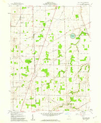
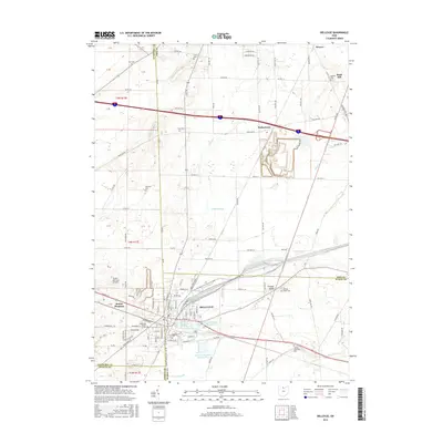
(32)- 1901 Map of Bellevue, 1958 Print
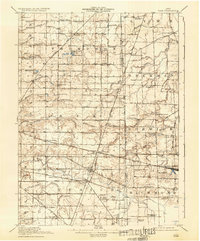
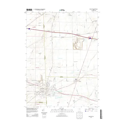
 1901 Bellevue1958 Print · USGSAcross the marshy lowlands and limestone springs of Erie and Sandusky counties at the turn of the century, a massive railroad network dominates the landscape. Genealogists can trace family footprints in Clyde and Bellevue or locate vanished rail stops at Thames and Parkertown.
 - 1903 Map of Bellevue
 1903 Bellevue1903 Print · USGSNear the dawn of the twentieth century, the junction of Erie and Sandusky counties was a bustling corridor of rail and water transport. Genealogists and historians can trace the early footprints of Bellevue and Clyde, or find specific local landmarks like the Blue Hole and the Connecticut Western Reserve Boundary Line.5 unique versions available
 - 1915 Map of Siam, 1936 Print
 1915 Siam1936 Print · USGSThe Seneca and Huron county borderlands are shown here in the years following the turn of the century as railroads and drainage projects transformed the landscape. Researchers can trace the legacy of small communities and rural education at Siam, Attica Junction, and the Podunk School.2 unique versions available
 - 1956 Map of Toledo, 1968 Print
 1956 Toledo1968 Print · USGSNorthwest Ohio and the Lake Erie shoreline are shown in detail during the late fifties, showcasing a landscape of heavy industry, railroads, and island communities. Genealogists and historians can trace rail networks like the Chesapeake & Ohio RR or locate landmarks such as the Erie Proving Ground and Kelleys Island.4 unique versions available
 - 1959 Map of Bellevue, 1960 Print
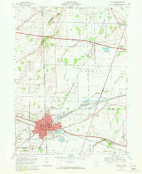
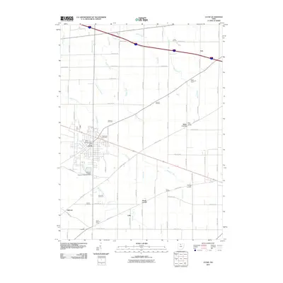
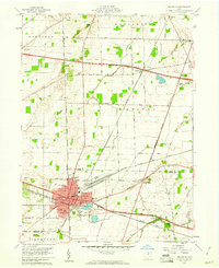 1959 Bellevue1960 Print · USGSBellevue stands at the four-county junction of Erie, Huron, Sandusky, and Seneca during the late 1950s expansion. Genealogists and local historians can trace school locations like Ridge Sch and Shumaker Sch alongside the tracks of the Pennsylvania RR.
 - 1959 Map of Clyde, 1960 Print
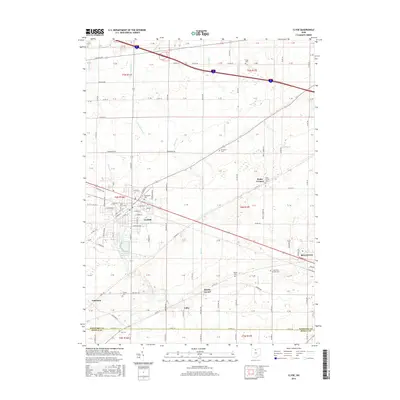
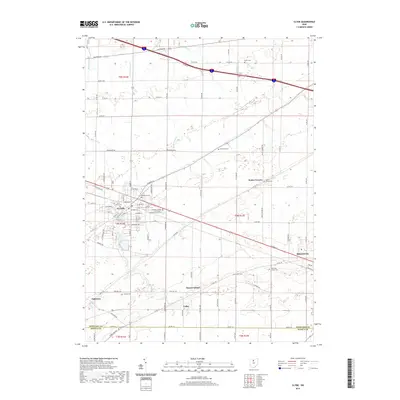
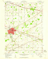 1959 Clyde1960 Print · USGSSandusky County is shown here in the late fifties as a bustling rail and highway corridor focused on the hub of Clyde. Genealogists and local historians can trace family plots and rural landmarks at McPherson Cemetery, Mt Carmel Cem, and York Free Chapel.
 - 1960 Map of Fireside, 1962 Print
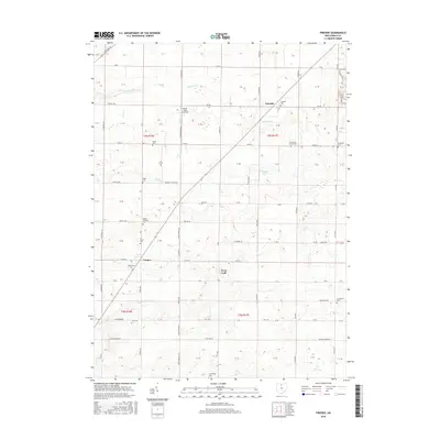
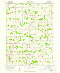 1960 Fireside1962 Print · USGSSeneca County's rural townships are captured here in the early sixties, showing a landscape of established family farms and local crossroads. Researchers can locate ancestral sites like Union Cem, the Assumption Sch, and small settlements like West Lodi and Fireside.3 unique versions available
 - 1960 Map of Flat Rock, 1962 Print
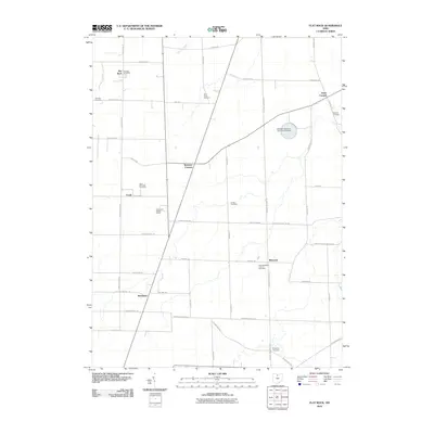
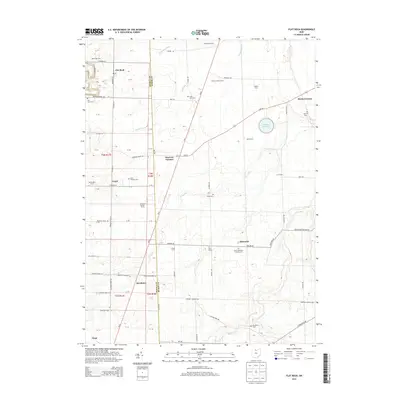
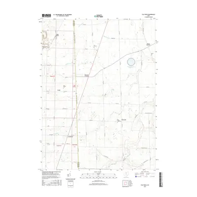
 1960 Flat Rock1962 Print · USGSSeneca and Huron counties are captured here in the early sixties, showing a landscape shaped by the legacy of the Connecticut Western Reserve. Genealogists can trace family names and local history through landmarks like Seneca Caverns, Bismarck, and the Sorrowfull Mother Shrine.3 unique versions available
 - 1961 Map of Toledo
 1961 Toledo1961 Print · USGSThe western basin of Lake Erie and the industrial heart of Northern Ohio are captured here during the post-war era. Researchers can trace historical rail lines like the New York Central or locate landmarks like the Erie Ordnance Depot and Pelee Island.
 - 1969 Map of Bellevue, 1971 Print
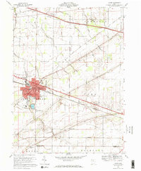
 1969 Bellevue1971 Print · USGSBellevue flourished as a vital rail crossroads during the late sixties, serving as a hub where major rail lines met the rural landscape. Local historians can trace family roots through numerous sites like Bellevue Cem, Providence Ch, and several historic schoolhouses including Lyme Sch.4 unique versions available
 - 1969 Map of Clyde, 1971 Print
 1969 Clyde1971 Print · USGSClyde and its surrounding townships are shown here in the late sixties as the regional rail and pike network reached its peak. Researchers can locate family roots at McPherson Cemetery or trace old rural hubs like Wales Corners and Colby.2 unique versions available
 - 1986 Map of Lorain
 1986 Lorain1986 Print · USGSThe Lake Erie shoreline and North Central Ohio interior are shown in detail during the mid-eighties, from the industrial docks of Lorain to the peninsulas of Sandusky. Researchers can trace historic transport routes like the Baltimore and Ohio Railroad or locate significant landmarks like Oberlin College and Cedar Point.2 unique versions available
 - 2010 Map of Bellevue, 2010 Print
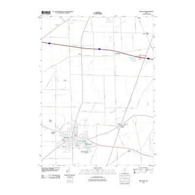 2010 Bellevue2010 Print · USGSCovers Thompson Township, including Bellevue, Groton Township, and other nearby areas
 - 2010 Map of Clyde, 2010 Print
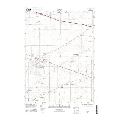
 2010 Clyde2010 Print · USGSCovers Thompson Township, including Clyde, Bellevue, and other nearby areas
 - 2010 Map of Flat Rock, 2010 Print
 2010 Flat Rock2010 Print · USGSCovers Thompson Township, including Sherman Township, Frank, and other nearby areas
 - 2010 Map of Fireside, 2010 Print
 2010 Fireside2010 Print · USGSCovers Thompson Township, including Fireside, Adams Township, and other nearby areas
 - 2013 Map of Bellevue, 2013 Print
 2013 Bellevue2013 Print · USGSCovers Thompson Township, including Bellevue, Groton Township, and other nearby areas
 - 2013 Map of Clyde, 2013 Print
 2013 Clyde2013 Print · USGSCovers Thompson Township, including Clyde, Bellevue, and other nearby areas
 - 2013 Map of Flat Rock, 2013 Print
 2013 Flat Rock2013 Print · USGSCovers Thompson Township, including Sherman Township, Frank, and other nearby areas
 - 2013 Map of Fireside, 2013 Print
 2013 Fireside2013 Print · USGSCovers Thompson Township, including Fireside, Adams Township, and other nearby areas
 - 2016 Map of Clyde, 2016 Print
 2016 Clyde2016 Print · USGSCovers Thompson Township, including Clyde, Bellevue, and other nearby areas
 - 2016 Map of Bellevue, 2016 Print
 2016 Bellevue2016 Print · USGSCovers Thompson Township, including Bellevue, Groton Township, and other nearby areas
 - 2016 Map of Fireside, 2016 Print
 2016 Fireside2016 Print · USGSCovers Thompson Township, including Fireside, Adams Township, and other nearby areas
 - 2016 Map of Flat Rock, 2016 Print
 2016 Flat Rock2016 Print · USGSCovers Thompson Township, including Sherman Township, Frank, and other nearby areas
 - 2019 Map of Clyde, 2019 Print
 2019 Clyde2019 Print · USGSCovers Thompson Township, including Clyde, Bellevue, and other nearby areas
Showing maps 1-25 of 32
Top cities near Thompson Township
- Sandusky historical maps
- Fremont historical maps
- Green Creek historical maps
- Willard historical maps
- Clyde historical maps
- Bellevue historical maps
See more
Top neighborhoods of Thompson Township
Frequently asked questions
- What are the different types of historical maps available for Thompson Township?
- What is the oldest map of Thompson Township?
- Where can I purchase historical maps of Thompson Township for my home or office?
- Where can I download high-res historical maps of Thompson Township?
- Are there historical topographic maps available for Thompson Township?
- Is there historical aerial imagery available for Thompson Township?
- Where are historical maps of Thompson Township sourced from?