2020s Maps of Massillon, Ohio
Explore 5 historic maps of Massillon from the 2020s. These maps offer a rare glimpse into what life looked like during the 2020s — showing old roads, neighborhoods, homes, and landmarks that have changed or disappeared over time.
Whether you're researching your family's past, planning a metal detecting trip, or studying how Massillon's landscape evolved across the 2020s, these high-resolution maps are a powerful tool for exploring the history of this region.
- Focus on a specific era: All maps on this page are from the 2020s, giving you a focused view of this time period.
- See what’s changed: Compare century-old streets, trails, and buildings to today's modern landscape using overlays and satellite layers.
- Research with precision: Use these maps for genealogy, historical research, land use analysis, or educational projects.
- View, download, or print: Maps are fully viewable online in high resolution, and can be downloaded or printed for your own records.
Start exploring Massillon's history through authentic maps from the 2020s. This is your window into the past.
Massillon, OH maps
(5)- 2023 Map of Navarre, 2023 Print
 2023 Navarre2023 Print · USGSNavarre and its surrounding townships are shown here as the contemporary landscape meets deep-rooted history. Genealogists can trace family heritage through numerous burial grounds like Saint Pauls Reformed Church Cem and the German Cem.
 - 2023 Map of Dalton, 2023 Print
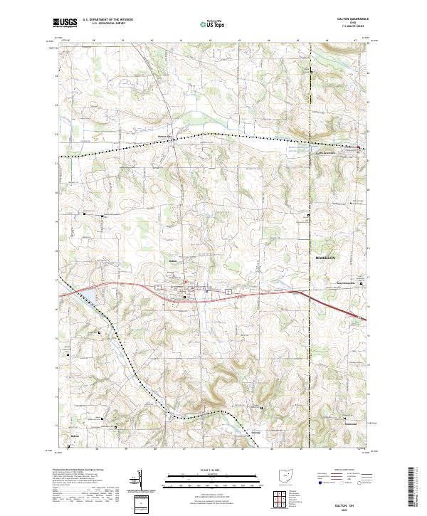 2023 Dalton2023 Print · USGSSettled farmlands and numerous Mennonite churchyards define the Wayne County landscape in the early twenty-first century. Genealogists can trace family lines at Bethel Mennonite Cem, Clover Hill Cem, and Union Cem near Dalton.
 - 2023 Map of Canton West, 2023 Print
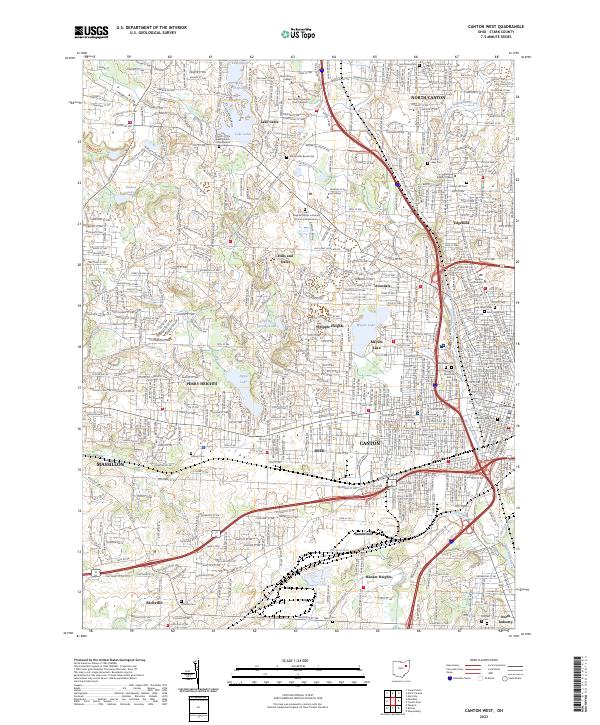 2023 Canton West2023 Print · USGSCanton and its western suburbs show a mature landscape of residential growth and institutional centers in the early 2020s. Genealogists and local researchers can pinpoint family locations near Westlawn Cem, Meyers Lake, and the Stark County Courthouse.
 - 2023 Map of Bolivar, 2023 Print
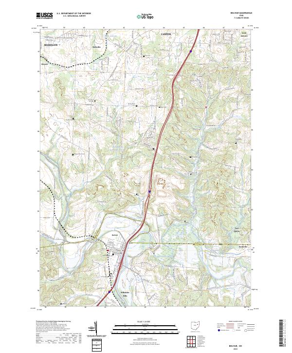 2023 Bolivar2023 Print · USGSThe Tuscarawas River valley and the Stark County border are meticulously detailed in this recent survey. Genealogists and historians can trace numerous family-named landmarks and resting places, including Fort Laurens Cem, Shepler Church Cem, and the village of Wilkshire Hills.
 - 2023 Map of Massillon, 2023 Print
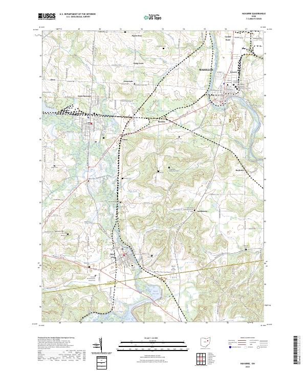
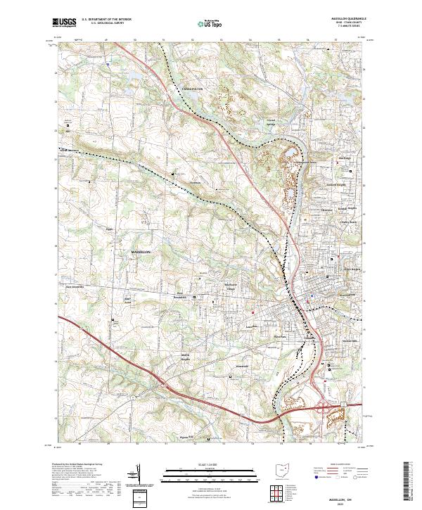 2023 Massillon2023 Print · USGSMassillon and the Tuscarawas River valley are shown in detail during this recent era of Stark County history. Researchers can locate dozens of family landmarks including Rose Hill Memorial Park Cem, Sixteen Church Cem, and the Wheeling & Lake Erie RR line.
End of results
Showing maps 1-5 of 5
Top cities near Massillon
- Akron historical maps
- Canton historical maps
- Green historical maps
- Barberton historical maps
- Wadsworth historical maps
- North Canton historical maps
See more
Top neighborhoods of Massillon
- Lawndale historical maps
- Mayflower Village historical maps
- Walnut Hills historical maps
- West Brookfield historical maps
- West Park historical maps
- Westarado historical maps
See more
Frequently asked questions
- What are the different types of historical maps available for Massillon?
- What is the oldest map of Massillon?
- Where can I purchase historical maps of Massillon for my home or office?
- Where can I download high-res historical maps of Massillon?
- Are there historical topographic maps available for Massillon?
- Is there historical aerial imagery available for Massillon?
- Where are historical maps of Massillon sourced from?