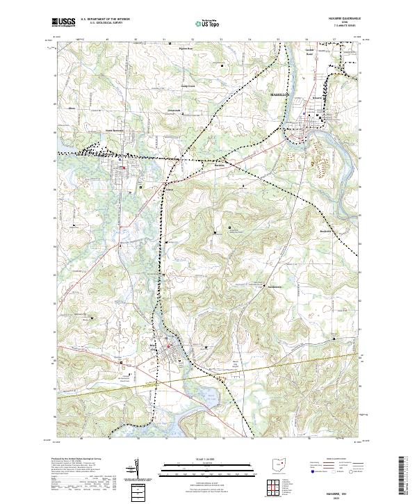
2023 Map of Navarre
USGS Topo · Published 2023About this map
The Tuscarawas River and Sugar Creek converge near the established village of Navarre, anchoring a landscape shaped by water and rail. The corridor of the Wheeling and Lake Erie Railway serves as a modern industrial spine, passing through the yards at Brewster and North Brewster. To the south, the waters of Beach City Lake dominate the valley floor, creating a significant geographical break between the townships. This 2023 survey documents a high concentration of generational markers, particularly church-affiliated burial grounds like the Saint Clements Parish Cem and the Christian Life-Mennonite Church Cem. These sites, along with smaller family-named features like Slutts Cem and Bose Cem, provide a dense record of the region’s settlement history across Pigeon Run, Justus, and the surrounding hills.
Find a feature on this map
153 named features on this map. Tap any name to fly to it.
Don’t see what you’re looking for? This feature index may not catch every label — zoom into the map to look around manually.
Map Details
Editions of this 2023 Navarre Map
This is the sole edition of this map. No revisions or reprints were ever made.
Other maps of this area

1901 · Massillon
USGS Topo · 1:62,500

1901 · Canton
USGS Topo · 1:62,500

1903 · Massillon
USGS Topo · 1:62,500

1903 · Canton
USGS Topo · 1:62,500

1912 · Dover
USGS Topo · 1:62,500

1914 · Navarre
USGS Topo · 1:62,500

1944 · Navarre
USGS Topo · 1:62,500

1944 · Dover
USGS Topo · 1:62,500

1951 · Canton
USGS Topo · 1:250,000

1951 · Bolivar
USGS Topo · 1:24,000