Old Maps of Hudson, Ohio for Academic Research
Study the evolution of Hudson with 24 high-resolution historic maps. Whether you're teaching, researching, or modeling changes in land use, these maps provide essential visual documentation of urban, environmental, and geographic change.
- Analyze long-term change: Track patterns in development, transportation, and natural features.
- Ideal for environmental or urban studies: Support academic projects with primary historical map data.
- Use in the classroom or lab: Educators and researchers rely on these maps to bring historical context to life.
These maps are a powerful tool for teaching, research, and visualizing how Hudson has changed over the decades.
Hudson, OH maps
(24)- 1906 Map of Kent, 1941 Print
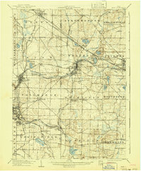 1906 Kent1941 Print · USGSPortage and Summit Counties are captured here at the height of the steam and electric rail era. Researchers can trace ancestral roots through early settlements like Tallmadge and Mogadore, or locate landmarks like the County Infirmary.2 unique versions available
 - 1906 Map of Chagrin Falls, 1955 Print
 1906 Chagrin Falls1955 Print · USGSThe Western Reserve landscape of Northeast Ohio is captured here during a period of rapid transit growth and settlement. Researchers can trace early township hubs and rail stops like Falls Junction Glenwillow PO, Orange Hill Church, and the winding Cleveland and Garrettsville Electric RR.
 - 1908 Map of Chagrin Falls, 1939 Print
 1908 Chagrin Falls1939 Print · USGSThe Chagrin Valley at the turn of the century was a crossroads of electric interurban lines and early rural post offices. Trace the old rail stops at Aurora Station and Cannons Crossing, or locate family landmarks like Orange Hill Church.2 unique versions available
 - 1950 Map of Cleveland
 1950 Cleveland1950 Print · USGSCovers Hudson, including Cleveland, Akron, and other nearby areas
 - 1953 Map of Twinsburg, 1955 Print
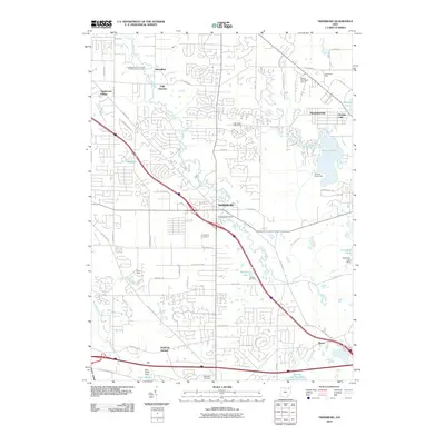
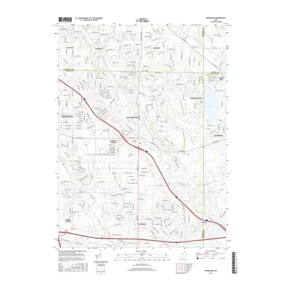
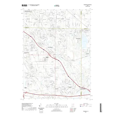
 1953 Twinsburg1955 Print · USGSNortheastern Ohio is shown here during a period of rapid post-war expansion, with the Ohio Turnpike still under construction. Genealogists and local historians can locate Crown Hill Cemetery, the Cleveland Boys Sch, and rail-side hamlets like Falls Junction and Glenwillow.
 - 1953 Map of Hudson, 1955 Print
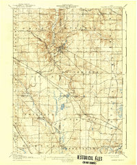
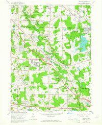
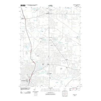
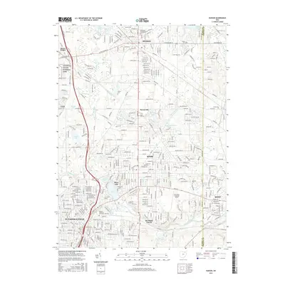
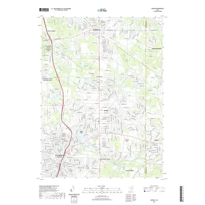
 1953 Hudson1955 Print · USGSNortheast Ohio's suburban and industrial growth is captured here in the early fifties as the rail lines still dominated the landscape. Genealogists and local historians can trace family plots at Markillie Cem or locate the old Mid City Airport and Lincoln Sch.
 - 1956 Map of Cleveland, 1967 Print
 1956 Cleveland1967 Print · USGSNortheast Ohio and Western Pennsylvania are shown at their industrial height during the mid-fifties, from the steel mills to the lakeshore. Researchers can trace the massive Ravenna Arsenal, the Ohio Turnpike, and vanished rail sidings of the B & O RR.3 unique versions available
 - 1962 Map of Cleveland
 1962 Cleveland1962 Print · USGSNortheast Ohio and the Pennsylvania borderlands appear here during the industrial peak of the early sixties. Genealogists and historians can trace the expansive rail lines of the Nickel Plate Road and the growth of suburbs from Parma to Lyndhurst.
 - 1963 Map of Twinsburg, 1964 Print
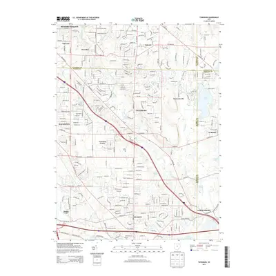
 1963 Twinsburg1964 Print · USGSNortheastern Ohio is shown in the early sixties as industrial rail corridors met growing suburban neighborhoods. Trace the grounds of the Amusement Park at Geauga Lake, find the Cleveland Boys Sch, or locate the Crown Hill Cemetery.4 unique versions available
 - 1963 Map of Hudson, 1964 Print
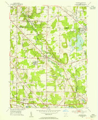
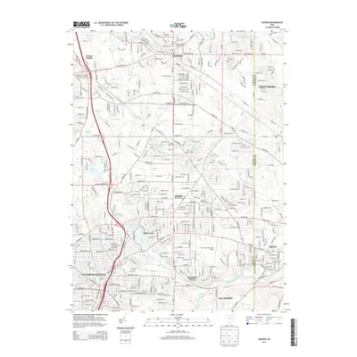
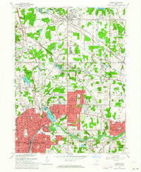 1963 Hudson1964 Print · USGSNortheastern Ohio’s suburban landscape comes into focus in the early sixties as the cities of the Cuyahoga Valley expand. Genealogists can locate family sites at Markillie Cem or Draper Cem, and trace the grounds of Western Reserve Academy or the quiet settlement of Darrowville.4 unique versions available
 - 1986 Map of Cleveland South
 1986 Cleveland South1986 Print · USGSNortheast Ohio in the mid-eighties shows the expanding reach of the Akron and Cleveland suburbs into the surrounding countryside. Trace the industrial rail networks of the Erie Lackawanna RR or find local landmarks like Kent State University and the Ravenna Arsenal.
 - 1994 Map of Cleveland South
 1994 Cleveland South1994 Print · USGSThe metropolitan corridor between Akron and Cleveland is shown here in the mid-nineties during a period of significant suburban growth. Researchers can trace the path of the Ohio Turnpike or explore expansive recreation lands like West Branch State Park.
 - 1994 Map of Hudson, 2000 Print
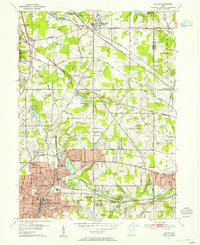
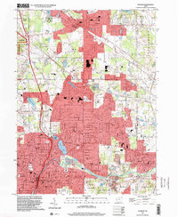 1994 Hudson2000 Print · USGSNortheast Ohio's suburban landscape comes into focus during the 1990s as the cities of Hudson and Stow expand toward the Cuyahoga Valley. Genealogists and local historians can trace legacy sites like Western Reserve Academy and Markillie Cem amidst the era's growing neighborhoods.
 - 1994 Map of Twinsburg, 2000 Print
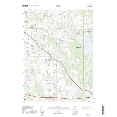
 1994 Twinsburg2000 Print · USGSThe northern reaches of Summit and Cuyahoga counties are shown here as suburban expansion began to reshape the old Western Reserve. Researchers can trace the layout of Geauga Lake, find the location of Locust Grove Cem, or locate the stop at Falls Junction.
 - 2010 Map of Hudson, 2010 Print
 2010 Hudson2010 Print · USGSCovers Hudson, including Cuyahoga Falls, Stow, and other nearby areas
 - 2010 Map of Twinsburg, 2010 Print
 2010 Twinsburg2010 Print · USGSCovers Hudson, including Solon, Twinsburg, and other nearby areas
 - 2013 Map of Hudson, 2013 Print
 2013 Hudson2013 Print · USGSCovers Hudson, including Cuyahoga Falls, Stow, and other nearby areas
 - 2013 Map of Twinsburg, 2013 Print
 2013 Twinsburg2013 Print · USGSCovers Hudson, including Solon, Twinsburg, and other nearby areas
 - 2016 Map of Twinsburg, 2016 Print
 2016 Twinsburg2016 Print · USGSCovers Hudson, including Solon, Twinsburg, and other nearby areas
 - 2016 Map of Hudson, 2016 Print
 2016 Hudson2016 Print · USGSCovers Hudson, including Cuyahoga Falls, Stow, and other nearby areas
 - 2019 Map of Twinsburg, 2019 Print
 2019 Twinsburg2019 Print · USGSCovers Hudson, including Solon, Twinsburg, and other nearby areas
 - 2019 Map of Hudson, 2019 Print
 2019 Hudson2019 Print · USGSCovers Hudson, including Cuyahoga Falls, Stow, and other nearby areas
 - 2023 Map of Hudson, 2023 Print
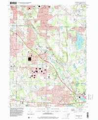
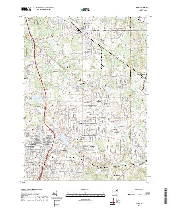 2023 Hudson2023 Print · USGSNortheastern Ohio's residential heartland is showcased here during a period of modern growth near the Cuyahoga Valley National Park. Genealogists and local historians can locate several burial sites including the Old Hudson Township Burying Ground Cem and Maple Lawn Cem.
 - 2023 Map of Twinsburg, 2023 Print
 2023 Twinsburg2023 Print · USGSThe suburbs southeast of Cleveland come into sharp focus in this recent survey of the Cuyahoga and Summit County line. Local researchers can trace residential growth and land use around Geauga Lake and find landmarks like Crown Hill Cem and Mausoleum.
End of results
Showing maps 1-24 of 24
Top cities near Hudson
- Cleveland historical maps
- Akron historical maps
- Cuyahoga Falls historical maps
- Stow historical maps
- Garfield Heights historical maps
- Shaker Heights historical maps
See more
Top neighborhoods of Hudson
- Olde Towne Colony historical maps
- St. Andrews historical maps
- Bridgewater Place historical maps
- Canterbury historical maps
- Canterbury Place historical maps
- Canterbury on the Lakes historical maps
See more
Frequently asked questions
- What are the different types of historical maps available for Hudson?
- What is the oldest map of Hudson?
- Where can I purchase historical maps of Hudson for my home or office?
- Where can I download high-res historical maps of Hudson?
- Are there historical topographic maps available for Hudson?
- Is there historical aerial imagery available for Hudson?
- Where are historical maps of Hudson sourced from?