1960s Maps of Trumbull County, Ohio
Explore 10 historic maps of Trumbull County from the 1960s. These maps offer a rare glimpse into what life looked like during the 1960s — showing old roads, neighborhoods, homes, and landmarks that have changed or disappeared over time.
Whether you're researching your family's past, planning a metal detecting trip, or studying how Trumbull County's landscape evolved across the 1960s, these high-resolution maps are a powerful tool for exploring the history of this region.
- Focus on a specific era: All maps on this page are from the 1960s, giving you a focused view of this time period.
- See what’s changed: Compare century-old streets, trails, and buildings to today's modern landscape using overlays and satellite layers.
- Research with precision: Use these maps for genealogy, historical research, land use analysis, or educational projects.
- View, download, or print: Maps are fully viewable online in high resolution, and can be downloaded or printed for your own records.
Start exploring Trumbull County's history through authentic maps from the 1960s. This is your window into the past.
Trumbull County, OH maps
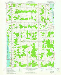
(10)- 1960 Map of Bristolville, 1962 Print
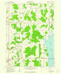 1960 Bristolville1962 Print · USGSTrumbull County in the early sixties shows a landscape of rural townships and the rising Mosquito Creek Reservoir. Genealogists can trace family names through the Sager Memorial Cemetery and the vanished post office at Spokane.4 unique versions available
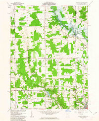
 - 1960 Map of Champion Heights, 1962 Print
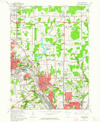
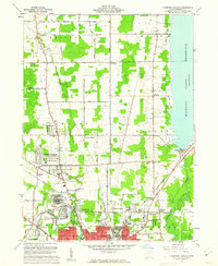 1960 Champion Heights1962 Print · USGSThe industrial Mahoning Valley meets the rural expanses of Trumbull County in the early sixties. Researchers can trace the Baltimore and Ohio rail lines and locate family landmarks like McMurry Cem or the County Infirmary Farm.5 unique versions available
 - 1960 Map of Orwell, 1962 Print
 1960 Orwell1962 Print · USGSAshtabula County townships maintained a steady rural character in the early sixties, centered on the Pennsylvania railroad line. Genealogists can locate family landmarks like Rome Center Cem and the Deeming Sch schoolhouse site.4 unique versions available
 - 1961 Map of Cortland, 1963 Print
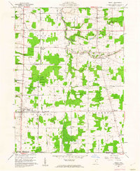
 1961 Cortland1963 Print · USGSTrumbull County is captured here in the early sixties as the suburbs and transportation networks of the post-war era began to expand. Genealogists can trace family names at Hillside Cem and Chadwick Corners or locate the old Nutwood (Fowler Sta) along the rails.3 unique versions available
 - 1961 Map of Gustavus, 1963 Print
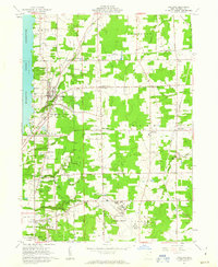
 1961 Gustavus1963 Print · USGSTrumbull County townships appear here in the early sixties as a structured landscape of family farms and historic crossroads. Genealogists can locate family plots at Old Gustavus Cem and Southside Cem or trace vanished rail stops along the New York Central.3 unique versions available
 - 1961 Map of Orangeville, 1963 Print
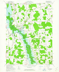
 1961 Orangeville1963 Print · USGSThe Trumbull County borderlands and the village of Orangeville appear here in the early sixties as the Shenango River Reservoir began to reshape the valley. Genealogists and local historians can trace family locations near Artherholt Cem, the Sharon Speedway, and the Erie-Lackawanna rail lines.4 unique versions available
 - 1961 Map of Kinsman, 1963 Print
 1961 Kinsman1963 Print · USGSIn the early sixties, the Trumbull County borderlands were defined by the growing Shenango River Reservoir and a network of traditional farming crossroads. Genealogists can trace family names and local landmarks like Farmdale (Kinsman Sta), Badger High Sch, and Rocky Ridge Cem.3 unique versions available
 - 1962 Map of Cleveland
 1962 Cleveland1962 Print · USGSNortheast Ohio and the Pennsylvania borderlands appear here during the industrial peak of the early sixties. Genealogists and historians can trace the expansive rail lines of the Nickel Plate Road and the growth of suburbs from Parma to Lyndhurst.
 - 1962 Map of Sharon West, 1964 Print
 1962 Sharon West1964 Print · USGSThe industrial corridor of the Ohio-Pennsylvania state line comes alive in the early sixties as manufacturing hubs like Sharon and Farrell thrive. Researchers can trace family sites at St Patricks Cemetery or locate vanishing rail stops like Brookfield Station.4 unique versions available
 - 1962 Map of Girard, 1964 Print
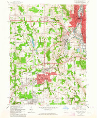
 1962 Girard1964 Print · USGSThe Mahoning Valley steel corridor is captured here at its mid-century industrial peak. Genealogists and historians can trace family-named crossroads like Madden Corners and Hakes Corners or locate local landmarks like the Ursuline Convent and H C Mines Sch.4 unique versions available
End of results
Showing maps 1-10 of 10
Top cities of Trumbull County
- Warren historical maps
- Weathersfield Township historical maps
- Howland Township historical maps
- Champion Township historical maps
- Newton Township historical maps
- Brookfield Township historical maps
See more
Frequently asked questions
- What are the different types of historical maps available for Trumbull County?
- What is the oldest map of Trumbull County?
- Where can I purchase historical maps of Trumbull County for my home or office?
- Where can I download high-res historical maps of Trumbull County?
- Are there historical topographic maps available for Trumbull County?
- Is there historical aerial imagery available for Trumbull County?
- Where are historical maps of Trumbull County sourced from?