Old Maps of Goshen, Ohio for Academic Research
Study the evolution of Goshen with 14 high-resolution historic maps. Whether you're teaching, researching, or modeling changes in land use, these maps provide essential visual documentation of urban, environmental, and geographic change.
- Analyze long-term change: Track patterns in development, transportation, and natural features.
- Ideal for environmental or urban studies: Support academic projects with primary historical map data.
- Use in the classroom or lab: Educators and researchers rely on these maps to bring historical context to life.
These maps are a powerful tool for teaching, research, and visualizing how Goshen has changed over the decades.
Goshen, OH maps
(14)- 1909 Map of Uhrichsville, 1956 Print
 1909 Uhrichsville1956 Print · USGSThe industrial valleys of Tuscarawas and Harrison Counties come alive in this early twentieth-century survey. Genealogists can trace family roots at Gnadenhutten, Goshen Beidler PO, and dozens of rural sites like Kennedy Church and Latto School.
 - 1911 Map of Uhrichsville, 1937 Print
 1911 Uhrichsville1937 Print · USGSTuscarawas County's industrial river valleys and canal routes are shown here at their height before the mid-century decline of rail. Researchers can trace the path of the Ohio and Erie Canal and locate family-named landmarks like Beidler P O, Wesley Church, and Gnadenhutten.
 - 1951 Map of Canton
 1951 Canton1951 Print · USGSThe industrial heartland of Ohio and Pennsylvania reached its mid-century peak during this era of heavy rail and river transit. Genealogists and historians can trace the development of steel towns like Aliquippa and Weirton alongside the Ohio River and major lines of the Pennsylvania RR.
 - 1953 Map of Canton
 1953 Canton1953 Print · USGSThe industrial heartland of Ohio and Pennsylvania is captured at its mid-century peak in this detailed regional survey. Genealogists and historians can trace the vast rail networks of the Pennsylvania RR and find local landmarks like Nimisila Reservoir and Tappan Reservoir.
 - 1957 Map of Canton, 1971 Print
 1957 Canton1971 Print · USGSThe industrial heartland of eastern Ohio and western Pennsylvania comes alive in this mid-century survey of the Ohio River Valley. Trace the heritage of rail and river commerce through Pittsburgh, the massive steel towns along the Ohio River, and major junctions on the Pennsylvania RR.3 unique versions available
 - 1962 Map of Canton
 1962 Canton1962 Print · USGSThe industrial heartland of Eastern Ohio and Western Pennsylvania thrives in the early sixties as steel mills and rail lines dominate the river valleys. Genealogists and historians can trace local landmarks like McKinley National Memorial, Malone College, and industrial sites such as Republic Steel Corp.2 unique versions available
 - 1962 Map of New Philadelphia, 1963 Print
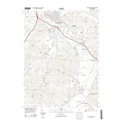
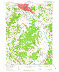 1962 New Philadelphia1963 Print · USGSTuscarawas County's industrial and coal-mining heritage is on display in the early sixties, centered on the river and its bustling valley. Genealogists can trace family roots through Evergreen Burial Park, St Peters Ch, and the historic Schoenbrunn State Memorial.4 unique versions available
 - 1993 Map of New Philadephia, 1994 Print
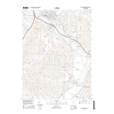
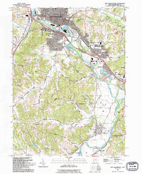 1993 New Philadephia1994 Print · USGSTuscarawas County in the early nineties shows a transition from coal and canal history to a modern educational and retail hub. Trace the Ohio Canal (Abandoned) near Tuscarawas or locate the St Peters Ch and Mud Run Cem.
 - 1994 Map of New Philadephia, 1998 Print
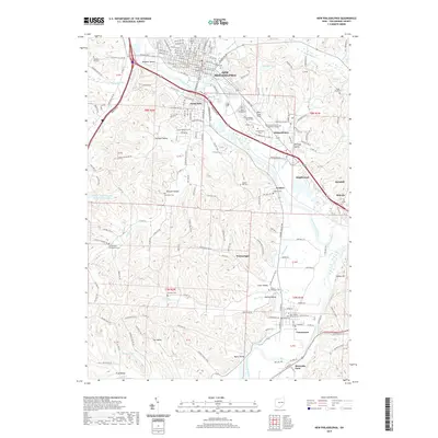
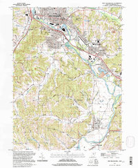 1994 New Philadephia1998 Print · USGSThe Tuscarawas Valley in the mid-nineties shows a landscape where industrial heritage meets academic growth and historic preservation. Genealogists can locate family sites near St Peters Ch, Fair St Cem, and old settlements like Wainwright and Midvale.
 - 2010 Map of New Philadelphia, 2010 Print
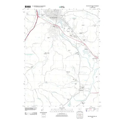 2010 New Philadelphia2010 Print · USGSCovers Goshen, including New Philadelphia, Dover, and other nearby areas
 - 2013 Map of New Philadelphia, 2013 Print
 2013 New Philadelphia2013 Print · USGSCovers Goshen, including New Philadelphia, Dover, and other nearby areas
 - 2016 Map of New Philadelphia, 2016 Print
 2016 New Philadelphia2016 Print · USGSCovers Goshen, including New Philadelphia, Dover, and other nearby areas
 - 2019 Map of New Philadelphia, 2019 Print
 2019 New Philadelphia2019 Print · USGSCovers Goshen, including New Philadelphia, Dover, and other nearby areas
 - 2023 Map of New Philadelphia, 2023 Print
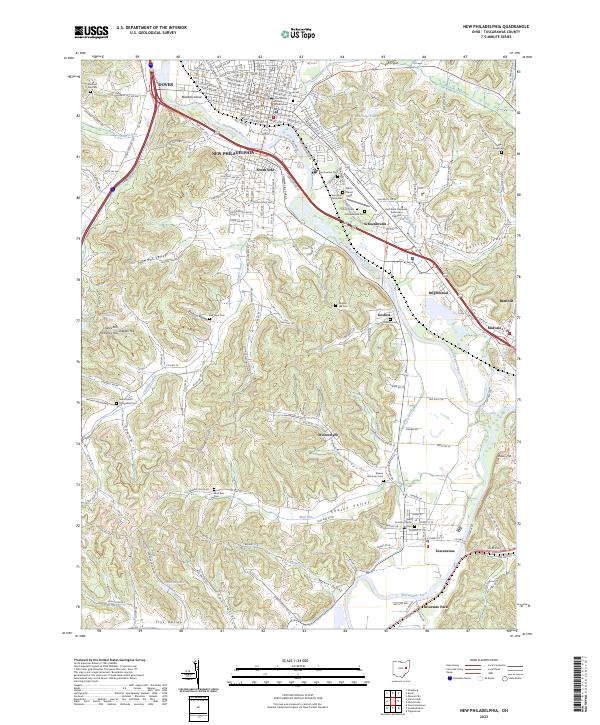 2023 New Philadelphia2023 Print · USGSModern Tuscarawas County maintains its deep valley roots where the river and old canal routes converge near the county seat. Researchers can find numerous family burial sites like Evergreen Burial Park and landmarks such as the Tuscarawas County Courthouse.
End of results
Showing maps 1-14 of 14
Top cities near Goshen
- New Philadelphia historical maps
- Dover historical maps
- Uhrichsville historical maps
- Newcomerstown historical maps
- Dennison historical maps
- Strasburg historical maps
See more
Frequently asked questions
- What are the different types of historical maps available for Goshen?
- What is the oldest map of Goshen?
- Where can I purchase historical maps of Goshen for my home or office?
- Where can I download high-res historical maps of Goshen?
- Are there historical topographic maps available for Goshen?
- Is there historical aerial imagery available for Goshen?
- Where are historical maps of Goshen sourced from?