1900s (20th Century) Maps of Vinton County, Ohio
Explore 43 historic maps of Vinton County from the 1900s (20th Century). These maps offer a rare glimpse into what life looked like during the 1900s — showing old roads, neighborhoods, homes, and landmarks that have changed or disappeared over time.
Whether you're researching your family's past, planning a metal detecting trip, or studying how Vinton County's landscape evolved across the 1900s, these high-resolution maps are a powerful tool for exploring the history of this region.
- Focus on a specific era: All maps on this page are from the 1900s, giving you a focused view of this time period.
- See what’s changed: Compare century-old streets, trails, and buildings to today's modern landscape using overlays and satellite layers.
- Research with precision: Use these maps for genealogy, historical research, land use analysis, or educational projects.
- View, download, or print: Maps are fully viewable online in high resolution, and can be downloaded or printed for your own records.
Start exploring Vinton County's history through authentic maps from the 1900s. This is your window into the past.
Vinton County, OH maps
(43)- 1904 Map of Zaleski, 1955 Print
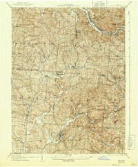
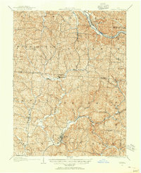 1904 Zaleski1955 Print · USGSVinton and Hocking Counties are shown at the turn of the century as the rail-and-river economy flourished. Trace family roots and vanished landmarks in Zaleski, Moonville, and the brick-making center of Haydenville.2 unique versions available
 - 1905 Map of Wilkesville, 1958 Print
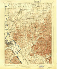
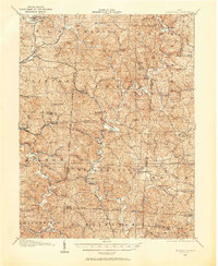 1905 Wilkesville1958 Print · USGSVinton County and its neighbors at the height of the early industrial era show a landscape shaped by charcoal furnaces and narrow-gauge rail interests. Genealogists can trace family footprints across dozens of local school districts like Auburn School or within established centers like Wilkesville and Minerton.
 - 1906 Map of Waverly
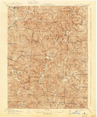
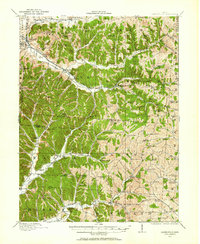
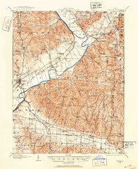 1906 Waverly1906 Print · USGSSouthern Ohio at the turn of the century shows a bustling corridor of river valleys and rail junctions centered on Waverly. Genealogists and historians can trace defunct post offices like Stony Creek Sta Pride PO and rural landmarks like Lilly Chapel or Cars Run School.
 - 1906 Map of Chillicothe, 1954 Print
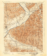
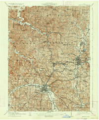
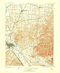 1906 Chillicothe1954 Print · USGSIn the early 1900s, this area of south-central Ohio was defined by a complex intersection of major railroads and river valleys. Researchers can trace the development of Chillicothe or locate ancestral sites at Londonderry, Bethel Chapel, and the County Infirmary.
 - 1907 Map of Zaleski, 1944 Print
 1907 Zaleski1944 Print · USGSVinton and Hocking counties at the turn of the century show an era of intense industrial activity along the coal branches. Trace the paths of the Baltimore and Ohio Southwestern RR through Moonville or find old homesteads near New Plymouth and Zaleski.
 - 1908 Map of Chillicothe, 1943 Print
 1908 Chillicothe1943 Print · USGSChillicothe and its surrounding rural townships thrive at a turn-of-the-century crossroads of river and rail. Trace old family landmarks and institutions like Mount Logan, Bethel Chapel, and the County Infirmary across Ross and Pickaway counties.
 - 1908 Map of Wilkesville, 1943 Print
 1908 Wilkesville1943 Print · USGSThe Vinton County hills are seen here during a peak era of iron furnaces and rail expansion before the Great War. Genealogists and researchers can trace dozens of family-named landmarks and institutions, from the Vinton Furnace site to Boring Church and the Haggerty School.
 - 1908 Map of Waverly, 1944 Print
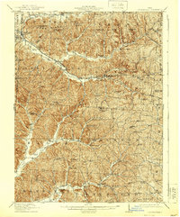
 1908 Waverly1944 Print · USGSThe Scioto River valley at the start of the twentieth century was a vital crossroads of five competing railroads. Local historians can trace early mail stops like Robbins Dove PO and rural landmarks such as Lily Chapel or Meadow Run Church.
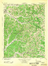
 - 1910 Map of Laurelville, 1962 Print
 1910 Laurelville1962 Print · USGSHocking and Vinton counties come alive in the decade before the First World War, showing a landscape of ridge-top farms and valley hamlets. Genealogists can locate family landmarks like Eagle Mills, the Indian Mound, and dozens of schools including Tuling School and Union School.
 - 1912 Map of Laurelville, 1939 Print
 1912 Laurelville1939 Print · USGSHocking and Vinton counties at the dawn of the twentieth century show a landscape of ridge-top schools and creek-side settlements. Researchers can trace the path of the Columbus and Southern RR (Abandoned) and locate landmarks like Ash Cave and the Indian Mound.2 unique versions available
 - 1913 Map of Jackson, 1934 Print
 1913 Jackson1934 Print · USGSThe coal and iron heart of southern Ohio comes into focus during the early twentieth century, showing the dense rail networks of the Wellston and Jackson districts. Genealogists can trace family roots through numerous rural landmarks like the Jackson Furnace, School No 10, and Ridgewood Cemetery.2 unique versions available
 - 1944 Map of Jackson
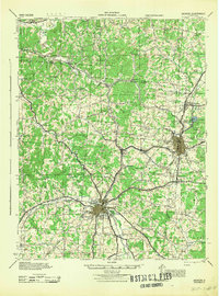 1944 Jackson1944 Print · USGSSouthern Ohio's industrial and rural heartland is detailed here during the mid-forties, centered on the coal and iron hubs of Jackson and Wellston. Genealogists can trace family roots through dozens of local landmarks like Ridgewood Cemetery and schools such as Oakland Sch.
 - 1944 Map of Laurelville
 1944 Laurelville1944 Print · USGSMid-century Hocking and Vinton Counties appear here as a patchwork of tight-knit upland communities during the Second World War. Researchers can locate dozens of local landmarks including Adelphi, Eagle Mills, and the Chestnut Grove Church nestled among the hollows.
 - 1947 Map of Columbus, 1948 Print
 1947 Columbus1948 Print · USGSCentral Ohio in the late 1940s is captured in this survey, showing the post-war transition of its rail hubs and military airfield expansions. Genealogists and historians can trace the paths of the Ohio Canal, the Pennsylvania RR lines, and the Camp Sherman Military Reservation.
 - 1961 Map of Columbus
 1961 Columbus1961 Print · USGSCentral and Southern Ohio are captured here in the early sixties, as the region's industrial rail hubs and military bases reached their peak. Genealogists and historians can trace the transition from urban Columbus to rural townships along the Scioto River, locating Lockbourne USAF and old junctions like Washington Court House.
 - 1961 Map of Mc Arthur
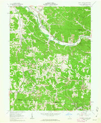
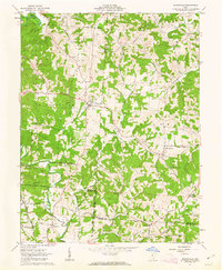
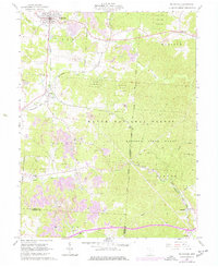 1961 Mc Arthur1961 Print · USGSCentral Vinton County during the early 1960s was a landscape defined by the intersection of industrial mining and deep state forests. You can trace early settlements and cemeteries like Dundas, Radcliff, and Hixon Cem along the busy Baltimore and Ohio rail lines.5 unique versions available
 - 1961 Map of Byer, 1963 Print
 1961 Byer1963 Print · USGSJackson County’s wooded ridges and railroad junctions are captured here in the early sixties as the timber and mining industries shaped the local economy. Researchers can locate family cemeteries and crossroads including Savageville, the Leo Petroglyph State Memorial, and the station at Byer.4 unique versions available
 - 1961 Map of Mineral, 1963 Print
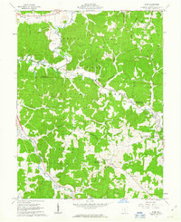
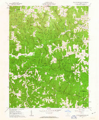
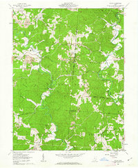
 1961 Mineral1963 Print · USGSVinton County and Athens County meet in this heavily forested landscape in the early sixties, where the railroad snakes through deep valleys. Trace the legacy of small hillside communities and rural landmarks like Moonville, Madison Ch, and the Hewett Cem.4 unique versions available
 - 1961 Map of Union Furnace, 1963 Print
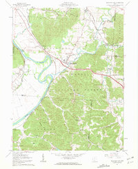
 1961 Union Furnace1963 Print · USGSThe Hocking River valley and the Wayne National Forest are captured here in the early sixties as coal mining and brick manufacturing shaped the landscape. Genealogists and historians can trace family sites at Morris Chapel Cem, the pottery town of Haydenville, and the remote mining camp at Carbondale.6 unique versions available
 - 1961 Map of New Plymouth, 1963 Print
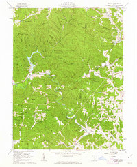
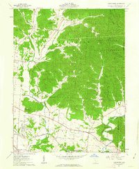
 1961 New Plymouth1963 Print · USGSIn the early sixties, the Hocking-Vinton county line was a landscape of deep woods and active coal extraction. Genealogists and historians can locate family cemeteries like Strawn Cem and trace the rail path of the Chesapeake and Ohio through New Plymouth.4 unique versions available
 - 1961 Map of South Bloomingville, 1963 Print
 1961 South Bloomingville1963 Print · USGSThe Hocking Hills region in the early sixties was a landscape of deep hollows and forest camps at the height of its mid-century recreational development. Researchers can find numerous family cemeteries and remote landmarks like Old Baptist Cem, the Gold Mine near Huffine Hollow, and the Rock House Lookout Tower.4 unique versions available
 - 1961 Map of Richmond Dale, 1963 Print
 1961 Richmond Dale1963 Print · USGSRoss and Pike counties are captured here in the early sixties, showing a landscape defined by the convergence of major rail lines and the Scioto River. Genealogists can trace family names at Little Mound Cem or the rural settlement of Limerick, while industrial historians can follow the Baltimore and Ohio Railroad.2 unique versions available
 - 1961 Map of Londonderry, 1963 Print
 1961 Londonderry1963 Print · USGSSoutheastern Ross County is shown here in the early sixties, where the hills meet the flat agricultural lands. Family historians can trace the Baltimore and Ohio Railroad corridor through Londonderry and find smaller sites like Lickskillet and Harrison Sch.3 unique versions available
 - 1961 Map of Wilkesville, 1963 Print
 1961 Wilkesville1963 Print · USGSThe hill country at the intersection of Vinton, Meigs, and Gallia counties is captured here in the early sixties. Genealogists and local historians can trace family locations through numerous sites like Old Salem Cem, Rowlesville, and Windy Ridge.4 unique versions available
 - 1961 Map of Mulga, 1963 Print
 1961 Mulga1963 Print · USGSJackson County and Vinton County are captured in the early sixties as industrial mining and forest preservation converged. Genealogists can trace family names at Fisher Cem or locate the historic Buckeye State Furnace Memorial and Morris Chapel.5 unique versions available
Showing maps 1-25 of 43
Top cities of Vinton County
- McArthur historical maps
- Richland historical maps
- Hamden historical maps
- Zaleski historical maps
- Wilkesville historical maps
Frequently asked questions
- What are the different types of historical maps available for Vinton County?
- What is the oldest map of Vinton County?
- Where can I purchase historical maps of Vinton County for my home or office?
- Where can I download high-res historical maps of Vinton County?
- Are there historical topographic maps available for Vinton County?
- Is there historical aerial imagery available for Vinton County?
- Where are historical maps of Vinton County sourced from?