2000s (21st Century) Maps of Hue, Swan Township
Explore 6 historic maps of Hue from the 2000s (21st Century). These maps offer a rare glimpse into what life looked like during the 2000s — showing old roads, neighborhoods, homes, and landmarks that have changed or disappeared over time.
Whether you're researching your family's past, planning a metal detecting trip, or studying how Hue's landscape evolved across the 2000s, these high-resolution maps are a powerful tool for exploring the history of this region.
- Focus on a specific era: All maps on this page are from the 2000s, giving you a focused view of this time period.
- See what’s changed: Compare century-old streets, trails, and buildings to today's modern landscape using overlays and satellite layers.
- Research with precision: Use these maps for genealogy, historical research, land use analysis, or educational projects.
- View, download, or print: Maps are fully viewable online in high resolution, and can be downloaded or printed for your own records.
Start exploring Hue's history through authentic maps from the 2000s. This is your window into the past.
Hue, Swan Township maps
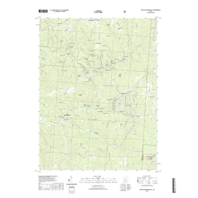
(6)- 2002 Map of South Bloomingville, 2006 Print
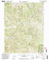 2002 South Bloomingville2006 Print · USGSHocking County’s wooded hollows and creek valleys appear in fine detail during the early 2000s, as public forest lands expanded around local settlements. Researchers can locate many rural burial sites like St John the Baptist Cem or trace the area's schools and lookouts, including the South Bloomingville Sch and Rock House Lookout.
 - 2011 Map of South Bloomingville, 2011 Print
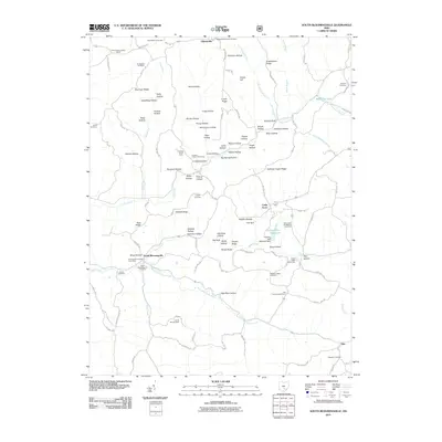 2011 South Bloomingville2011 Print · USGSCovers Hue, including Gibisonville, Cedar Grove, and other nearby areas
 - 2013 Map of South Bloomingville, 2013 Print
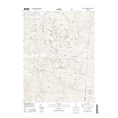 2013 South Bloomingville2013 Print · USGSCovers Hue, including Gibisonville, Cedar Grove, and other nearby areas
 - 2016 Map of South Bloomingville, 2016 Print
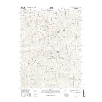 2016 South Bloomingville2016 Print · USGSCovers Hue, including Gibisonville, Cedar Grove, and other nearby areas
 - 2019 Map of South Bloomingville, 2019 Print
 2019 South Bloomingville2019 Print · USGSCovers Hue, including Gibisonville, Cedar Grove, and other nearby areas
 - 2023 Map of South Bloomingville, 2023 Print
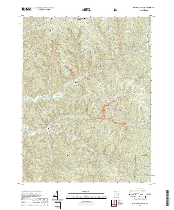 2023 South Bloomingville2023 Print · USGSHocking County’s wooded hollows and ridges are meticulously documented in this recent survey of the South Bloomingville area. Researchers can trace deep family roots at Old Baptist Cem, Wesley Chapel Cem, and find landmarks like Hagley Hollow Arch.
End of results
Showing maps 1-6 of 6
Top cities near Hue
- McArthur historical maps
- Richland historical maps
- Starr historical maps
- Hamden historical maps
- Knox historical maps
- Vinton historical maps
See more
Frequently asked questions
- What are the different types of historical maps available for Hue?
- What is the oldest map of Hue?
- Where can I purchase historical maps of Hue for my home or office?
- Where can I download high-res historical maps of Hue?
- Are there historical topographic maps available for Hue?
- Is there historical aerial imagery available for Hue?
- Where are historical maps of Hue sourced from?