1910s Maps of Plain Township, Ohio
Explore 3 historic maps of Plain Township from the 1910s. These maps offer a rare glimpse into what life looked like during the 1910s — showing old roads, neighborhoods, homes, and landmarks that have changed or disappeared over time.
Whether you're researching your family's past, planning a metal detecting trip, or studying how Plain Township's landscape evolved across the 1910s, these high-resolution maps are a powerful tool for exploring the history of this region.
- Focus on a specific era: All maps on this page are from the 1910s, giving you a focused view of this time period.
- See what’s changed: Compare century-old streets, trails, and buildings to today's modern landscape using overlays and satellite layers.
- Research with precision: Use these maps for genealogy, historical research, land use analysis, or educational projects.
- View, download, or print: Maps are fully viewable online in high resolution, and can be downloaded or printed for your own records.
Start exploring Plain Township's history through authentic maps from the 1910s. This is your window into the past.
Plain Township, OH maps
(3)- 1912 Map of Loudonville, 1958 Print
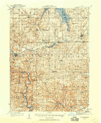 1912 Loudonville1958 Print · USGSBefore modern highways rearranged rural Ohio, this area thrived as a network of rail-side towns and country schoolhouses. Genealogists can trace family footprints at Germany School, the Greenville Treaty Line, and the village of Shreve.
 - 1914 Map of Loudonville, 1944 Print
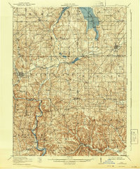 1914 Loudonville1944 Print · USGSNorth-central Ohio is captured here in the years before the Great War, showing a dense network of hill-country farms and railroad towns. Genealogists can trace family roots through dozens of local landmarks like Germany School, Miley Crossroads, and the historic Greenville Treaty Line.
 - 1915 Map of Millersburg, 1935 Print
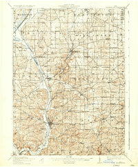 1915 Millersburg1935 Print · USGSHolmes County and southern Wayne County appear here during the early twentieth century, showing a landscape defined by small farming hamlets and a dense network of country schools. Genealogists can trace family footprints near Millersburg or locate landmarks like the GREENVILLE TREATY LINE, Mount Hope, and the Indian Trail.2 unique versions available
End of results
Showing maps 1-3 of 3
Top cities near Plain Township
- Wooster historical maps
- Ashland historical maps
- Millersburg historical maps
- Loudonville historical maps
- Creston historical maps
- Shreve historical maps
See more
Top neighborhoods of Plain Township
- Blachleyville historical maps
- Funk historical maps
- Millbrook historical maps
- Jefferson historical maps
- Reedsburg historical maps
- Springville historical maps
Frequently asked questions
- What are the different types of historical maps available for Plain Township?
- What is the oldest map of Plain Township?
- Where can I purchase historical maps of Plain Township for my home or office?
- Where can I download high-res historical maps of Plain Township?
- Are there historical topographic maps available for Plain Township?
- Is there historical aerial imagery available for Plain Township?
- Where are historical maps of Plain Township sourced from?