2020s Maps of Jerry City, Ohio
Explore 2 historic maps of Jerry City from the 2020s. These maps offer a rare glimpse into what life looked like during the 2020s — showing old roads, neighborhoods, homes, and landmarks that have changed or disappeared over time.
Whether you're researching your family's past, planning a metal detecting trip, or studying how Jerry City's landscape evolved across the 2020s, these high-resolution maps are a powerful tool for exploring the history of this region.
- Focus on a specific era: All maps on this page are from the 2020s, giving you a focused view of this time period.
- See what’s changed: Compare century-old streets, trails, and buildings to today's modern landscape using overlays and satellite layers.
- Research with precision: Use these maps for genealogy, historical research, land use analysis, or educational projects.
- View, download, or print: Maps are fully viewable online in high resolution, and can be downloaded or printed for your own records.
Start exploring Jerry City's history through authentic maps from the 2020s. This is your window into the past.
Jerry City, OH maps
(2)- 2023 Map of Jerry City, 2023 Print
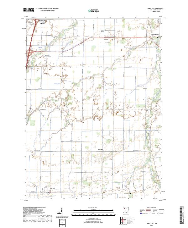 2023 Jerry City2023 Print · USGSWood County’s agricultural heartland is documented here in the early twenty-first century, showing the rural grid and its small hamlets. Genealogists can locate family names and burial sites at the Jerry City Cem, Fish Cem, and the historic Mennonite Cem.
 - 2023 Map of Bloomdale, 2023 Print
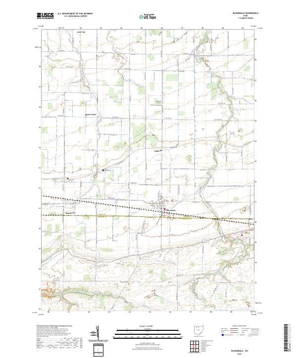 2023 Bloomdale2023 Print · USGSNorthwestern Ohio's agricultural heartland is documented here, showing the rural communities along the Wood and Hancock county line. Researchers can locate family roots at Bloom Chapel Cem, track the South Branch Portage River, and explore the village layouts of Bloomdale and Jerry City.
End of results
Showing maps 1-2 of 2
Top cities near Jerry City
- Findlay historical maps
- Bowling Green historical maps
- Fostoria historical maps
- Waterville historical maps
- North Baltimore historical maps
- Woodville historical maps
See more
Frequently asked questions
- What are the different types of historical maps available for Jerry City?
- What is the oldest map of Jerry City?
- Where can I purchase historical maps of Jerry City for my home or office?
- Where can I download high-res historical maps of Jerry City?
- Are there historical topographic maps available for Jerry City?
- Is there historical aerial imagery available for Jerry City?
- Where are historical maps of Jerry City sourced from?