1900s (20th Century) Maps of Atoka, Oklahoma
Explore 8 historic maps of Atoka from the 1900s (20th Century). These maps offer a rare glimpse into what life looked like during the 1900s — showing old roads, neighborhoods, homes, and landmarks that have changed or disappeared over time.
Whether you're researching your family's past, planning a metal detecting trip, or studying how Atoka's landscape evolved across the 1900s, these high-resolution maps are a powerful tool for exploring the history of this region.
- Focus on a specific era: All maps on this page are from the 1900s, giving you a focused view of this time period.
- See what’s changed: Compare century-old streets, trails, and buildings to today's modern landscape using overlays and satellite layers.
- Research with precision: Use these maps for genealogy, historical research, land use analysis, or educational projects.
- View, download, or print: Maps are fully viewable online in high resolution, and can be downloaded or printed for your own records.
Start exploring Atoka's history through authentic maps from the 1900s. This is your window into the past.
Atoka, OK maps
(8)- 1900 Map of Atoka
 1900 Atoka1900 Print · USGSIndian Territory at the turn of the century shows the developing rail-and-river network before Oklahoma statehood. Genealogists and historians can trace original settlements like Old Boggy Depot, find the Chickasaw Rock Academy, and follow the Missouri Kansas and Texas R.R. through Atoka.4 unique versions available
 - 1956 Map of Stringtown, 1958 Print
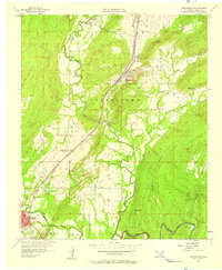 1956 Stringtown1958 Print · USGSSoutheastern Oklahoma’s rail-and-river landscape is captured here in the mid-fifties as the Missouri Kansas Texas line navigates the valley floor. Researchers can locate the Confederate Cemetery, the West Tellico School, and the river crossing at Boggy Bend Ford.4 unique versions available
 - 1957 Map of Lehigh, 1958 Print
 1957 Lehigh1958 Print · USGSOklahoma's coal mining heartland comes alive in this mid-century survey of the Lehigh and Atoka area. Researchers can trace family history through the Lehigh Cem, locate old Strip Mine works, and find rural landmarks like Macedonia Sch.4 unique versions available
 - 1957 Map of Bruno, 1958 Print
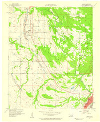
 1957 Bruno1958 Print · USGSAtoka County during the late fifties shows a rural landscape where small community centers like Bruno and Stringtown thrived. Researchers can trace local heritage through numerous landmarks, including Bethany Cem, Harmony Sch, and New Zion Ch.3 unique versions available
 - 1957 Map of Ardmore, 1968 Print
 1957 Ardmore1968 Print · USGSSouth-central Oklahoma in the late fifties was a landscape of rising reservoir waters and expanding rail lines. Genealogists and historians can trace the foundations of Ardmore and Duncan or locate early recreation sites at Platt National Park and Lake Murray State Park.3 unique versions available
 - 1963 Map of Ardmore
 1963 Ardmore1963 Print · USGSSouthern Oklahoma during the early sixties shows a landscape defined by the Arbuckle Mountains and a booming energy economy. Genealogists and historians can trace family-named sites across the Ardmore Oil Field, find old schools like Southeastern State College, or locate historic markers such as Boggy Depot State Park.2 unique versions available
 - 1969 Map of Tushka, 1971 Print
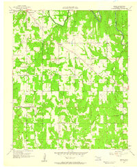
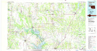
 1969 Tushka1971 Print · USGSAtoka and the surrounding Oklahoma plains are captured here in the late sixties, where the steel rails of the Missouri-Kansas-Texas line cut through a landscape of creek bottoms. Genealogists can trace family roots through sites like Wards Chapel, Tushka Cem, and the small settlement of Taloah.
 - 1985 Map of Tishomingo, 1986 Print
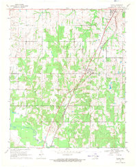
 1985 Tishomingo1986 Print · USGSSouthern Oklahoma in the mid-eighties reveals a landscape shaped by significant water projects and conservation lands. Genealogists and historians can trace the footprints of communities like Wapanucka and Bromide alongside the Washita River and Lake Texoma.3 unique versions available
End of results
Showing maps 1-8 of 8
Top cities near Atoka
- Coalgate historical maps
- Stringtown historical maps
- Tushka historical maps
- Lehigh historical maps
- Caney historical maps
- Phillips historical maps
See more
Frequently asked questions
- What are the different types of historical maps available for Atoka?
- What is the oldest map of Atoka?
- Where can I purchase historical maps of Atoka for my home or office?
- Where can I download high-res historical maps of Atoka?
- Are there historical topographic maps available for Atoka?
- Is there historical aerial imagery available for Atoka?
- Where are historical maps of Atoka sourced from?