Old Maps of Atoka County, Oklahoma
Explore 44 old maps of Atoka County, spanning from 1896 to today. These high-resolution historic maps reveal how streets, neighborhoods, landmarks, and natural features evolved over time — perfect for genealogy, metal detecting, research, and local history exploration.
What you can do with these maps:
- See how Atoka County changed over time: Compare historical maps to modern-day views to trace roads, homesites, rail lines & more.
- View detailed metadata: Each map includes creators, publishers, year, scale, and archive source.
- Overlay maps with satellite & LiDAR: Visualize the past alongside modern tools to explore terrain & human change.
- Trusted historical sources: Maps sourced from the USGS, Library of Congress, and other archives.
- Access maps your way: View online, download high-res files, or order prints for personal or research use.
Start exploring old maps of Atoka County to uncover forgotten places, hidden landmarks, and the deep history beneath your feet.
Atoka County, OK maps
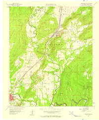
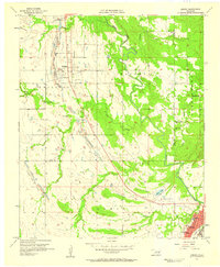
(44)- 1896 Map of Coalgate, 1957 Print
 1896 Coalgate1957 Print · USGSCovers Atoka County, including Coalgate, Allen, and other nearby areas
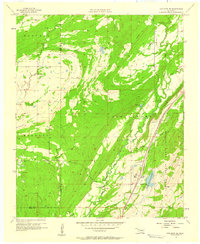
 - 1898 Map of McAlester
 1898 McAlester1898 Print · USGSCovers Atoka County, including McAlester, Krebs, and other nearby areas3 unique versions available
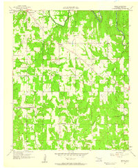
 - 1899 Map of Coalgate
 1899 Coalgate1899 Print · USGSCovers Atoka County, including Coalgate, Allen, and other nearby areas
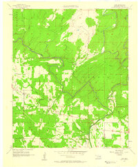
 - 1899 Map of Atoka
 1899 Atoka1899 Print · USGSCovers Atoka County, including Durant, Atoka, and other nearby areas
 - 1900 Map of Atoka
 1900 Atoka1900 Print · USGSCovers Atoka County, including Durant, Atoka, and other nearby areas3 unique versions available
 - 1900 Map of Coalgate
 1900 Coalgate1900 Print · USGSCovers Atoka County, including Coalgate, Allen, and other nearby areas3 unique versions available
 - 1901 Map of Antlers
 1901 Antlers1901 Print · USGSCovers Atoka County, including Hugo, Antlers, and other nearby areas
 - 1909 Map of Mc Alester
 1909 Mc Alester1909 Print · USGSCovers Atoka County, including McAlester, Krebs, and other nearby areas3 unique versions available
 - 1912 Map of Antlers
 1912 Antlers1912 Print · USGSCovers Atoka County, including Hugo, Antlers, and other nearby areas
 - 1925 Map of Antlers
 1925 Antlers1925 Print · USGSCovers Atoka County, including Hugo, Antlers, and other nearby areas
 - 1950 Map of Mcalester
 1950 Mcalester1950 Print · USGSCovers Atoka County, including McAlester, Poteau, and other nearby areas2 unique versions available
 - 1956 Map of Stringtown, 1958 Print
 1956 Stringtown1958 Print · USGSCovers Atoka County, including Atoka, Stringtown, and other nearby areas2 unique versions available
 - 1957 Map of Lane NW, 1958 Print
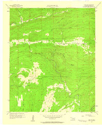 1957 Lane NW1958 Print · USGSCovers Atoka County, including Fugate, United States, and other nearby areas2 unique versions available
 - 1957 Map of Coalgate, 1958 Print
 1957 Coalgate1958 Print · USGSCovers Atoka County, including Coalgate, Phillips, and other nearby areas2 unique versions available
 - 1957 Map of Farris, 1958 Print
 1957 Farris1958 Print · USGSCovers Atoka County, including Farris, Pushmataha County, and other nearby areas3 unique versions available
 - 1957 Map of Lehigh, 1958 Print
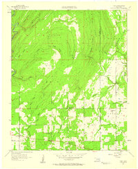
 1957 Lehigh1958 Print · USGSCovers Atoka County, including Atoka, Lehigh, and other nearby areas3 unique versions available
 - 1957 Map of Coalgate SE, 1958 Print
 1957 Coalgate SE1958 Print · USGSCovers Atoka County, including Flora, Coal County, and other nearby areas3 unique versions available
 - 1957 Map of Bruno, 1958 Print
 1957 Bruno1958 Print · USGSCovers Atoka County, including Atoka, Half Bank Crossing, and other nearby areas3 unique versions available
 - 1957 Map of Lane, 1958 Print
 1957 Lane1958 Print · USGSCovers Atoka County, including Negro Bend, Payton Crossing, and other nearby areas3 unique versions available
 - 1957 Map of Lane NE, 1958 Print
 1957 Lane NE1958 Print · USGSCovers Atoka County, including Pushmataha County, United States, and other nearby areas3 unique versions available
 - 1957 Map of Limestone Gap, 1958 Print
 1957 Limestone Gap1958 Print · USGSCovers Atoka County, including Wesley, Burg, and other nearby areas2 unique versions available
 - 1957 Map of Ardmore, 1968 Print
 1957 Ardmore1968 Print · USGSCovers Atoka County, including Ardmore, Duncan, and other nearby areas2 unique versions available
 - 1961 Map of Darwin, 1963 Print
 1961 Darwin1963 Print · USGSCovers Atoka County, including Darwin, Sand Bluff, and other nearby areas2 unique versions available
 - 1962 Map of McAlester
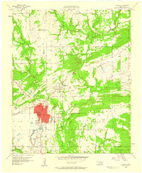
 1962 McAlester1962 Print · USGSCovers Atoka County, including McAlester, Poteau, and other nearby areas
 - 1963 Map of Ardmore
 1963 Ardmore1963 Print · USGSCovers Atoka County, including Ardmore, Duncan, and other nearby areas
Showing maps 1-25 of 44
Top cities of Atoka County
Frequently asked questions
- What are the different types of historical maps available for Atoka County?
- What is the oldest map of Atoka County?
- Where can I purchase historical maps of Atoka County for my home or office?
- Where can I download high-res historical maps of Atoka County?
- Are there historical topographic maps available for Atoka County?
- Is there historical aerial imagery available for Atoka County?
- Where are historical maps of Atoka County sourced from?