1960s Maps of Atoka County, Oklahoma
Explore 16 historic maps of Atoka County from the 1960s. These maps offer a rare glimpse into what life looked like during the 1960s — showing old roads, neighborhoods, homes, and landmarks that have changed or disappeared over time.
Whether you're researching your family's past, planning a metal detecting trip, or studying how Atoka County's landscape evolved across the 1960s, these high-resolution maps are a powerful tool for exploring the history of this region.
- Focus on a specific era: All maps on this page are from the 1960s, giving you a focused view of this time period.
- See what’s changed: Compare century-old streets, trails, and buildings to today's modern landscape using overlays and satellite layers.
- Research with precision: Use these maps for genealogy, historical research, land use analysis, or educational projects.
- View, download, or print: Maps are fully viewable online in high resolution, and can be downloaded or printed for your own records.
Start exploring Atoka County's history through authentic maps from the 1960s. This is your window into the past.
Atoka County, OK maps
(16)- 1961 Map of Darwin, 1963 Print
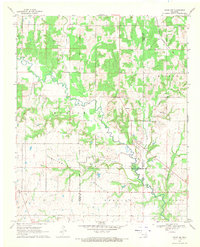
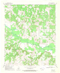
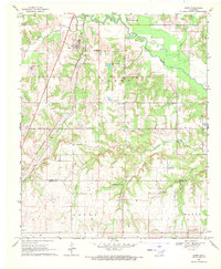
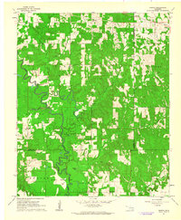 1961 Darwin1963 Print · USGSSoutheastern Oklahoma’s river bottoms and timberlands are captured here in the early sixties as small farming communities thrived. Local researchers can map the grounds of the Mc Leod Honor Farm or find family roots near Darwin Ch and Old Farris.2 unique versions available
 - 1962 Map of McAlester
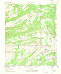
 1962 McAlester1962 Print · USGSSoutheastern Oklahoma and western Arkansas are shown here during the early sixties, a time of transition for the region's mountain communities and timberlands. Researchers can trace the paths of the Kansas City Southern RR through Heavener or locate settlements like Talihina and Broken Bow near the Kiamichi Mountains.2 unique versions available
 - 1963 Map of Ardmore
 1963 Ardmore1963 Print · USGSSouthern Oklahoma during the early sixties shows a landscape defined by the Arbuckle Mountains and a booming energy economy. Genealogists and historians can trace family-named sites across the Ardmore Oil Field, find old schools like Southeastern State College, or locate historic markers such as Boggy Depot State Park.2 unique versions available
 - 1965 Map of McAlester
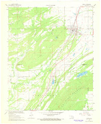
 1965 McAlester1965 Print · USGSSoutheastern Oklahoma and western Arkansas appear here in the mid-1960s, showing the intersection of the timber industry and the growing reservoir system. Genealogists can trace family roots through settlements like Antlers, Idabel, and Kiowa or follow the historic routes of the Kansas City Southern Ry.3 unique versions available
 - 1967 Map of Wardville, 1968 Print
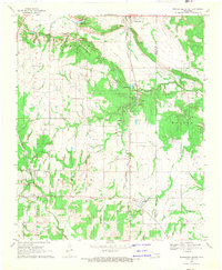
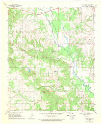
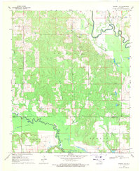
 1967 Wardville1968 Print · USGSWardville and the surrounding prairie lands of Atoka and Coal Counties are captured here in the late sixties, showing a landscape of scattered family farms and energy exploration. Genealogists and local historians can locate King Cem, Lone Star Ch, and the rural community of Wardville near Rabbit Creek.2 unique versions available
 - 1967 Map of Kiowa, 1968 Print
 1967 Kiowa1968 Print · USGSKiowa and the surrounding Pittsburg County ranch land are shown here in the late sixties as industrial quarries began to mark the ridges. Researchers can trace family sites at Oak Hill Cem or follow the Old Railroad Grade near Reynolds.2 unique versions available
 - 1968 Map of Wapanucka South, 1971 Print
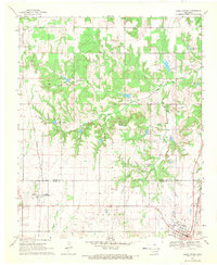
 1968 Wapanucka South1971 Print · USGSSoutheast Oklahoma at the end of the sixties shows a landscape shaped by historical borders and industrial rail transit. Researchers can trace the Old Indian Treaty Boundary and locate local landmarks like Sandy Creek Ch and Lake Ream.
 - 1968 Map of Caddo NW, 1971 Print
 1968 Caddo NW1971 Print · USGSSouthern Oklahoma at the end of the 1960s reveals a landscape defined by ranching, river systems, and early territorial lines. Genealogists and local historians can trace family locations through Oak Grove Cem, the settlement of Folsom, and the Old Indian Treaty Boundary.
 - 1969 Map of Boggy Depot, 1971 Print
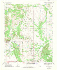
 1969 Boggy Depot1971 Print · USGSOklahoma’s early territorial history is preserved in this late-1960s look at the Choctaw Nation region near Boggy Depot. Researchers can trace old family sites at Wilson Cem or locate the East Boggy Depot Oil Field and the waters of Flag Lake.2 unique versions available
 - 1969 Map of Caddo North, 1971 Print
 1969 Caddo North1971 Print · USGSThe Oklahoma borderlands of Atoka and Bryan counties come alive in this late-sixties study of the Kenefic and Caddo area. Researchers can trace the dual rail lines of the Kansas Oklahoma and Gulf and the Missouri Kansas Texas or locate family sites at Maytubby Cem and Perkins Cem.
 - 1969 Map of Tushka, 1971 Print
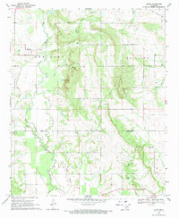
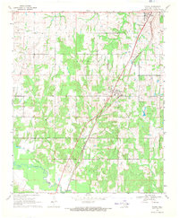 1969 Tushka1971 Print · USGSAtoka and the surrounding Oklahoma plains are captured here in the late sixties, where the steel rails of the Missouri-Kansas-Texas line cut through a landscape of creek bottoms. Genealogists can trace family roots through sites like Wards Chapel, Tushka Cem, and the small settlement of Taloah.
 - 1969 Map of Bentley, 1971 Print
 1969 Bentley1971 Print · USGSThe borderlands of Atoka and Bryan counties appear here in the late sixties, showing a landscape defined by meandering creek systems. Genealogists and local historians can locate family sites near Bentley, Matoy, and the Turnbull Cem or trace the waters of Clear Boggy Creek.2 unique versions available
 - 1969 Map of Boswell NW, 1971 Print
 1969 Boswell NW1971 Print · USGSSoutheastern Oklahoma in the late sixties reveals a landscape shaped by the winding paths of Muddy Boggy Creek and Clear Boggy Creek. Researchers can locate rural landmarks like Crystal Ch, Myrtle Day Ch, and the Crystal Cem.
 - 1969 Map of Wapanucka North, 1971 Print
 1969 Wapanucka North1971 Print · USGSOklahoma's Johnston and Coal Counties are captured here in the late sixties, where the Kansas Oklahoma and Gulf Railroad defines the local economy. Researchers can trace the Old Indian Treaty Boundary and locate the Chickasaw Rock Academy (Ruin).2 unique versions available
 - 1969 Map of Olney, 1971 Print
 1969 Olney1971 Print · USGSThe rural landscape of Coal and Atoka Counties is captured here in the late sixties, where small settlements and family plots define the terrain. Genealogists can trace family landmarks like Whitehall Cem and Valley View Cem or the path of the Old Railroad Grade.
 - 1969 Map of Caney, 1971 Print
 1969 Caney1971 Print · USGSThe town of Caney and its surrounding ranch lands are shown at the close of the 1960s, a period when the rail-and-ranch economy still defined the Atoka County landscape. Researchers can trace family sites near Folsom Cem, Mt Carmel Ch, and the extensive Stuart Ranch.
End of results
Showing maps 1-16 of 16
Top cities of Atoka County
Frequently asked questions
- What are the different types of historical maps available for Atoka County?
- What is the oldest map of Atoka County?
- Where can I purchase historical maps of Atoka County for my home or office?
- Where can I download high-res historical maps of Atoka County?
- Are there historical topographic maps available for Atoka County?
- Is there historical aerial imagery available for Atoka County?
- Where are historical maps of Atoka County sourced from?