2020s Maps of Sayre, Oklahoma
Explore 3 historic maps of Sayre from the 2020s. These maps offer a rare glimpse into what life looked like during the 2020s — showing old roads, neighborhoods, homes, and landmarks that have changed or disappeared over time.
Whether you're researching your family's past, planning a metal detecting trip, or studying how Sayre's landscape evolved across the 2020s, these high-resolution maps are a powerful tool for exploring the history of this region.
- Focus on a specific era: All maps on this page are from the 2020s, giving you a focused view of this time period.
- See what’s changed: Compare century-old streets, trails, and buildings to today's modern landscape using overlays and satellite layers.
- Research with precision: Use these maps for genealogy, historical research, land use analysis, or educational projects.
- View, download, or print: Maps are fully viewable online in high resolution, and can be downloaded or printed for your own records.
Start exploring Sayre's history through authentic maps from the 2020s. This is your window into the past.
Sayre, OK maps
(3)- 2022 Map of Doxey, 2022 Print
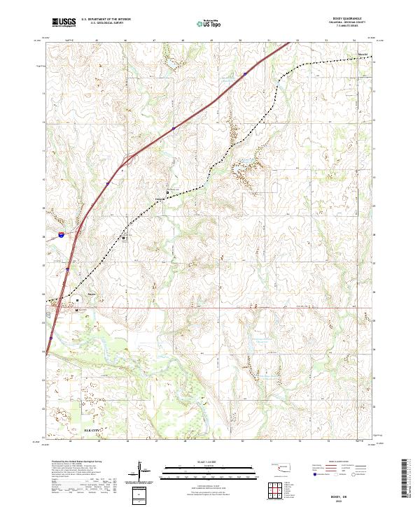 2022 Doxey2022 Print · USGSWestern Oklahoma’s prairie landscape is mapped here in the early 2020s, centered on the community of Doxey and the northern outskirts of Sayre. Researchers can trace local heritage through the Old Doxey Cem and the winding course of the North Fork Red River.
 - 2022 Map of Sayre, 2022 Print
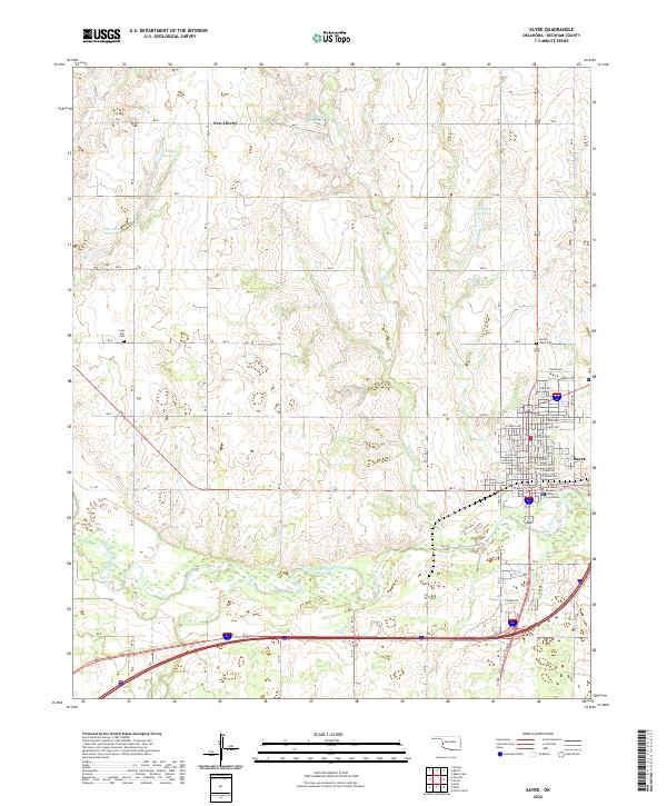 2022 Sayre2022 Print · USGSThe county seat of Sayre and its surrounding ranchlands are documented here in the early 2020s. Researchers can trace family history at Lone Oak Cem or explore the river bottom terrain along the North Fork Red River and Turkey Cr.
 - 2022 Map of Delhi, 2022 Print
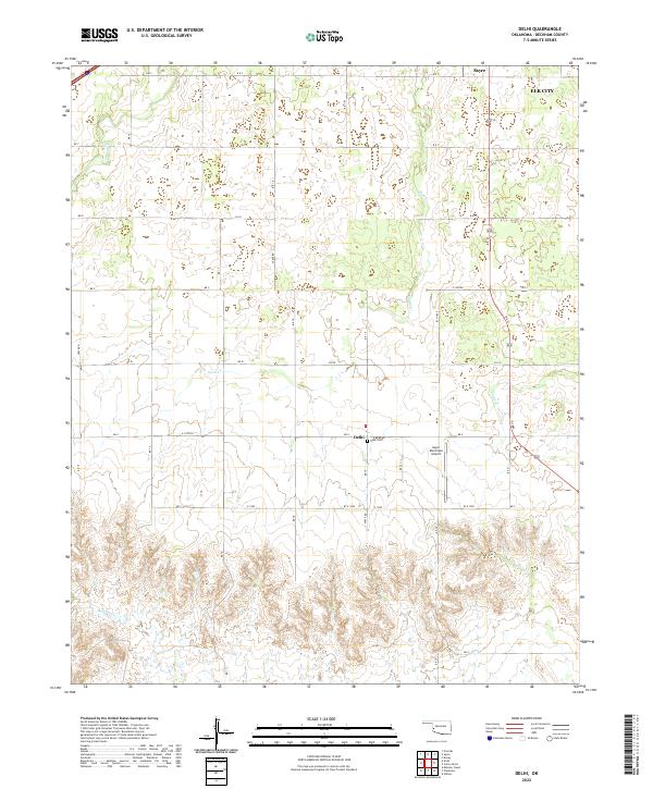 2022 Delhi2022 Print · USGSWestern Oklahoma’s agricultural landscape is documented here in the early twenty-first century near the settlement of Delhi. Genealogists and researchers can locate the Delhi Cem and trace the drainage of Sand Cr and Haystack Cr.
End of results
Showing maps 1-3 of 3
Top cities near Sayre
Frequently asked questions
- What are the different types of historical maps available for Sayre?
- What is the oldest map of Sayre?
- Where can I purchase historical maps of Sayre for my home or office?
- Where can I download high-res historical maps of Sayre?
- Are there historical topographic maps available for Sayre?
- Is there historical aerial imagery available for Sayre?
- Where are historical maps of Sayre sourced from?