Old Maps of Greenfield, Oklahoma
Explore 16 old maps of Greenfield, spanning from 1942 to today. These high-resolution historic maps reveal how streets, neighborhoods, landmarks, and natural features evolved over time — perfect for genealogy, metal detecting, research, and local history exploration.
What you can do with these maps:
- See how Greenfield changed over time: Compare historical maps to modern-day views to trace roads, homesites, rail lines & more.
- View detailed metadata: Each map includes creators, publishers, year, scale, and archive source.
- Overlay maps with satellite & LiDAR: Visualize the past alongside modern tools to explore terrain & human change.
- Trusted historical sources: Maps sourced from the USGS, Library of Congress, and other archives.
- Access maps your way: View online, download high-res files, or order prints for personal or research use.
Start exploring old maps of Greenfield to uncover forgotten places, hidden landmarks, and the deep history beneath your feet.
Greenfield, OK maps
(16)- 1942 Map of Geary
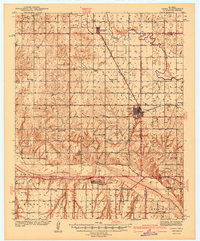 1942 Geary1942 Print · USGSCentral Oklahoma's agrarian heartland comes alive in this pre-war survey of the winding Canadian River valley. Genealogists and local historians can map out dozens of rural school sites like Victor Sch and Richland Sch alongside the busy Chicago Rock Island and Pacific rail line.3 unique versions available
 - 1955 Map of Clinton, 1964 Print
 1955 Clinton1964 Print · USGSWestern Oklahoma during the mid-century transition shows a landscape of growing reservoirs and active military flight lines. Genealogists and historians can locate rural landmarks such as Mountain View Church, Berlin School, and the Riverside Indian School Reserve.3 unique versions available
 - 1957 Map of Clinton
 1957 Clinton1957 Print · USGSWestern Oklahoma in the mid-fifties is captured here as a landscape of river-valley settlements and emerging energy fields. Genealogists can trace family roots through numerous rural landmarks like the Swapping Back Indian School, Hebron Church, and the Riverside Indian School Reserve.
 - 1979 Map of Geary North
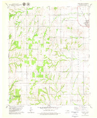
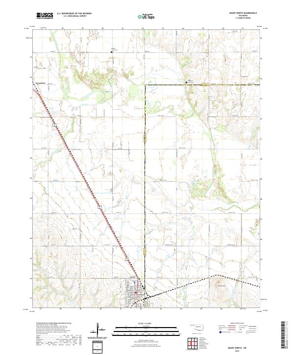
 1979 Geary North1979 Print · USGSSettlement in Blaine County and Canadian County during the late 1970s is centered around the rail hub of Geary. Trace the diagonal route of the Chicago Rock Island and Pacific or locate rural landmarks like Grandview Ch and Left Hand Spring.
 - 1979 Map of Greenfield
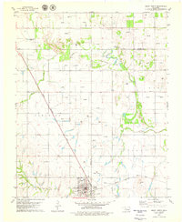
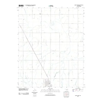
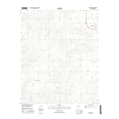
 1979 Greenfield1979 Print · USGSBlaine County's rural landscape is captured here in the late seventies, showing the transition from rail-side commerce to the southern canyonlands. Researchers can find the Richland Cemetery, the community of Greenfield, and the waters of American Horse Lake.2 unique versions available
 - 1985 Map of Watonga
 1985 Watonga1985 Print · USGSCentral Oklahoma in the mid-eighties shows a robust network of river-valley settlements and rural rail lines. Genealogists and historians can trace the footprint of Southwestern State College, the historic Fort Reno, and family-named landmarks like Dead Women Crossing.2 unique versions available
 - 2009 Map of Greenfield, 2009 Print
 2009 Greenfield2009 Print · USGSCovers Greenfield, including Blaine County, United States, and other nearby areas
 - 2009 Map of Geary North, 2009 Print
 2009 Geary North2009 Print · USGSCovers Greenfield, including Geary, Canadian County, and other nearby areas
 - 2012 Map of Geary North, 2012 Print
 2012 Geary North2012 Print · USGSCovers Greenfield, including Geary, Canadian County, and other nearby areas
 - 2013 Map of Greenfield, 2013 Print
 2013 Greenfield2013 Print · USGSCovers Greenfield, including Blaine County, United States, and other nearby areas
 - 2016 Map of Geary North, 2016 Print
 2016 Geary North2016 Print · USGSCovers Greenfield, including Geary, Canadian County, and other nearby areas
 - 2016 Map of Greenfield, 2016 Print
 2016 Greenfield2016 Print · USGSCovers Greenfield, including Blaine County, United States, and other nearby areas
 - 2018 Map of Greenfield, 2018 Print
 2018 Greenfield2018 Print · USGSCovers Greenfield, including Blaine County, United States, and other nearby areas
 - 2018 Map of Geary North, 2018 Print
 2018 Geary North2018 Print · USGSCovers Greenfield, including Geary, Canadian County, and other nearby areas
 - 2022 Map of Geary North, 2022 Print
 2022 Geary North2022 Print · USGSThe river bottomlands and prairies of Blaine and Canadian counties appear here in the early twenty-first century. Genealogists and historians can locate the Jesse Chisholm Grave Site, the Indian Cem, and the town of Geary.
 - 2023 Map of Greenfield, 2023 Print
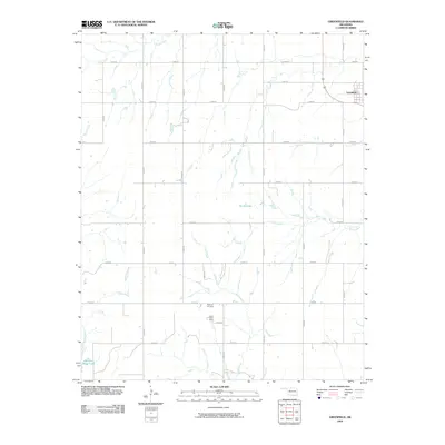
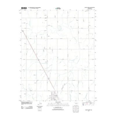
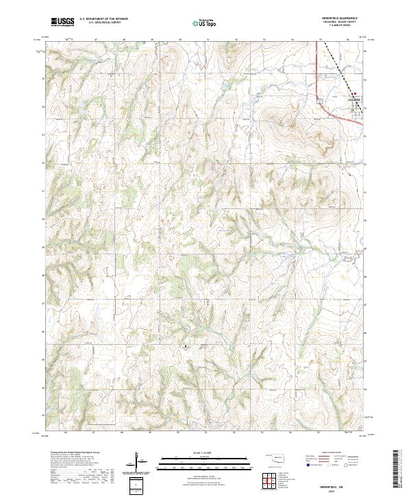 2023 Greenfield2023 Print · USGSGreenfield and the surrounding Blaine County plains are captured here in the early twenty-first century, showing a landscape defined by section-line roads and creek drainages. Researchers can locate Richland Cem, trace the waters of Horse Creek, and explore the canyon floor at American Horse Canyon.
End of results
Showing maps 1-16 of 16
Top cities near Greenfield
Frequently asked questions
- What are the different types of historical maps available for Greenfield?
- What is the oldest map of Greenfield?
- Where can I purchase historical maps of Greenfield for my home or office?
- Where can I download high-res historical maps of Greenfield?
- Are there historical topographic maps available for Greenfield?
- Is there historical aerial imagery available for Greenfield?
- Where are historical maps of Greenfield sourced from?