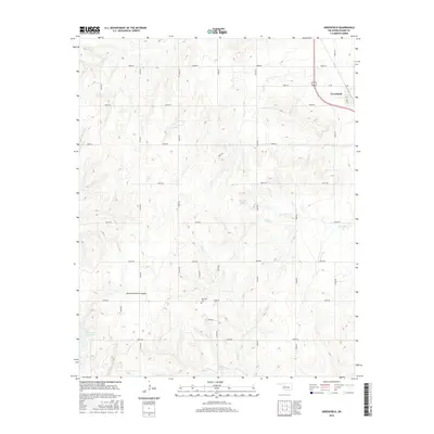
2016 Map of Greenfield
USGS Topo · Published 2016About this map
Greenfield sits at the northeastern corner of this western Oklahoma landscape, where the flat upland plains begin to break into the drainage systems of the North Canadian River valley. The terrain is defined by a series of south-flowing intermittent streams, including Horse Cr and Lariat Cr, which carve into the red-earth prairie. To the southwest, the topography becomes more pronounced within American Horse Canyon, leading to American Horse Lake. This 2016 survey illustrates a strictly organized section-line road grid, from n2530 RD to n2590 RD, that dictates the rural settlement pattern. Aside from the concentrated community of Greenfield, the land is dotted with dispersed homesteads and agricultural sites, including the Richland Cem, which serves as a significant genealogical marker for the local farming families of Blaine County.
Find a feature on this map
30 named features on this map. Tap any name to fly to it.
Don’t see what you’re looking for? This feature index may not catch every label — zoom into the map to look around manually.
Map Details
Editions of this 2016 Greenfield Map
This is the sole edition of this map. No revisions or reprints were ever made.
Other maps of this area
1942 · Geary
USGS Topo · 1:62,500

1955 · Clinton
USGS Topo · 1:250,000

1957 · Clinton
USGS Topo · 1:250,000
1964 · Oakwood
USGS Topo · 1:62,500
1964 · Weatherford
USGS Topo · 1:62,500
1972 · Watonga
USGS Topo · 1:24,000
1972 · Watonga SE
USGS Topo · 1:24,000
1979 · Geary North
USGS Topo · 1:24,000
1979 · Geary South
USGS Topo · 1:24,000
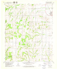
1979 · Greenfield
USGS Topo · 1:24,000