
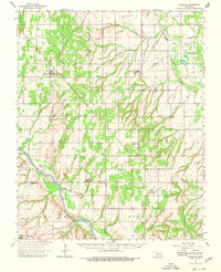
1964 Map of Oakwood
USGS Topo · Published 1965About this map
The Canadian River cuts through this Western Oklahoma landscape at a time when rural life centered on small agricultural hubs and river-bottom townships. The small settlements of Oakwood and Eagle City serve as anchors in the northern half of the region, each supported by its own local burial grounds like Oakwood Cem and Eagle City Cem. The presence of several country churches, including Rising Sun Ch and the Church of the First Born, reflects the importance of religious community in these prairie townships.
Find a feature on this map
35 named features on this map. Tap any name to fly to it.
Don’t see what you’re looking for? This feature index may not catch every label — zoom into the map to look around manually.
Map Details
Editions of this 1964 Oakwood Map
2 editions found
Other maps of this area

1942 · Geary
USGS Topo · 1:62,500

1955 · Clinton
USGS Topo · 1:250,000

1955 · Woodward
USGS Topo · 1:250,000

1957 · Clinton
USGS Topo · 1:250,000

1957 · Clinton
USGS Topo · 1:62,500

1958 · Woodward
USGS Topo · 1:250,000

1962 · Putnam
USGS Topo · 1:62,500

1964 · Weatherford
USGS Topo · 1:62,500

1972 · Watonga
USGS Topo · 1:24,000

1972 · Canton
USGS Topo · 1:24,000