2020s Maps of Mead, Oklahoma
Explore 2 historic maps of Mead from the 2020s. These maps offer a rare glimpse into what life looked like during the 2020s — showing old roads, neighborhoods, homes, and landmarks that have changed or disappeared over time.
Whether you're researching your family's past, planning a metal detecting trip, or studying how Mead's landscape evolved across the 2020s, these high-resolution maps are a powerful tool for exploring the history of this region.
- Focus on a specific era: All maps on this page are from the 2020s, giving you a focused view of this time period.
- See what’s changed: Compare century-old streets, trails, and buildings to today's modern landscape using overlays and satellite layers.
- Research with precision: Use these maps for genealogy, historical research, land use analysis, or educational projects.
- View, download, or print: Maps are fully viewable online in high resolution, and can be downloaded or printed for your own records.
Start exploring Mead's history through authentic maps from the 2020s. This is your window into the past.
Mead, OK maps
(2)- 2022 Map of Little City, 2022 Print
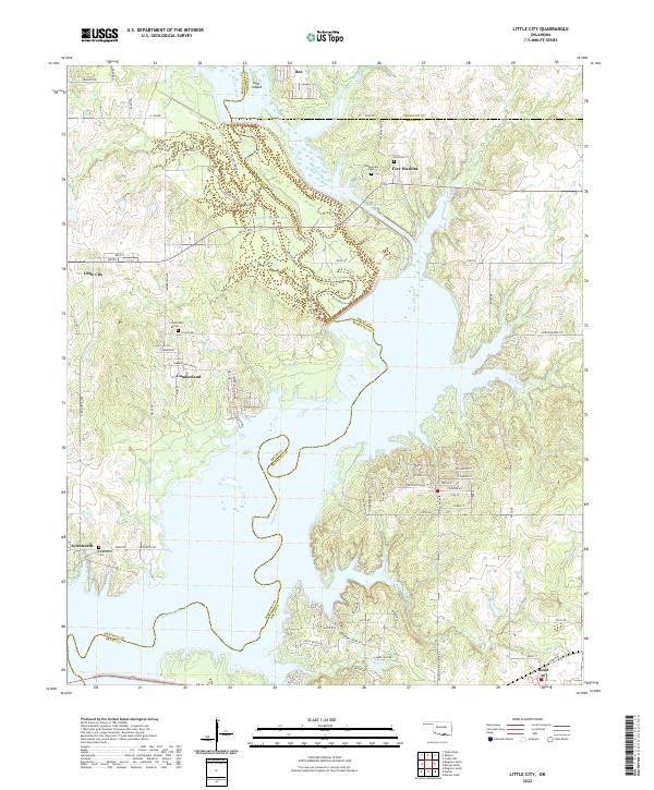 2022 Little City2022 Print · USGSThe northern reaches of Lake Texoma and the historic grounds of Fort Washita are captured here in the early twenty-first century. Genealogists and local historians can trace family locations near Cumberland Cem, the settlement of Little City, and the winding Old Channel Washita River.
 - 2023 Map of Platter, 2023 Print
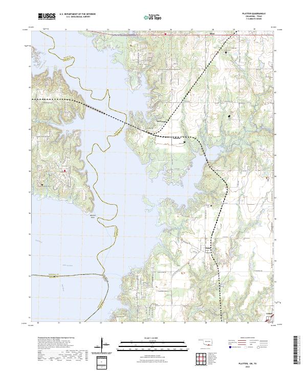 2023 Platter2023 Print · USGSThe Oklahoma-Texas borderlands around Lake Texoma appear in the early 2020s, revealing a landscape of recreational growth and rural heritage. Genealogists and local historians can trace several family burial sites, including Old Woodville Cem, Love Cem, and Harrison Cem.
End of results
Showing maps 1-2 of 2
Top cities near Mead
- Denison historical maps
- Durant historical maps
- Madill historical maps
- Tishomingo historical maps
- Calera historical maps
- Pottsboro historical maps
See more
Frequently asked questions
- What are the different types of historical maps available for Mead?
- What is the oldest map of Mead?
- Where can I purchase historical maps of Mead for my home or office?
- Where can I download high-res historical maps of Mead?
- Are there historical topographic maps available for Mead?
- Is there historical aerial imagery available for Mead?
- Where are historical maps of Mead sourced from?