2020s Maps of Mannford, Oklahoma
Explore 6 historic maps of Mannford from the 2020s. These maps offer a rare glimpse into what life looked like during the 2020s — showing old roads, neighborhoods, homes, and landmarks that have changed or disappeared over time.
Whether you're researching your family's past, planning a metal detecting trip, or studying how Mannford's landscape evolved across the 2020s, these high-resolution maps are a powerful tool for exploring the history of this region.
- Focus on a specific era: All maps on this page are from the 2020s, giving you a focused view of this time period.
- See what’s changed: Compare century-old streets, trails, and buildings to today's modern landscape using overlays and satellite layers.
- Research with precision: Use these maps for genealogy, historical research, land use analysis, or educational projects.
- View, download, or print: Maps are fully viewable online in high resolution, and can be downloaded or printed for your own records.
Start exploring Mannford's history through authentic maps from the 2020s. This is your window into the past.
Mannford, OK maps
(6)- 2022 Map of Olive, 2022 Print
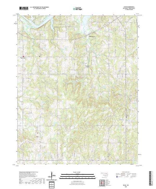 2022 Olive2022 Print · USGSCreek County’s rural landscape comes into focus here during the early twenty-first century, centered on the community of Olive. Genealogists can locate family landmarks like New Friendship Cem or trace the winding paths of Sand Cr and Lawrence Creek.
 - 2022 Map of Wekiwa, 2022 Print
 2022 Wekiwa2022 Print · USGSThe riverbanks and lakefronts of the Oklahoma interior are captured in this recent survey of the lands between the Arkansas River and Keystone Lake. Researchers can trace local development around Westport, Mannford, and the rural community of Lotsee.
 - 2022 Map of Terlton, 2022 Print
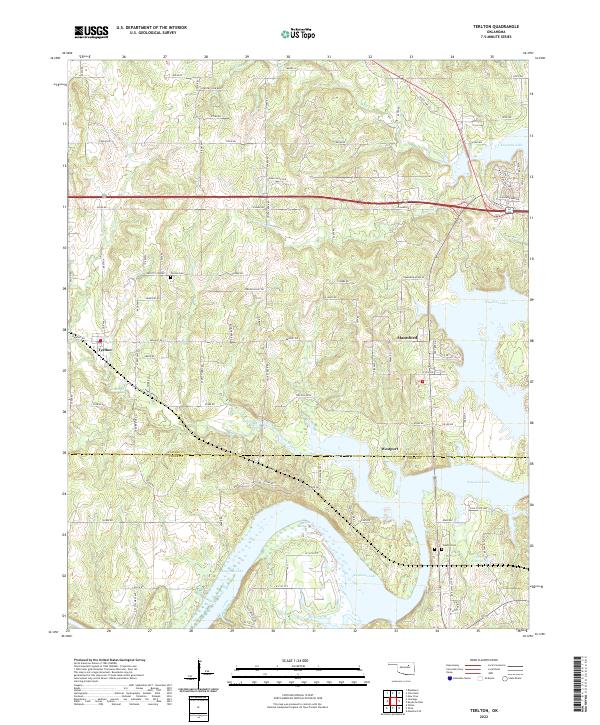 2022 Terlton2022 Print · USGSOklahoma's lake country near the Pawnee and Creek county line is revealed here in the early twenty-first century. Genealogists and local historians can trace family sites from Terlton Cemetery to Oakhill Cemetery or follow the inlets of Keystone Lake toward Mannford.
 - 2022 Map of Lake Sahoma, 2022 Print
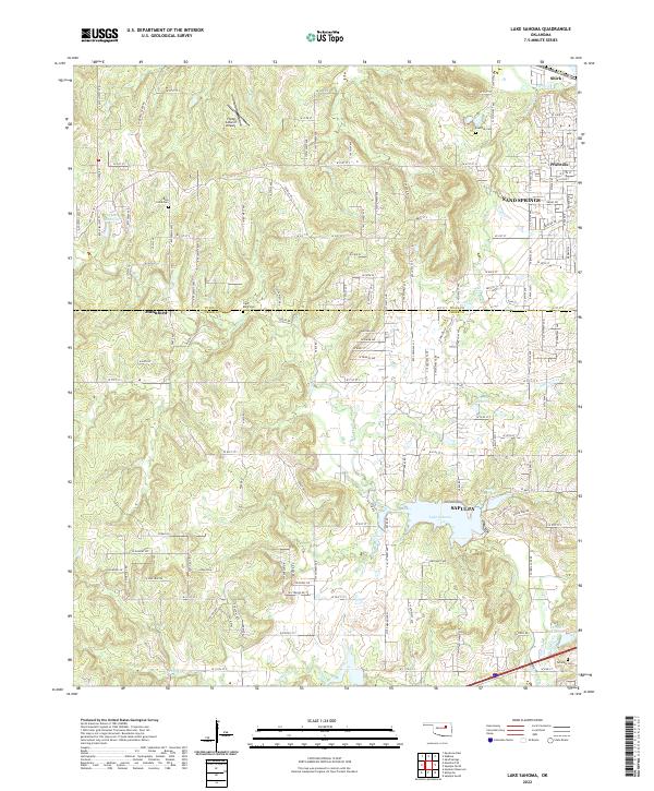 2022 Lake Sahoma2022 Print · USGSThe borderlands of Creek and Tulsa Counties come into focus here during the early 2020s, where suburban expansion meets rural landscapes. Genealogists and local historians can trace family locations through sites like Rock Creek Cem, Tiger Bone Cem, and the neighborhoods surrounding Lake Sahoma.
 - 2022 Map of Keystone Dam, 2022 Print
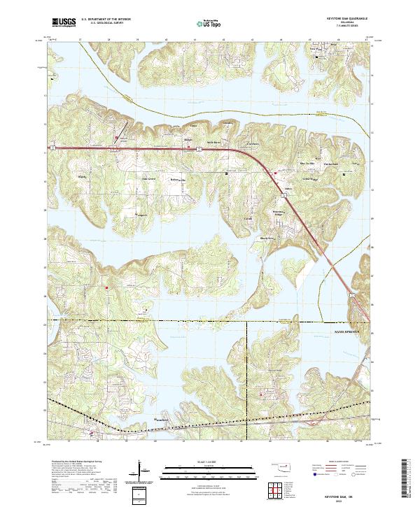 2022 Keystone Dam2022 Print · USGSThe intricate shoreline of Keystone Lake and the Arkansas River define this corner of Oklahoma in 2022. Researchers can trace local landmarks like Westport Airport, family burial sites at Prairie View Cem, and the layout of Mannford.
 - 2022 Map of Mannford SE, 2022 Print
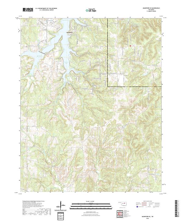 2022 Mannford SE2022 Print · USGSMannford and the shores of Keystone Lake are captured here in the early twenty-first century as the area continued to develop along the Creek and Tulsa County line. Local historians can trace family land via the township grids or follow the winding paths of Turkey Creek and Euchee Creek.
End of results
Showing maps 1-6 of 6
Top cities near Mannford
- Sapulpa historical maps
- Sand Springs historical maps
- Skiatook historical maps
- Cleveland historical maps
- Drumright historical maps
- Mounds historical maps
See more
Frequently asked questions
- What are the different types of historical maps available for Mannford?
- What is the oldest map of Mannford?
- Where can I purchase historical maps of Mannford for my home or office?
- Where can I download high-res historical maps of Mannford?
- Are there historical topographic maps available for Mannford?
- Is there historical aerial imagery available for Mannford?
- Where are historical maps of Mannford sourced from?