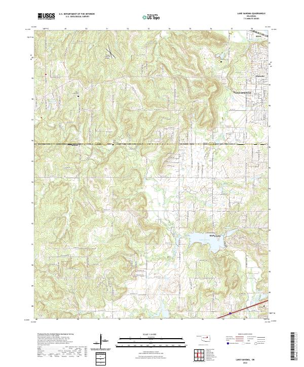
2022 Map of Lake Sahoma
USGS Topo · Published 2022About this map
Lake Sahoma and Pretty Water Lake anchor the central landscape of this western Tulsa region, where the urban edges of Sapulpa and Sand Springs meet the more open rural stretches of the Tulsa and Creek County line. The map illustrates a network of section-line roads and winding trails like Coyote Trl, connecting small residential clusters such as Prattville and Shirk with outlying industrial or agricultural sites. For those tracing family histories, the area is notable for several established burial grounds, including Rock Creek Cem, Tiger Bone Cem, and Post Oak Cem. The presence of the Flying G Ranch Airport and various unnamed reservoirs suggests a transition between suburban growth and the managed water systems of the Rock Creek and Anderson Creek drainages. This survey provides a clear view of the regional infrastructure as it appeared in the early 2020s, showing the intersection of municipal boundaries and private landholdings.
Find a feature on this map
136 named features on this map. Tap any name to fly to it.
Don’t see what you’re looking for? This feature index may not catch every label — zoom into the map to look around manually.
Map Details
Editions of this 2022 Lake Sahoma Map
This is the sole edition of this map. No revisions or reprints were ever made.
Other maps of this area

1901 · Nuyaka
USGS Topo · 1:125,000

1912 · Hominy
USGS Topo · 1:125,000

1914 · Kiefer
USGS Topo · 1:62,500

1915 · Hominy
USGS Topo · 1:125,000

1916 · Kiefer
USGS Topo · 1:62,500

1916 · Bristow
USGS Topo · 1:62,500

1954 · Oklahoma City
USGS Topo · 1:250,000

1955 · Enid
USGS Topo · 1:250,000

1956 · Sand Springs
USGS Topo · 1:24,000

1956 · Sapulpa North
USGS Topo · 1:24,000