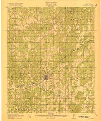
1916 Map of Bristow
USGS Topo · Published 1916About this map
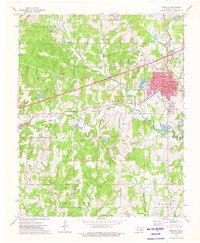
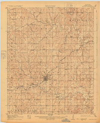
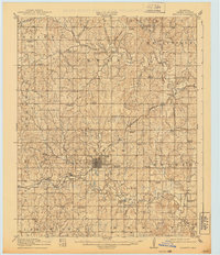
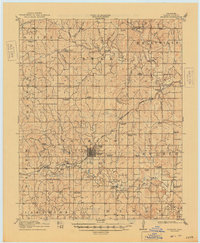
The town of Bristow serves as the central hub of this 1910s Creek County landscape, where the growing influence of the petroleum industry is evidenced by the massive Oil Tank Farm located just south of the municipal limits. The area's social fabric is defined by a dense network of rural school districts and places of worship, including Victor Chapel School, Shiloh School, and Sunrise School. Transportation is anchored by the St Louis and San Francisco railroad, which cuts through the rugged hills and creek bottoms that dominate the terrain.
Find a feature on this map
62 named features on this map. Tap any name to fly to it.
Don’t see what you’re looking for? This feature index may not catch every label — zoom into the map to look around manually.
Map Details
Editions of this 1916 Bristow Map
5 editions found
Historical Maps of Bristow Through Time
8 maps found