
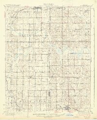
1932 Map of Stroud
USGS Topo · Published 1932About this map
The Oklahoma Indian Territory Boundary runs through the heart of this landscape, marking a historical divide that shaped the local settlement patterns of the early 1930s. Education and community life are anchored by dozens of country schools, including the Sac and Fox Sch and the Union Graded School 1, alongside rural congregations like Henderson Chapel. The topography is defined by the winding course of the Deep Fork Canadian River and its numerous tributaries such as Salt Creek and Deer Creek. Transport and commerce follow the paths of the St Louis San Francisco railroad and the Fort Smith and Western, connecting towns like Paden, Arlington, and Willzetta. This era reflects a transition where early highways like Highway No 66 and Fort Smith Hwy No 62 began to supplement the established rail network.
Find a feature on this map
67 named features on this map. Tap any name to fly to it.
Don’t see what you’re looking for? This feature index may not catch every label — zoom into the map to look around manually.
Map Details
Editions of this 1932 Stroud Map
2 editions found
Other maps of this area

1896 · Seminole and Prague
USGS Topo · 1:125,000

1900 · Wewoka
USGS Topo · 1:125,000

1901 · Nuyaka
USGS Topo · 1:125,000

1905 · Chandler
USGS Topo · 1:62,500

1907 · Chandler
USGS Topo · 1:62,500

1908 · Agra
USGS Topo · 1:62,500

1909 · Shawnee
USGS Topo · 1:62,500

1916 · Bristow
USGS Topo · 1:62,500

1929 · Stroud
USGS Topo · 1:62,500

1931 · Drumright
USGS Topo · 1:62,500