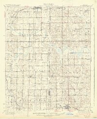
1932 Map of Stroud
USGS Topo · Published 1932About this map
The Old Indian Territory Oklahoma Boundary runs vertically through this 1932 topographic sheet, marking the historical divide between the former Oklahoma Territory and the lands of the Muscogee (Creek) Nation. Centered on the Deep Fork Canadian River, the landscape is defined by a dense network of rural one-room schools such as Mud College, Sac and Fox Sch, and Pettiquah Sch, reflecting a high density of farming families in the early twentieth century. The town of Stroud serves as the northern hub, situated at the junction of the St Louis San Francisco railroad and Highway No 66. Further south, the Fort Smith and Western railway links the community of Paden to the wider region. This survey captures a moment when local life revolved around small social centers like Henderson Chapel and Mission Ch before mid-century school consolidations changed the rural educational landscape forever.
Find a feature on this map
71 named features on this map. Tap any name to fly to it.
Don’t see what you’re looking for? This feature index may not catch every label — zoom into the map to look around manually.
Map Details
Editions of this 1932 Stroud Map
2 editions found

Other maps of this area

1896 · Seminole and Prague
USGS Topo · 1:125,000

1900 · Wewoka
USGS Topo · 1:125,000

1901 · Nuyaka
USGS Topo · 1:125,000

1905 · Chandler
USGS Topo · 1:62,500

1907 · Chandler
USGS Topo · 1:62,500

1908 · Agra
USGS Topo · 1:62,500

1909 · Shawnee
USGS Topo · 1:62,500

1916 · Bristow
USGS Topo · 1:62,500

1929 · Stroud
USGS Topo · 1:62,500

1931 · Drumright
USGS Topo · 1:62,500