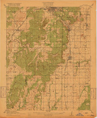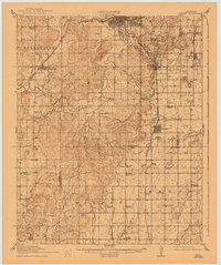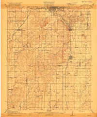
1916 Map of Kiefer
USGS Topo · Published 1916About this map
Kiefer and Kellyville serve as primary hubs on this survey, reflecting a landscape defined by the early 20th-century oil boom and a dense network of rural infrastructure. The presence of a prominent Oil Tank near Mounds and the concentration of structures around the St Louis San Francisco RR suggest an economy rapidly evolving around petroleum and rail transport. The map is particularly rich in social geography, documenting nearly twenty local schools and several churches, including the Louisiana Baptist Church and Grayson Church, which anchored these growing communities.
Find a feature on this map
59 named features on this map. Tap any name to fly to it.
Don’t see what you’re looking for? This feature index may not catch every label — zoom into the map to look around manually.
Map Details
Editions of this 1916 Kiefer Map
3 editions found