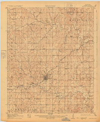
1916 Map of Bristow
USGS Topo · Published 1925About this map
Bristow serves as the central hub for this 1914-1915 survey of Creek County, capturing the region during a period of significant growth driven by the burgeoning oil industry. The landscape is dotted with specialized infrastructure including a large Oil Tank Farm near the city center and the St Louis and San Francisco railroad lines that facilitated transport across the territory. Rural life is well-documented through a dense network of country schools and churches such as Victor Chapel School, Shiloh School, and East Side School, indicating a well-settled agricultural and industrial population.
Find a feature on this map
71 named features on this map. Tap any name to fly to it.
Don’t see what you’re looking for? This feature index may not catch every label — zoom into the map to look around manually.
Map Details
Editions of this 1916 Bristow Map
5 editions found
Other maps of this area

1901 · Nuyaka
USGS Topo · 1:125,000

1912 · Hominy
USGS Topo · 1:125,000

1914 · Kiefer
USGS Topo · 1:62,500

1915 · Hominy
USGS Topo · 1:125,000

1916 · Kiefer
USGS Topo · 1:62,500

1916 · Bristow
USGS Topo · 1:62,500

1929 · Yale
USGS Topo · 1:62,500

1929 · Stroud
USGS Topo · 1:62,500

1931 · Drumright
USGS Topo · 1:62,500

1932 · Stroud
USGS Topo · 1:62,500