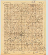
1916 Map of Bristow
USGS Topo · Published 1939About this map
The town of Bristow serves as the central hub for this Oklahoma survey, situated amidst the complex drainage basins of Deep Fork and Polecat Creek. At the time of this 1914–1915 survey, the landscape was heavily dotted with rural community institutions, evidenced by a high density of one-room schoolhouses such as McClintock School, Sunrise School, and Wyatt School. Cultural and agricultural landmarks of the early twentieth century are clearly marked, including the Indian Dance Grounds south of town and the County Farm to the west.
Find a feature on this map
61 named features on this map. Tap any name to fly to it.
Don’t see what you’re looking for? This feature index may not catch every label — zoom into the map to look around manually.
Map Details
Editions of this 1916 Bristow Map
5 editions found
Other maps of this area

1901 · Nuyaka
USGS Topo · 1:125,000

1912 · Hominy
USGS Topo · 1:125,000

1914 · Kiefer
USGS Topo · 1:62,500

1915 · Hominy
USGS Topo · 1:125,000

1916 · Kiefer
USGS Topo · 1:62,500

1916 · Bristow
USGS Topo · 1:62,500

1929 · Yale
USGS Topo · 1:62,500

1929 · Stroud
USGS Topo · 1:62,500

1931 · Drumright
USGS Topo · 1:62,500

1932 · Stroud
USGS Topo · 1:62,500