1950s Maps of Bailey, Oklahoma
Explore 3 historic maps of Bailey from the 1950s. These maps offer a rare glimpse into what life looked like during the 1950s — showing old roads, neighborhoods, homes, and landmarks that have changed or disappeared over time.
Whether you're researching your family's past, planning a metal detecting trip, or studying how Bailey's landscape evolved across the 1950s, these high-resolution maps are a powerful tool for exploring the history of this region.
- Focus on a specific era: All maps on this page are from the 1950s, giving you a focused view of this time period.
- See what’s changed: Compare century-old streets, trails, and buildings to today's modern landscape using overlays and satellite layers.
- Research with precision: Use these maps for genealogy, historical research, land use analysis, or educational projects.
- View, download, or print: Maps are fully viewable online in high resolution, and can be downloaded or printed for your own records.
Start exploring Bailey's history through authentic maps from the 1950s. This is your window into the past.
Bailey, OK maps
(3)- 1950 Map of Marlow, 1973 Print
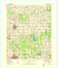 1950 Marlow1973 Print · USGSMid-century Stephens County comes alive in this survey of the Marlow and Duncan corridor during a period of oil growth and educational shifts. Genealogists can locate family-named landmarks like Short Cem or rural schoolhouses including Gatlin Sch and Payne Sch.
 - 1951 Map of Marlow
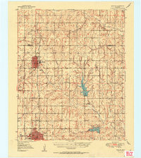 1951 Marlow1951 Print · USGSStephens County transitions into a modern energy and transit hub during the early fifties, centering on the growing communities of Marlow and Duncan. Genealogists and historians can trace family locations near Union Center Ch, Stover Sch, or the historic path of the Chisholm Trail.2 unique versions available
 - 1957 Map of Ardmore, 1968 Print
 1957 Ardmore1968 Print · USGSSouth-central Oklahoma in the late fifties was a landscape of rising reservoir waters and expanding rail lines. Genealogists and historians can trace the foundations of Ardmore and Duncan or locate early recreation sites at Platt National Park and Lake Murray State Park.3 unique versions available
End of results
Showing maps 1-3 of 3
Top cities near Bailey
- Duncan historical maps
- Marlow historical maps
- Lindsay historical maps
- Rush Springs historical maps
- Bray historical maps
- Central High historical maps
See more
Frequently asked questions
- What are the different types of historical maps available for Bailey?
- What is the oldest map of Bailey?
- Where can I purchase historical maps of Bailey for my home or office?
- Where can I download high-res historical maps of Bailey?
- Are there historical topographic maps available for Bailey?
- Is there historical aerial imagery available for Bailey?
- Where are historical maps of Bailey sourced from?