1970s Maps of Harper County, Oklahoma
Explore 32 historic maps of Harper County from the 1970s. These maps offer a rare glimpse into what life looked like during the 1970s — showing old roads, neighborhoods, homes, and landmarks that have changed or disappeared over time.
Whether you're researching your family's past, planning a metal detecting trip, or studying how Harper County's landscape evolved across the 1970s, these high-resolution maps are a powerful tool for exploring the history of this region.
- Focus on a specific era: All maps on this page are from the 1970s, giving you a focused view of this time period.
- See what’s changed: Compare century-old streets, trails, and buildings to today's modern landscape using overlays and satellite layers.
- Research with precision: Use these maps for genealogy, historical research, land use analysis, or educational projects.
- View, download, or print: Maps are fully viewable online in high resolution, and can be downloaded or printed for your own records.
Start exploring Harper County's history through authentic maps from the 1970s. This is your window into the past.
Harper County, OK maps
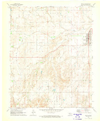
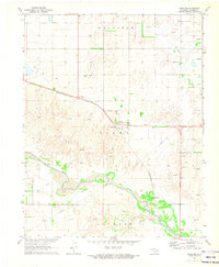
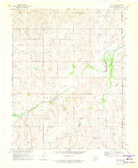
(32)- 1970 Map of Gate, 1972 Print
 1970 Gate1972 Print · USGSThe Oklahoma panhandle town of Gate is captured here during its mid-century energy boom. Researchers can trace the Missouri-Kansas-Texas rail line and locate rural landmarks like Zelma Cem, Cline Cem, and Gate Lake.
 - 1970 Map of Lookout, 1972 Print
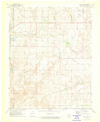
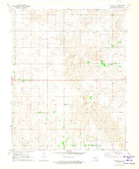
 1970 Lookout1972 Print · USGSThe Oklahoma-Kansas borderlands in the early 1970s reveal a landscape shaped by the energy industry and rural community life. Researchers can trace the sprawling Patterson Oil and Gas Field and locate landmarks like Lookout Ch and the Coy Community Hall.
 - 1970 Map of Gate NE, 1972 Print
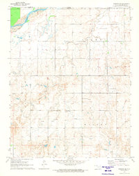
 1970 Gate NE1972 Print · USGSBeaver County is captured in the early seventies, showing a landscape defined by the winding Cimarron River and increasing energy infrastructure. Researchers can locate Gate Cem and trace water history via the Old Settlers Irrigation Ditch.
 - 1970 Map of Buffalo SE, 1973 Print
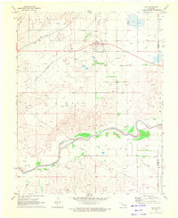
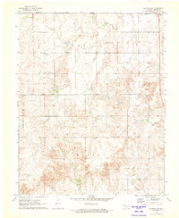
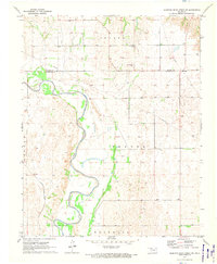
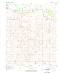
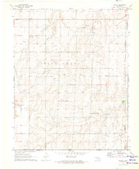
 1970 Buffalo SE1973 Print · USGSHarper County at the dawn of the seventies shows a prairie landscape shaped by rail and resource extraction. Genealogists and local historians can trace family locations near Hopewell Cem, the Atchison Topeka and Santa Fe tracks, or the outskirts of Buffalo.
 - 1970 Map of Selman NW, 1973 Print
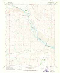
 1970 Selman NW1973 Print · USGSThe Oklahoma-Kansas borderlands come into focus in the early 1970s as industrial exploration meets traditional ranching. Local researchers can locate the Lutheran Cem, the rural settlement of Lodge, and numerous Gas Wells along the Cimarron River.
 - 1970 Map of Buffalo NW, 1973 Print
 1970 Buffalo NW1973 Print · USGSThe Oklahoma-Kansas borderlands come into focus at the dawn of the 1970s, showcasing a rural landscape defined by township lines and cattle-country creek beds. Researchers can locate the settlement of Willard, a local Cem, and numerous Gas Wells along Snake Creek.2 unique versions available
 - 1970 Map of Rosston NW, 1973 Print
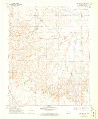
 1970 Rosston NW1973 Print · USGSAcross the Harper County line in the early 1970s, this survey shows a landscape of Oklahoma ranchland and riverbeds integrated with the energy industry. Researchers can find the Ditch Valley Community Building and trace the Old Settlers Irrigation Ditch and Redoubt Creek.
 - 1970 Map of Laverne SW, 1973 Print
 1970 Laverne SW1973 Print · USGSThe borderlands of Ellis and Harper Counties are captured here during the 1970s energy boom. Genealogists and historians can trace the rural township lines of Speermoore and Otter, locating landmarks like Speermoore Cem and the Caliche Pit.2 unique versions available
 - 1970 Map of Rosston NE, 1973 Print
 1970 Rosston NE1973 Print · USGSNorth of the Harper County line in the early 1970s, this landscape shows the intersection of ranching and energy extraction. Genealogists and historians can trace the Old Settlers Irr Ditch and locate burials at Pleasant Valley Cem.
 - 1970 Map of Sleeping Bear Creek SW, 1973 Print
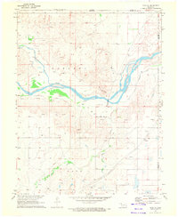
 1970 Sleeping Bear Creek SW1973 Print · USGSNorthwestern Oklahoma in the early 1970s shows a landscape of river bends and rural social centers. Genealogists and historians can trace the path of the North Canadian River past the Rock Church Cem and the Missouri - Kansas - Texas railroad.
 - 1970 Map of Buffalo NE, 1973 Print
 1970 Buffalo NE1973 Print · USGSThe Oklahoma-Kansas state line north of Buffalo is documented here during the early 1970s, showcasing a rural landscape of ranching and oil extraction. Researchers can locate community centers like the Paruna Community Hall and trace family sites at Willow Creek Cem.
 - 1970 Map of Sleeping Bear Creek NW, 1973 Print
 1970 Sleeping Bear Creek NW1973 Print · USGSHarper County's high plains and gas fields come into focus in this early 1970s survey. Researchers can trace land ownership patterns across the GOOD, SALINE, and CENTER townships while locating landmarks like Fern Cem and various Gas Wells.
 - 1970 Map of Sleeping Bear Creek SE, 1973 Print
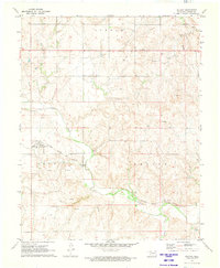
 1970 Sleeping Bear Creek SE1973 Print · USGSThe Oklahoma high plains at the dawn of the 1970s reveal a landscape defined by ranching section lines and oil production. Researchers can trace family sites near Lathrop Cem or follow the paths of Sleeping Bear Creek and Traders Creek.
 - 1970 Map of Buffalo, 1973 Print
 1970 Buffalo1973 Print · USGSBuffalo and its surrounding Northwest Oklahoma rangeland are captured here at the start of the 1970s. Trace the energy and extraction history of Harper County through numerous Gas Well sites, a Caliche Pit, and the Buffalo Creek drainage.
 - 1971 Map of Rosston SE, 1973 Print
 1971 Rosston SE1973 Print · USGSNorthwestern Oklahoma is captured in the early 1970s as energy development expands across the plains. Trace family ties at Doby Springs Cem and Rose Hill Cem, or explore the landscape around Buffalo Creek and Doby Springs Park.
 - 1971 Map of May East, 1973 Print
 1971 May East1973 Print · USGSThe rural landscape of Ellis County is captured here in the early 1970s as energy production and rail transport shaped the plains. Researchers can locate the town of May, trace the Missouri - Kansas - Texas railroad, and find local landmarks like Mt Olive Ch.
 - 1971 Map of Selman SE, 1973 Print
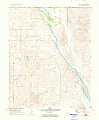
 1971 Selman SE1973 Print · USGSNorthwestern Oklahoma’s river valley is captured here in the early seventies, where three counties meet along the sandy bends of the Cimarron River. Researchers can trace the Atchison Topeka and Santa Fe line or locate family sites at Spring Valley Cem and Nixon Cem.
 - 1971 Map of Rosston, 1973 Print
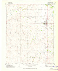
 1971 Rosston1973 Print · USGSAcross the Harper County prairie in the early seventies, the settlement of Rosston sits at the junction of rail and river. Genealogists and historians can trace the Missouri-Kansas-Texas route, find the Pleasant Ridge Cem, and locate numerous Gas Wells.
 - 1971 Map of Fort Supply, 1973 Print
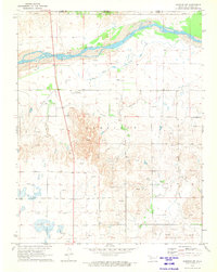
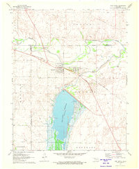 1971 Fort Supply1973 Print · USGSNorthwest Oklahoma’s landscape in the early seventies centers on the vital waters of the Fort Supply Reservoir. Local researchers can trace the Missouri - Kansas - Texas rail line or locate family sites near Fairlawn Cem and the Western State Hospital.
 - 1971 Map of Fort Supply NW, 1973 Print
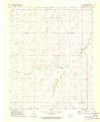
 1971 Fort Supply NW1973 Print · USGSHarper County in the early seventies shows an active landscape of energy exploration and rural utility. Researchers can trace the extensive AND GAS FIELD and locate local landmarks like the Townhall, Roadside Park, and Sand Creek.
 - 1971 Map of Selman, 1973 Print
 1971 Selman1973 Print · USGSThe high plains of Harper County come into focus in the early seventies, centered on the railroad town of Selman. Researchers can trace the path of the Atchison Topeka and Santa Fe line as it follows the valley of Buffalo Creek past numerous energy sites and Gas Wells.
 - 1971 Map of Logan NE, 1973 Print
 1971 Logan NE1973 Print · USGSBeaver County is captured in the early 1970s as the regional energy sector and ranching life intertwined. Genealogists and historians can locate Madison Cem, Fairview Cem, and the industry at the Pumping Station near Kiowa Creek.
 - 1971 Map of Slapout, 1973 Print
 1971 Slapout1973 Print · USGSThe Oklahoma Panhandle near Slapout is documented in the early seventies during a period of significant energy development. Local historians can trace family ties at Poplar Grove Cem and Fairview Ch or map the growth of natural gas infrastructure through dozens of Gas Wells.
 - 1971 Map of Fort Supply NE, 1973 Print
 1971 Fort Supply NE1973 Print · USGSHarper County's rural townships are captured here in the early 1970s, showcasing the prairie landscape of northwest Oklahoma. Researchers can identify local landmarks like the Kibby Cem and trace the paths of Sand Creek and a major industrial Pipeline.
 - 1971 Map of Laverne, 1973 Print
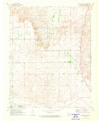
 1971 Laverne1973 Print · USGSLaverne was a growing hub of the Oklahoma panhandle in the early seventies, where rail lines met the river. Researchers can trace the town's expansion through the Laverne Airport, the Missouri-Kansas-Texas railroad, and the Laverne Memorial Cem.
Showing maps 1-25 of 32
Top cities of Harper County
Frequently asked questions
- What are the different types of historical maps available for Harper County?
- What is the oldest map of Harper County?
- Where can I purchase historical maps of Harper County for my home or office?
- Where can I download high-res historical maps of Harper County?
- Are there historical topographic maps available for Harper County?
- Is there historical aerial imagery available for Harper County?
- Where are historical maps of Harper County sourced from?