2020s Maps of Waurika, Oklahoma
Explore 2 historic maps of Waurika from the 2020s. These maps offer a rare glimpse into what life looked like during the 2020s — showing old roads, neighborhoods, homes, and landmarks that have changed or disappeared over time.
Whether you're researching your family's past, planning a metal detecting trip, or studying how Waurika's landscape evolved across the 2020s, these high-resolution maps are a powerful tool for exploring the history of this region.
- Focus on a specific era: All maps on this page are from the 2020s, giving you a focused view of this time period.
- See what’s changed: Compare century-old streets, trails, and buildings to today's modern landscape using overlays and satellite layers.
- Research with precision: Use these maps for genealogy, historical research, land use analysis, or educational projects.
- View, download, or print: Maps are fully viewable online in high resolution, and can be downloaded or printed for your own records.
Start exploring Waurika's history through authentic maps from the 2020s. This is your window into the past.
Waurika, OK maps
(2)- 2022 Map of Waurika East, 2022 Print
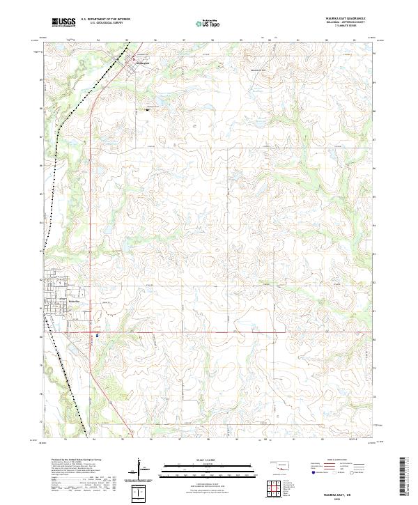 2022 Waurika East2022 Print · USGSJefferson County ranching and water management define this area south of Addington in the early twenty-first century. Researchers can trace family-named landmarks like Youree Ranch Rd and Stuart Ranch Rd or locate ancestors at Addington Cem.
 - 2022 Map of Waurika West, 2022 Print
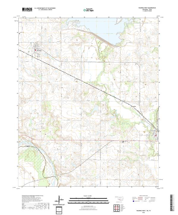 2022 Waurika West2022 Print · USGSSouthern Oklahoma meets the Texas border along the Red River in this detailed 2022 survey of Jefferson County. Genealogists can locate Hastings Cem and the Jefferson County Courthouse, while water history is recorded at Waurika Lake and Beaver Cr.
End of results
Showing maps 1-2 of 2
Top cities near Waurika
- Comanche historical maps
- Temple historical maps
- Ryan historical maps
- Empire City historical maps
- Petrolia historical maps
- Byers historical maps
See more
Frequently asked questions
- What are the different types of historical maps available for Waurika?
- What is the oldest map of Waurika?
- Where can I purchase historical maps of Waurika for my home or office?
- Where can I download high-res historical maps of Waurika?
- Are there historical topographic maps available for Waurika?
- Is there historical aerial imagery available for Waurika?
- Where are historical maps of Waurika sourced from?