1970s Maps of Chilli, Oklahoma
Explore 2 historic maps of Chilli from the 1970s. These maps offer a rare glimpse into what life looked like during the 1970s — showing old roads, neighborhoods, homes, and landmarks that have changed or disappeared over time.
Whether you're researching your family's past, planning a metal detecting trip, or studying how Chilli's landscape evolved across the 1970s, these high-resolution maps are a powerful tool for exploring the history of this region.
- Focus on a specific era: All maps on this page are from the 1970s, giving you a focused view of this time period.
- See what’s changed: Compare century-old streets, trails, and buildings to today's modern landscape using overlays and satellite layers.
- Research with precision: Use these maps for genealogy, historical research, land use analysis, or educational projects.
- View, download, or print: Maps are fully viewable online in high resolution, and can be downloaded or printed for your own records.
Start exploring Chilli's history through authentic maps from the 1970s. This is your window into the past.
Chilli, OK maps
(2)- 1971 Map of Gowen, 1973 Print
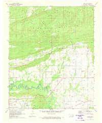 1971 Gowen1973 Print · USGSEastern Oklahoma's coal and gas country is shown in the early seventies as the landscape evolved around the new shoreline of Eufaula Lake. Researchers can trace the rail-and-road connections between Gowen, Bowers, and Patterson near the local Strip Mines.2 unique versions available
 - 1977 Map of Gowen
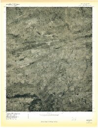 1977 Gowen1977 Print · USGSLatimer County in the late seventies is shown through high-altitude aerial photography, revealing the rural character of the settlements below the Sans Bois Mountains. Researchers can trace the layout of small communities like Gowen, Chilli, and Patterson against the natural meanders of Gaines Creek.
End of results
Showing maps 1-2 of 2
Top cities near Chilli
- Wilburton historical maps
- Hartshorne historical maps
- Quinton historical maps
- Haileyville historical maps
- Crowder historical maps
- Kinta historical maps
Frequently asked questions
- What are the different types of historical maps available for Chilli?
- What is the oldest map of Chilli?
- Where can I purchase historical maps of Chilli for my home or office?
- Where can I download high-res historical maps of Chilli?
- Are there historical topographic maps available for Chilli?
- Is there historical aerial imagery available for Chilli?
- Where are historical maps of Chilli sourced from?