Old Maps of Love County, Oklahoma for Genealogy
Trace your family roots with 134 historic maps of Love County. These high-res maps reveal old neighborhoods, homesites, landmarks, and streets — helping you uncover where your ancestors lived and how the area evolved over time.
- Explore historic neighborhoods: Identify where your relatives may have lived in the 1800s or 1900s.
- Compare maps over time: Trace the changes in streets, buildings, and landmarks for multi-generational research.
- Perfect for genealogy & ancestry research: Used by family historians and researchers to map out lineage and migration.
These maps are an incredible resource for exploring your personal connection to Love County's past.
Love County, OK maps
(134)- 1901 Map of Addington
 1901 Addington1901 Print · USGSThe Chickasaw Nation at the turn of the century shows a landscape transitioning from cattle trails to rail commerce. Local historians can trace the Chisholm Trail and the Chicago Rock Island and Pacific rail line through Duncan, Comanche, and Addington.6 unique versions available
 - 1901 Map of Tishomingo
 1901 Tishomingo1901 Print · USGSThe Chickasaw Nation comes to life in this late-frontier survey of Johnston County and the surrounding Indian Territory. Genealogists and historians can locate early industrial sites like the Asphalt Mines, the landmark Harley Institute, and the site of Fort Washita.4 unique versions available
 - 1901 Map of Ardmore
 1901 Ardmore1901 Print · USGSThe Chickasaw Nation of Indian Territory is captured here at the turn of the century, showing a landscape of burgeoning rail towns and early industry. Researchers can trace the Gulf Colorado and Santa Fe line through Ardmore or locate early Asphalt Mine sites near Newport.6 unique versions available
 - 1901 Map of Denison
 1901 Denison1901 Print · USGSThe Red River valley in the final years of the Indian Territory era was a landscape of river crossings and rail expansion. Genealogists and historians can trace the early transit networks through Willis Ferry, Cedar Mills, and the Colbert Bridge.4 unique versions available
 - 1902 Map of Gainesville
 1902 Gainesville1902 Print · USGSThe Red River frontier comes alive in the years before Oklahoma statehood, showing the border between Texas and the Chickasaw Nation. Trace early river travel through Rock Bluff Ferry and Freemans Ferry or locate old schoolhouses like Wolf Ridge Schoolhouse.5 unique versions available
 - 1905 Map of Montague
 1905 Montague1905 Print · USGSMontague County and the bordering Chickasaw Nation are captured here in the early twentieth century as the frontier transitioned into a settled rail corridor. Genealogists and local researchers can locate numerous rural schools like Eagle Pt. School and trace river crossings such as Owings Ferry.3 unique versions available
 - 1918 Map of Ardmore
 1918 Ardmore1918 Print · USGSSouthern Oklahoma was a hub of energy production and rail traffic during the late teens. Researchers can trace the early infrastructure of the Healdton Oil Fields, find vanished sites like Joiner City, or locate the Post Oak School.
 - 1943 Map of Gainesville
 1943 Gainesville1943 Print · USGSTexas and Oklahoma borders meet along the winding Red River during the height of the Second World War. Genealogists can trace family names through dozens of rural landmarks like Whaley Chapel School, Spring Valley Church, and the sprawling Camp Howze Military Reservation.
 - 1954 Map of Sherman, 1964 Print
 1954 Sherman1964 Print · USGSThe Red River valley and North Texas plains are captured here in the mid-fifties, showing the region as new reservoirs like Lake Texoma and Lavon Reservoir reshaped the land. Genealogists can trace family roots through specific local landmarks like Courtney P O, Pilot Grove Sch, and New Hope Ch.2 unique versions available
 - 1957 Map of Ardmore, 1968 Print
 1957 Ardmore1968 Print · USGSSouth-central Oklahoma in the late fifties was a landscape of rising reservoir waters and expanding rail lines. Genealogists and historians can trace the foundations of Ardmore and Duncan or locate early recreation sites at Platt National Park and Lake Murray State Park.3 unique versions available
 - 1958 Map of Gordonville, 1959 Print
 1958 Gordonville1959 Print · USGSGrayson County and the Red River valley are shown here just after the mid-century, as the region adjusted to the presence of the reservoir. Genealogists can locate family sites like Mt Tabor Cem, Johnson Cem, and the rural community of Gordonville.2 unique versions available
 - 1958 Map of Sherman, 1959 Print
 1958 Sherman1959 Print · USGSNorth Texas and Southern Oklahoma were undergoing significant development in the late fifties as the Red River Valley transit networks matured. Researchers can trace historic family-named locations such as Saddler Bend, the grounds of Perrin AFB, and early shoreline developments at Lake Texoma.
 - 1960 Map of Callisburg, 1963 Print
 1960 Callisburg1963 Print · USGSCooke County and the Oklahoma border are documented here in the early sixties as the regional oil industry thrived. Researchers can locate family landmarks like Center Hill Cem, the Gainesville State School For Girls, and the extensive Walnut Bend Oil Field.2 unique versions available
 - 1960 Map of Gainesville North, 1964 Print
 1960 Gainesville North1964 Print · USGSGainesville and the surrounding Texas-Oklahoma borderlands are captured here in the early sixties as the regional rail and air infrastructure expanded. Trace local family roots at Rest Haven Memorial Cemetery or explore the rail junction of the Missouri Kansas Texas and Gulf Colorado and Santa Fe lines.2 unique versions available
 - 1963 Map of Ardmore
 1963 Ardmore1963 Print · USGSSouthern Oklahoma during the early sixties shows a landscape defined by the Arbuckle Mountains and a booming energy economy. Genealogists and historians can trace family-named sites across the Ardmore Oil Field, find old schools like Southeastern State College, or locate historic markers such as Boggy Depot State Park.2 unique versions available
 - 1963 Map of Mc Millan, 1964 Print
 1963 Mc Millan1964 Print · USGSThe rural landscape of Marshall County is shown in the early sixties as Lake Texoma reached into the surrounding creek valleys. Researchers can trace family roots through sites like McMillan Cem, Pickens Ch, and the settlement of Enyille.2 unique versions available
 - 1964 Map of Lake Murray, 1965 Print
 1964 Lake Murray1965 Print · USGSLove and Carter Counties center on the expansive waters of Lake Murray during the mid-sixties. Local historians and genealogists can trace the early road network around Greenville or locate family sites like Legate Cem and Wilson Cem.3 unique versions available
 - 1964 Map of Overbrook, 1965 Print
 1964 Overbrook1965 Print · USGSLove and Carter Counties are captured in the mid-sixties during a period of transition, showing a landscape of oil production and emerging highways. Researchers can trace family sites like Crinnerville Ch or the McAlester Cem alongside the winding Hickory Creek.3 unique versions available
 - 1967 Map of Marietta East, 1971 Print
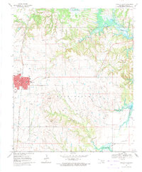 1967 Marietta East1971 Print · USGSLove County during the late sixties shows the expansion of Marietta toward the reservoir-affected terrain of Loves Valley. Local researchers can trace family landmarks like Love Cem, industrial sites such as the Refinery, and the rail line of the Atchison Topeka and Santa Fe.2 unique versions available
 - 1968 Map of Thackerville, 1971 Print
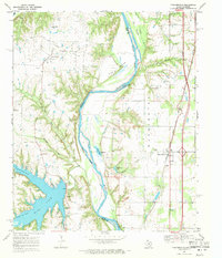 1968 Thackerville1971 Print · USGSThe Red River border between Oklahoma and Texas is shown here in the late sixties, highlighting the intersection of rail and river commerce. Researchers can trace the Atchison Topeka and Santa Fe tracks through Thackerville and locate the Sivells Bend Sch near the oil fields.2 unique versions available
 - 1968 Map of Burneyville, 1971 Print
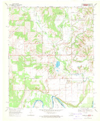 1968 Burneyville1971 Print · USGSLove County, Oklahoma, is documented here in the late sixties as a landscape of river bends and rural settlements. Genealogists and historians can locate family burial sites at Box Cem or Parker Cem and trace the paths of Simon Creek and Bone Creek.2 unique versions available
 - 1968 Map of Spanish Fort, 1971 Print
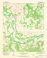 1968 Spanish Fort1971 Print · USGSThe Oklahoma-Texas borderlands along the Red River appear here in the late sixties as a landscape of rural settlements and emerging energy fields. Researchers can locate early burial sites and communities like Petersburg Cem, Spanish Fort, and the Illinois Bend Oil Field.2 unique versions available
 - 1968 Map of Leon North, 1971 Print
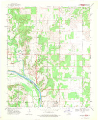 1968 Leon North1971 Print · USGSThe Red River frontier comes into focus during the late 1960s as it weaves between Oklahoma and Texas. Researchers can trace family roots at Courtney Cem or explore the river loops at Illinois Bend and the small settlements of Leon and Rubottom.2 unique versions available
 - 1968 Map of Horseshoe Bend, 1971 Print
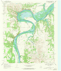 1968 Horseshoe Bend1971 Print · USGSThe Red River border between Texas and Oklahoma was defined by a heavy petroleum economy and winding river bends in the late sixties. Genealogists and historians can trace the rural infrastructure of the day, from the Walnut Bend Sch and Black Cem to the sprawling Walnut Bend Oil Field.2 unique versions available
 - 1968 Map of Marysville, 1971 Print
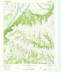 1968 Marysville1971 Print · USGSThe Red River frontier in the late sixties reveals a landscape of winding river bends and rural Texas settlements. Genealogists and researchers can locate the Weaver Cem, the small community of Marysville, and the Olsen Ranch Landing Strip.2 unique versions available
Showing maps 1-25 of 134
Top cities of Love County
Frequently asked questions
- What are the different types of historical maps available for Love County?
- What is the oldest map of Love County?
- Where can I purchase historical maps of Love County for my home or office?
- Where can I download high-res historical maps of Love County?
- Are there historical topographic maps available for Love County?
- Is there historical aerial imagery available for Love County?
- Where are historical maps of Love County sourced from?