1900s (20th Century) Maps of Maud, Oklahoma
Explore 8 historic maps of Maud from the 1900s (20th Century). These maps offer a rare glimpse into what life looked like during the 1900s — showing old roads, neighborhoods, homes, and landmarks that have changed or disappeared over time.
Whether you're researching your family's past, planning a metal detecting trip, or studying how Maud's landscape evolved across the 1900s, these high-resolution maps are a powerful tool for exploring the history of this region.
- Focus on a specific era: All maps on this page are from the 1900s, giving you a focused view of this time period.
- See what’s changed: Compare century-old streets, trails, and buildings to today's modern landscape using overlays and satellite layers.
- Research with precision: Use these maps for genealogy, historical research, land use analysis, or educational projects.
- View, download, or print: Maps are fully viewable online in high resolution, and can be downloaded or printed for your own records.
Start exploring Maud's history through authentic maps from the 1900s. This is your window into the past.
Maud, OK maps
(8)- 1907 Map of Maud, 1957 Print
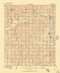 1907 Maud1957 Print · USGSPottawatomie County at the dawn of statehood shows a landscape of emerging rail towns and scattered country schoolhouses. Researchers can trace the early footprints of Maud and Pearson or locate family landmarks like Sacred Heart P O Georgetown and New Paradise School.
 - 1908 Map of Maud
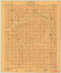 1908 Maud1908 Print · USGSCentral Oklahoma at the time of statehood shows a landscape of emerging rail towns and rural school districts. Genealogists can trace family roots through sites like Sacred Heart P.O. and Maud, or find vanished schoolhouses such as New Paradise School and Antioch Schools.3 unique versions available
 - 1954 Map of Oklahoma City
 1954 Oklahoma City1954 Print · USGSOklahoma City and its surrounding counties are captured here in the early fifties during a period of significant postwar growth. Researchers can trace the development of the Turner Turnpike and locate aviation hubs like Tinker Field or Will Rogers Field.
 - 1957 Map of Oklahoma City, 1969 Print
 1957 Oklahoma City1969 Print · USGSCentral Oklahoma is captured here in a period of significant mid-century growth and industrialization. Researchers can trace family roots through numerous rural markers like Memory Lane Cem, New Hope School, and the sprawling grounds of Tinker Air Force Base.3 unique versions available
 - 1963 Map of Oklahoma City
 1963 Oklahoma City1963 Print · USGSCentral Oklahoma in the early sixties showcases a landscape of rapid suburban growth and established oil production. Researchers can trace historic rail lines like the Chicago Rock Island and Pacific RR or locate rural landmarks such as Mayflower School and Bethel Church.
 - 1972 Map of Maud, 1974 Print
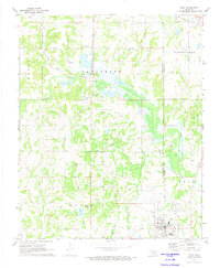 1972 Maud1974 Print · USGSThe Oklahoma oil patch near Maud is captured here in the early seventies as the petroleum and rail economy shaped the border between Pottawatomie and Seminole counties. Researchers can trace the Old Indian Treaty Boundary and locate family burial sites at Union Cems and Fairview Cem.
 - 1972 Map of St. Louis, 1974 Print
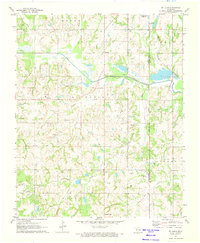 1972 St. Louis1974 Print · USGSCentral Oklahoma's petroleum landscape is captured here in the early seventies, spanning the border of Pottawatomie and Seminole counties. Trace the extensive St Louis Oil Field and find historic sites like Sacred Heart and Collins Cem.2 unique versions available
 - 1985 Map of Shawnee
 1985 Shawnee1985 Print · USGSCentral Oklahoma in the mid-eighties shows a landscape shaped by the North Canadian River and a maturing highway network. Trace family roots and old rail lines through Holdenville, Seminole, and the grounds of St Gregory College.2 unique versions available
End of results
Showing maps 1-8 of 8
Top cities near Maud
- Shawnee historical maps
- Seminole historical maps
- Tecumseh historical maps
- Bethel Acres historical maps
- Konawa historical maps
- Earlsboro historical maps
See more
Frequently asked questions
- What are the different types of historical maps available for Maud?
- What is the oldest map of Maud?
- Where can I purchase historical maps of Maud for my home or office?
- Where can I download high-res historical maps of Maud?
- Are there historical topographic maps available for Maud?
- Is there historical aerial imagery available for Maud?
- Where are historical maps of Maud sourced from?