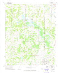
1972 Map of Maud
USGS Topo · Published 1974About this map
The town of Maud sits at the intersection of the Pottawatomie Co Seminole Co line, serving as a focal point for this early 1970s landscape defined by petroleum extraction and ranching. The presence of a massive Tank Farm south of town and the sprawling Oil Field designations throughout the area reveal an economy deeply tied to the land's mineral wealth. Historical land divisions are still prominent, most notably the Old Indian Treaty Boundary that cuts diagonally across the northern sections.
Find a feature on this map
28 named features on this map. Tap any name to fly to it.
Don’t see what you’re looking for? This feature index may not catch every label — zoom into the map to look around manually.
Map Details
Editions of this 1972 Maud Map
This is the sole edition of this map. No revisions or reprints were ever made.
Other maps of this area

1896 · Seminole and Prague
USGS Topo · 1:125,000

1907 · Maud
USGS Topo · 1:62,500

1908 · Maud
USGS Topo · 1:62,500

1909 · Shawnee
USGS Topo · 1:62,500

1954 · Oklahoma City
USGS Topo · 1:250,000

1957 · Oklahoma City
USGS Topo · 1:250,000
1958 · Pearson
USGS Topo · 1:24,000

1963 · Oklahoma City
USGS Topo · 1:250,000

1967 · Prague SW
USGS Topo · 1:24,000
1967 · Shawnee
USGS Topo · 1:24,000