
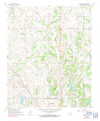
1967 Map of Prague SW
USGS Topo · Published 1968About this map
Seminole and the surrounding Oklahoma oil country are captured here in the mid-1960s, showing a landscape defined by petroleum extraction and rural community hubs. The presence of the North Searight Oil Field, Earlsboro Oil Field, and East Keokuk Oil Field reveals the density of the region's energy economy, with numerous Oil Wells scattered across the terrain. These industrial features contrast with established local institutions like the Prairie Valley Sch, Varnum Sch, and Goodhope Sch, alongside several country churches and family cemeteries.
Find a feature on this map
26 named features on this map. Tap any name to fly to it.
Don’t see what you’re looking for? This feature index may not catch every label — zoom into the map to look around manually.
Map Details
Editions of this 1967 Prague SW Map
2 editions found
Other maps of this area

1896 · Seminole and Prague
USGS Topo · 1:125,000

1907 · Maud
USGS Topo · 1:62,500

1908 · Maud
USGS Topo · 1:62,500

1909 · Shawnee
USGS Topo · 1:62,500

1954 · Oklahoma City
USGS Topo · 1:250,000

1957 · Oklahoma City
USGS Topo · 1:250,000

1963 · Oklahoma City
USGS Topo · 1:250,000
1967 · Earlsboro
USGS Topo · 1:24,000

1967 · Prague NE
USGS Topo · 1:24,000

1967 · Prague SE
USGS Topo · 1:24,000