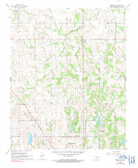
1967 Map of Prague SW
USGS Topo · Published 1991About this map
The oil-rich landscape of Seminole County is defined by extensive drilling operations and established rural communities in the late 1960s. The northern reaches of Seminole anchor the sheet, where the Seminole Municipal Airport and Goodhope Sch sit near the city's corporate boundaries. This area was a productive hub for the energy industry, evidenced by the dense concentration of the North Searight Oil Field, Keokuk Oil Field, and North Earlbsboro Oil Field.
Find a feature on this map
26 named features on this map. Tap any name to fly to it.
Don’t see what you’re looking for? This feature index may not catch every label — zoom into the map to look around manually.
Map Details
Editions of this 1967 Prague SW Map
2 editions found
Other maps of this area

1896 · Seminole and Prague
USGS Topo · 1:125,000

1907 · Maud
USGS Topo · 1:62,500

1908 · Maud
USGS Topo · 1:62,500

1909 · Shawnee
USGS Topo · 1:62,500

1954 · Oklahoma City
USGS Topo · 1:250,000

1957 · Oklahoma City
USGS Topo · 1:250,000

1963 · Oklahoma City
USGS Topo · 1:250,000

1967 · Prague SW
USGS Topo · 1:24,000
1967 · Earlsboro
USGS Topo · 1:24,000

1967 · Prague NE
USGS Topo · 1:24,000