2020s Maps of Webbers Falls, Oklahoma
Explore 3 historic maps of Webbers Falls from the 2020s. These maps offer a rare glimpse into what life looked like during the 2020s — showing old roads, neighborhoods, homes, and landmarks that have changed or disappeared over time.
Whether you're researching your family's past, planning a metal detecting trip, or studying how Webbers Falls's landscape evolved across the 2020s, these high-resolution maps are a powerful tool for exploring the history of this region.
- Focus on a specific era: All maps on this page are from the 2020s, giving you a focused view of this time period.
- See what’s changed: Compare century-old streets, trails, and buildings to today's modern landscape using overlays and satellite layers.
- Research with precision: Use these maps for genealogy, historical research, land use analysis, or educational projects.
- View, download, or print: Maps are fully viewable online in high resolution, and can be downloaded or printed for your own records.
Start exploring Webbers Falls's history through authentic maps from the 2020s. This is your window into the past.
Webbers Falls, OK maps
(3)- 2022 Map of Webbers Falls, 2022 Print
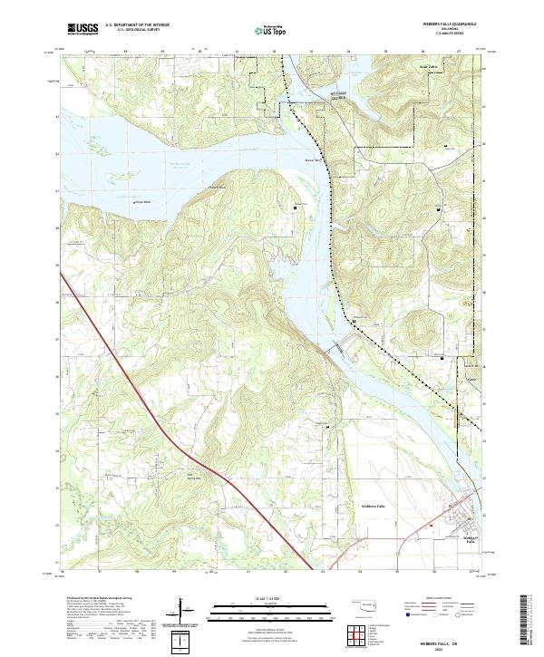 2022 Webbers Falls2022 Print · USGSThe Arkansas River corridor near the Muskogee and Sequoyah county line is documented here in the early twenty-first century. History seekers can trace the river landings and local settlements of Webbers Falls, Gore, and Sour John.
 - 2022 Map of Gore, 2022 Print
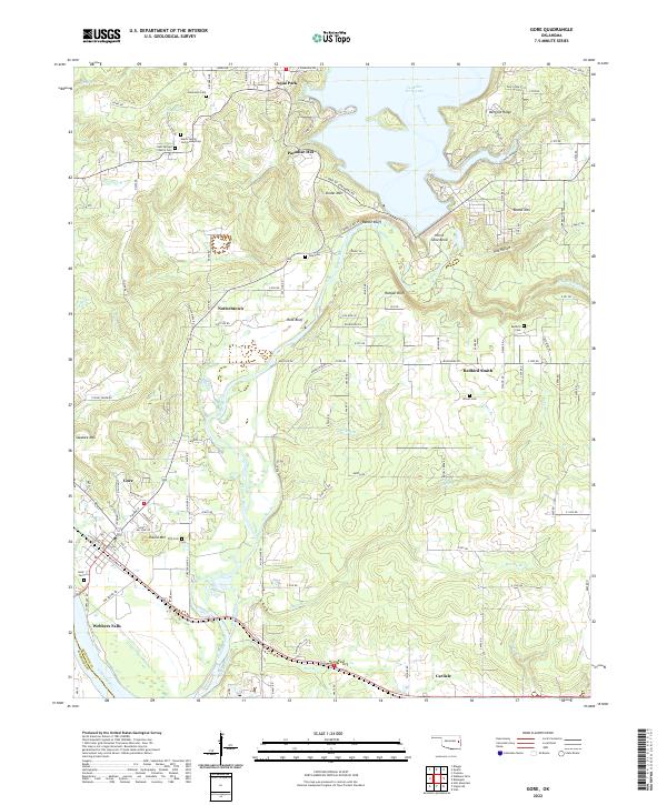 2022 Gore2022 Print · USGSThe Illinois and Arkansas Rivers meet here in the 2020s, a landscape defined by Cherokee history and the Tenkiller Ferry Lake dam. Researchers can trace family roots at Redbird Cem, the Gates Family Cem Gumsprings, or the community of Redbird Smith.
 - 2022 Map of Holt Mountain, 2022 Print
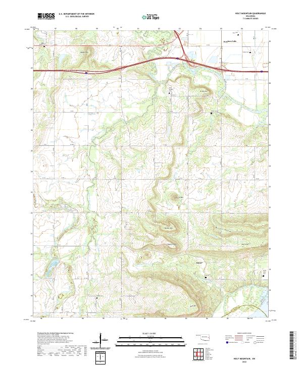 2022 Holt Mountain2022 Print · USGSEastern Oklahoma near the border of Muskogee and Haskell Counties comes into focus in this recent survey. Researchers can trace family history through a high concentration of cemeteries including Snake Girty Cem and Toney Cem near the settlement of Simms.
End of results
Showing maps 1-3 of 3
Top cities near Webbers Falls
- Muskogee historical maps
- Vian historical maps
- Vian historical maps
- Warner historical maps
- Gore historical maps
- Porum historical maps
See more
Frequently asked questions
- What are the different types of historical maps available for Webbers Falls?
- What is the oldest map of Webbers Falls?
- Where can I purchase historical maps of Webbers Falls for my home or office?
- Where can I download high-res historical maps of Webbers Falls?
- Are there historical topographic maps available for Webbers Falls?
- Is there historical aerial imagery available for Webbers Falls?
- Where are historical maps of Webbers Falls sourced from?