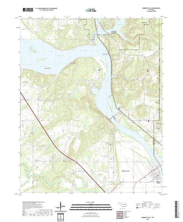
2022 Map of Webbers Falls
USGS Topo · Published 2022About this map
Webbers Falls occupies a historic position along the Arkansas River, serving as a focal point for settlement and river commerce in this portion of Oklahoma. The river landscape is characterized by prominent bends and bluffs, where the waterway transitions through a series of significant curves that have long dictated the placement of local roads and communities. To the northeast, the small settlement of Gore sits near the confluence of local tributaries, while the area labeled Sour John identifies a specific landing or locality further upstream. The map illustrates a landscape defined by the interplay between the broad river channel and the rising terrain of the surrounding valley, reflecting the enduring importance of this waterway to the regional geographic identity.
Find a feature on this map
3 named features on this map. Tap any name to fly to it.
Don’t see what you’re looking for? This feature index may not catch every label — zoom into the map to look around manually.
Map Details
Editions of this 2022 Webbers Falls Map
This is the sole edition of this map. No revisions or reprints were ever made.
Other maps of this area

1900 · Sansbois
USGS Topo · 1:125,000

1901 · Muscogee
USGS Topo · 1:125,000

1905 · Muscogee
USGS Topo · 1:125,000

1909 · Sans Bois
USGS Topo · 1:125,000

1911 · Sansbois
USGS Topo · 1:125,000

1946 · Fort Smith
USGS Topo · 1:250,000

1948 · Keefeton
USGS Topo · 1:62,500

1948 · Webbers Falls
USGS Topo · 1:62,500

1950 · Keefeton
USGS Topo · 1:62,500

1950 · Webbers Falls
USGS Topo · 1:62,500