
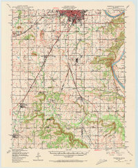
1948 Map of Keefeton
USGS Topo · Published 1963About this map
The Arkansas River serves as a prominent natural boundary on this 1940s landscape, bordering the rugged rise of Brushy Mtn. The region is defined by a dense network of early 20th-century railroads, including the St Louis San Francisco, the Midland Valley, and the Kansas Oklahoma and Gulf. These lines connected small agricultural and industrial hubs like Summit, Oktaha, and Rentiesville.
Find a feature on this map
67 named features on this map. Tap any name to fly to it.
Don’t see what you’re looking for? This feature index may not catch every label — zoom into the map to look around manually.
Map Details
Editions of this 1948 Keefeton Map
2 editions found
Other maps of this area

1896 · Okmulgee
USGS Topo · 1:125,000

1900 · Sansbois
USGS Topo · 1:125,000

1900 · Canadian
USGS Topo · 1:125,000

1900 · Okmulgee
USGS Topo · 1:125,000

1901 · Muscogee
USGS Topo · 1:125,000

1905 · Muscogee
USGS Topo · 1:125,000

1909 · Sans Bois
USGS Topo · 1:125,000

1911 · Sansbois
USGS Topo · 1:125,000

1946 · Fort Smith
USGS Topo · 1:250,000

1948 · Hulbert
USGS Topo · 1:62,500