1970s Maps of Okfuskee County, Oklahoma
Explore 11 historic maps of Okfuskee County from the 1970s. These maps offer a rare glimpse into what life looked like during the 1970s — showing old roads, neighborhoods, homes, and landmarks that have changed or disappeared over time.
Whether you're researching your family's past, planning a metal detecting trip, or studying how Okfuskee County's landscape evolved across the 1970s, these high-resolution maps are a powerful tool for exploring the history of this region.
- Focus on a specific era: All maps on this page are from the 1970s, giving you a focused view of this time period.
- See what’s changed: Compare century-old streets, trails, and buildings to today's modern landscape using overlays and satellite layers.
- Research with precision: Use these maps for genealogy, historical research, land use analysis, or educational projects.
- View, download, or print: Maps are fully viewable online in high resolution, and can be downloaded or printed for your own records.
Start exploring Okfuskee County's history through authentic maps from the 1970s. This is your window into the past.
Okfuskee County, OK maps
(11)- 1973 Map of Nuyaka, 1975 Print
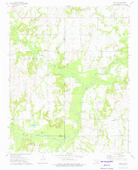 1973 Nuyaka1975 Print · USGSThe Creek County and Okmulgee County line in the early 1970s reveals a landscape of active oil production and small rural settlements. Researchers can locate Tuskegee Cem, the Old Railroad Grade, and the quiet crossroads of Nuyaka.
 - 1973 Map of Newby, 1975 Print
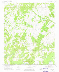 1973 Newby1975 Print · USGSCreek and Okfuskee Counties are captured here in the early seventies during a period of active petroleum extraction. Researchers can trace family sites like Wilson Cem or the industrial footprint of the Newby Oil Field and the Old RR Grade.
 - 1973 Map of Okfuskee, 1975 Print
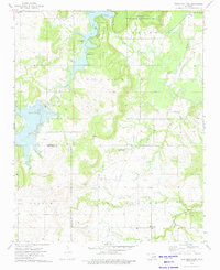
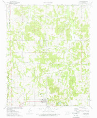
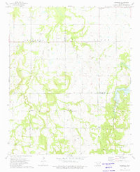 1973 Okfuskee1975 Print · USGSOklahoma's petroleum and mission history intersect in the 1970s at the boundary of Okfuskee and Okmulgee counties. Genealogists and historians can locate family landmarks like Nuyaka Mission Ch, the Okfuskee Cem, and early settlements such as Oriental.
 - 1973 Map of Gypsy, 1975 Print
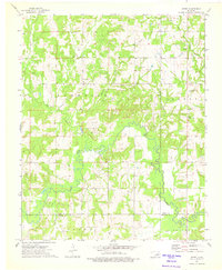 1973 Gypsy1975 Print · USGSThe Creek and Okfuskee county borderlands are shown in the early seventies, dominated by the active petroleum industry. Researchers can trace rural community life through the Bucktrot Cem, Gypsy Ch, and the winding banks of the Deep Fork river.
 - 1973 Map of Okmulgee Lake, 1976 Print
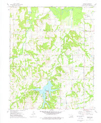
 1973 Okmulgee Lake1976 Print · USGSOkmulgee County in the early 1970s reveals a landscape where expansive state recreation areas and game management lands intersect with an active oil industry. Genealogists and local historians can trace rural roots through Honey Creek Ch and several burial grounds, including Indian Cem and Edwards Cem.
 - 1973 Map of Welty, 1976 Print
 1973 Welty1976 Print · USGSOkfuskee County's rural oil country comes into focus in the early 1970s, showcasing a landscape of scattered family farms and energy extraction. Researchers can trace local history through dozens of landmarks like Welty Cem, Chilesville, and the Old RR Grade.
 - 1973 Map of Mason, 1976 Print
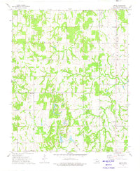
 1973 Mason1976 Print · USGSOkfuskee County in the early seventies is a landscape defined by the energy industry and the quiet development of Okemah Lake. Genealogists and researchers can trace local roots through sites like Haydenville, Montezuma Camp, and the White Rose Cem.
 - 1974 Map of Ritts Junction, 1977 Print
 1974 Ritts Junction1977 Print · USGSThe area surrounding Ritts Junction is shown in the mid-seventies, defined by the winding Deep Fork and a heavy industrial footprint. Genealogists can locate family-named sites like Hosey Cem and Big Pond Cem or the Little Creek Ch near the rail line.
 - 1974 Map of Paden, 1977 Print
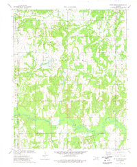
 1974 Paden1977 Print · USGSIn the mid-1970s, the Paden area was a landscape of oil fields and quiet country churches. Researchers can trace the path of the Old RR Grade and locate family history at Oakdale Cem and Micawber Cem.
 - 1978 Map of Eufaula, 1979 Print
 1978 Eufaula1979 Print · USGSEastern Oklahoma in the late seventies is defined by the sprawling waters of Eufaula Lake and the dense timber of the Sans Bois Mountains. Genealogists and historians can trace the development of towns like Checotah and Stigler or locate legacy sites like the Old R R Grade and Robbers Cave State Park.
 - 1978 Map of Fort Smith, 1979 Print
 1978 Fort Smith1979 Print · USGSThe Arkansas-Oklahoma borderlands in the late seventies show a landscape shaped by massive river reservoirs and sprawling military reservations. Trace the historic rail lines of the Missouri Pacific RR and locate regional landmarks like Fort Gibson, Tenkiller Ferry Lake, and Barling.2 unique versions available
End of results
Showing maps 1-11 of 11
Top cities of Okfuskee County
- Okemah historical maps
- Boley historical maps
- Weleetka historical maps
- Paden historical maps
- Bearden historical maps
- Castle historical maps
See more
Frequently asked questions
- What are the different types of historical maps available for Okfuskee County?
- What is the oldest map of Okfuskee County?
- Where can I purchase historical maps of Okfuskee County for my home or office?
- Where can I download high-res historical maps of Okfuskee County?
- Are there historical topographic maps available for Okfuskee County?
- Is there historical aerial imagery available for Okfuskee County?
- Where are historical maps of Okfuskee County sourced from?