Old Maps of Okfuskee County, Oklahoma for Hiking & Exploration
Hike through history with 136 historic maps of Okfuskee County. Explore old trails, ghost towns, and forgotten backroads — perfect for outdoor adventurers and local explorers.
- Rediscover forgotten places: Map out old mining camps, roads, and footpaths that no longer exist on modern maps.
- Layer with modern tools: Combine with LiDAR or satellite views to plan hikes through historical terrain.
- Made for exploration: Popular among hikers, overlanders, and local history lovers.
Use these maps to find adventure and explore the hidden past of Okfuskee County.
Okfuskee County, OK maps
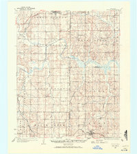
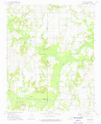
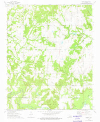
(136)- 1896 Map of Seminole and Prague
 1896 Seminole and Prague1896 Print · USGSOklahoma Territory and tribal nations meet in the mid-1890s along the North Fork Canadian River. Researchers can trace early tribal boundaries and find vanished locations like Mekosukey, Heliswa, and the Seminole Creek Nation Boundary.
 - 1900 Map of Canadian
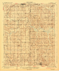
 1900 Canadian1900 Print · USGSIndian Territory at the turn of the century shows a landscape of tribal nations and developing rail towns along the CANADIAN RIVER. Genealogists and historians can trace early settlements like Fishertown and Indianola or the original Creek Nation Choctaw Nation Boundary Line.6 unique versions available
 - 1900 Map of Wewoka
 1900 Wewoka1900 Print · USGSIndian Territory at the turn of the century shows a landscape defined by tribal nations and the early expansion of the railway. Genealogists can trace family homesteads near Wewoka and Holdenville, or locate remote landmarks like Marks Store and the Baptist Mission.4 unique versions available
 - 1901 Map of Nuyaka
 1901 Nuyaka1901 Print · USGSIndian Territory within the Creek Nation was undergoing rapid change in the late 19th century as railroads connected once-remote outposts. Researchers can trace early settlements and schools like Nuyaka Mission, Bristow, and the crossroads at Smiths Store before Oklahoma reached statehood.4 unique versions available
 - 1929 Map of Stroud, 1972 Print
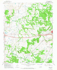
 1929 Stroud1972 Print · USGSCentral Oklahoma is captured here in the late twenties, showing the intersection of early highway travel and deep-rooted rural communities. Researchers can trace historic schools and rail lines, including the Sac and Fox Sch, Paden, and the legendary Highway No 66.
 - 1932 Map of Stroud
 1932 Stroud1932 Print · USGSCentral Oklahoma at the start of the 1930s reveals a landscape shaped by former territorial boundaries and a dense network of rural schools. Genealogists and historians can trace family roots through landmarks like Sac and Fox Sch, Arlington, and the many country schools such as Pettiquah Sch.2 unique versions available
 - 1946 Map of Fort Smith
 1946 Fort Smith1946 Print · USGSThe Arkansas-Oklahoma borderlands appear here in the mid-forties, as new reservoirs began to transform the river valleys. Genealogists and historians can trace rail-served towns from Muskogee to Fort Smith and locate landmarks like Camp Chaffee.
 - 1954 Map of Oklahoma City
 1954 Oklahoma City1954 Print · USGSOklahoma City and its surrounding counties are captured here in the early fifties during a period of significant postwar growth. Researchers can trace the development of the Turner Turnpike and locate aviation hubs like Tinker Field or Will Rogers Field.
 - 1957 Map of Oklahoma City, 1969 Print
 1957 Oklahoma City1969 Print · USGSCentral Oklahoma is captured here in a period of significant mid-century growth and industrialization. Researchers can trace family roots through numerous rural markers like Memory Lane Cem, New Hope School, and the sprawling grounds of Tinker Air Force Base.3 unique versions available
 - 1962 Map of Henryetta, 1963 Print
 1962 Henryetta1963 Print · USGSHenryetta and its surrounding rail junctions are captured here in the early sixties as the landscape prepared for the creation of Eufaula Reservoir. Researchers can trace historic industrial sites like the Smelter and small communities such as Spelter City, Dewar, and Kusa.4 unique versions available
 - 1962 Map of Henryetta SW, 1963 Print
 1962 Henryetta SW1963 Print · USGSThe North Canadian River valley near the McIntosh and Okfuskee county lines comes alive in this early sixties survey. Local historians can trace family-named landmarks and tribal community centers like Yardeka Ch, Ryals Sch, and the Hickory Ground No 1 Ch.2 unique versions available
 - 1963 Map of Oklahoma City
 1963 Oklahoma City1963 Print · USGSCentral Oklahoma in the early sixties showcases a landscape of rapid suburban growth and established oil production. Researchers can trace historic rail lines like the Chicago Rock Island and Pacific RR or locate rural landmarks such as Mayflower School and Bethel Church.
 - 1965 Map of Fort Smith
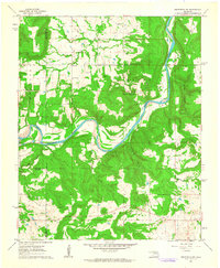
 1965 Fort Smith1965 Print · USGSEastern Oklahoma and Western Arkansas are captured here during a period of massive post-war change as new reservoirs reshaped the river valleys. Genealogists and historians can trace the rail networks of the Midland Valley RR and find established communities like Stilwell, Sallisaw, and Stigler.
 - 1967 Map of Fort Smith
 1967 Fort Smith1967 Print · USGSThe Arkansas River valley and the foothills of the Ozarks are captured here during a period of significant military and industrial activity. Researchers can trace the sprawling bounds of Camp Chaffee and Camp Gruber or locate vanished rail stops along the Midland Valley RR.
 - 1967 Map of Pharoah, 1968 Print
 1967 Pharoah1968 Print · USGSThe Oklahoma oil fields west of Henryetta are captured here during the late sixties, showcasing a landscape defined by petroleum extraction and rail transport. Genealogists can trace family locations through numerous sites like West Lawn Cemetery, Arbeka Ch, and the settlement at Pharoah.2 unique versions available
 - 1967 Map of Cromwell, 1968 Print
 1967 Cromwell1968 Print · USGSMid-century Oklahoma energy production and rural community life meet in this 1960s survey of the Seminole County borderlands. Genealogists and historians can locate the Childrens Home, Quarsarty Ch, and legacy family sites at Bearden Cem or Butner.
 - 1967 Map of Prague NE, 1968 Print
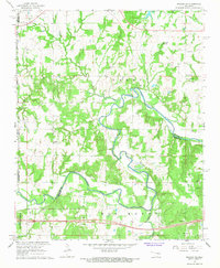 1967 Prague NE1968 Print · USGSOkfuskee and Seminole counties meet along the winding river loops of central Oklahoma in the late sixties. Genealogists and local historians can locate rural landmarks such as Vanzant Ch, Shady Grove Cem, and the prominent Red Mound.
 - 1967 Map of Okemah SE, 1968 Print
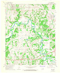
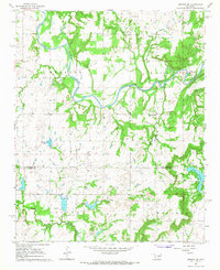 1967 Okemah SE1968 Print · USGSOklahoma's petroleum landscape is captured here in the late sixties along the North Canadian River. Genealogists and historians can trace rural landmarks like the Lone Star Sch, Thlopthlocco Ch, and the Papoose Oil Field.2 unique versions available
 - 1967 Map of Weleetka, 1968 Print
 1967 Weleetka1968 Print · USGSIn the heart of the Sooner State during the late sixties, this area shows a landscape defined by the winding North Canadian River and an active petroleum industry. Genealogists and historians can trace early community life through North Fork Cem, Alabama Ch, and the St Louis-San Francisco rail corridor.2 unique versions available
 - 1967 Map of Okemah, 1968 Print
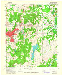
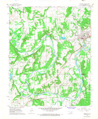
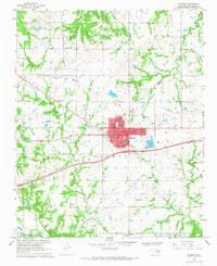 1967 Okemah1968 Print · USGSOkemah and the surrounding oil fields are captured here in the late sixties, showcasing the area's industrial footprint and civic layout. Researchers can locate family landmarks like Highland Cemetery, Buckeye Church, and the Lincoln School.2 unique versions available
 - 1967 Map of Boley, 1968 Print
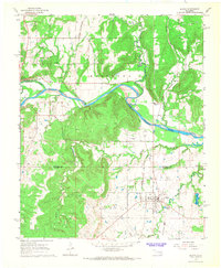
 1967 Boley1968 Print · USGSThe Oklahoma landscape near Boley and Castle is captured here in the late sixties as the winding North Canadian River defines the rural boundaries. Genealogists can trace local roots through numerous country landmarks like St Emmanuel Ch, Boley Cem, and the Sand Creek Sch.2 unique versions available
 - 1967 Map of Clearview, 1968 Print
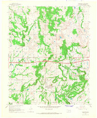 1967 Clearview1968 Print · USGSClearview and the surrounding Okfuskee County oil patches are documented here during the late sixties. Genealogists and industrial historians can trace the Old Railroad Grade and locate local sites like Creek Chapel and the Deaner Oil Field.2 unique versions available
 - 1967 Map of Dustin, 1968 Print
 1967 Dustin1968 Print · USGSThe rail-and-river landscape near the Hughes County line comes to life in the late 1960s as a hub for the region's energy industry. Trace the heritage of local families at Mosewiley Cemetery or follow the Old Railroad Grade near Dustin.3 unique versions available
 - 1973 Map of Nuyaka, 1975 Print
 1973 Nuyaka1975 Print · USGSThe Creek County and Okmulgee County line in the early 1970s reveals a landscape of active oil production and small rural settlements. Researchers can locate Tuskegee Cem, the Old Railroad Grade, and the quiet crossroads of Nuyaka.
 - 1973 Map of Newby, 1975 Print
 1973 Newby1975 Print · USGSCreek and Okfuskee Counties are captured here in the early seventies during a period of active petroleum extraction. Researchers can trace family sites like Wilson Cem or the industrial footprint of the Newby Oil Field and the Old RR Grade.
Showing maps 1-25 of 136
Top cities of Okfuskee County
- Okemah historical maps
- Boley historical maps
- Weleetka historical maps
- Paden historical maps
- Bearden historical maps
- Castle historical maps
See more
Frequently asked questions
- What are the different types of historical maps available for Okfuskee County?
- What is the oldest map of Okfuskee County?
- Where can I purchase historical maps of Okfuskee County for my home or office?
- Where can I download high-res historical maps of Okfuskee County?
- Are there historical topographic maps available for Okfuskee County?
- Is there historical aerial imagery available for Okfuskee County?
- Where are historical maps of Okfuskee County sourced from?