Old Maps of Strohm, Oklahoma for Genealogy
Trace your family roots with 10 historic maps of Strohm. These high-res maps reveal old neighborhoods, homesites, landmarks, and streets — helping you uncover where your ancestors lived and how the area evolved over time.
- Explore historic neighborhoods: Identify where your relatives may have lived in the 1800s or 1900s.
- Compare maps over time: Trace the changes in streets, buildings, and landmarks for multi-generational research.
- Perfect for genealogy & ancestry research: Used by family historians and researchers to map out lineage and migration.
These maps are an incredible resource for exploring your personal connection to Strohm's past.
Strohm, OK maps
(10)- 1932 Map of Fairfax
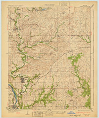 1932 Fairfax1932 Print · USGSOsage County is shown at the height of its oil-era development in the early thirties. Local historians can trace the industrial footprint of Carter Nine, find rural landmarks like St Johns Sch, and follow the Atchison Topeka and Santa Fe rail line.4 unique versions available
 - 1955 Map of Enid, 1966 Print
 1955 Enid1966 Print · USGSNorth-central Oklahoma's transition from open plains to the blackjack hills of the Osage Indian Reservation is captured in the mid-1950s. Researchers can trace the development of the Naval Reserve Oil Field, the grounds of Vance AFB, and the early footprints of Tulsa and Stillwater.4 unique versions available
 - 1958 Map of Enid
 1958 Enid1958 Print · USGSNorthern Oklahoma is mapped here in the late fifties, showcasing a dense network of petroleum production and historic tribal lands. Researchers can trace the legacy of the Osage Indian Reservation, early energy hubs like the Cushing Oil Field, and the Chilocco Indian Agricultural School.2 unique versions available
 - 1978 Map of Baconrind Creek
 1978 Baconrind Creek1978 Print · USGSOsage Indian Reservation land is shown here in the late 1970s, characterized by its deep ties to the petroleum industry. Researchers can trace the layout of the Fairfield Oil Field and locate landmarks like the T-Apple Ranch and Baconrind Creek.
 - 1985 Map of Pawhuska, 1986 Print
 1985 Pawhuska1986 Print · USGSThe Osage Indian Reservation and its tribal capital at Pawhuska are seen here in the mid-1980s as the region's ranching and oil legacies matured. Genealogists and historians can trace family-named sites and vanished industrial tracks near Bigheart, Wynona, and Gray Horse.2 unique versions available
 - 2009 Map of Baconrind Creek, 2009 Print
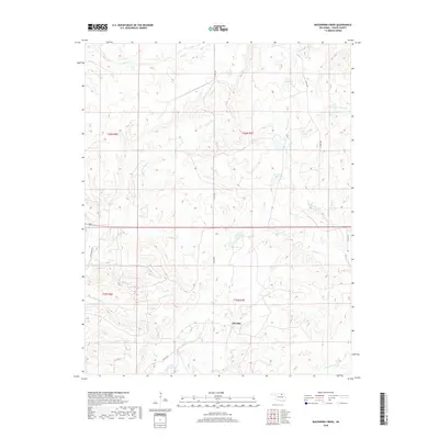
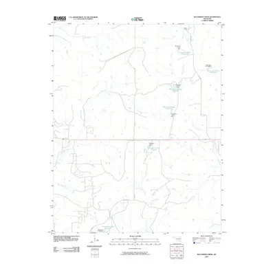 2009 Baconrind Creek2009 Print · USGSCovers Strohm, including Osage County, United States, and other nearby areas
 - 2012 Map of Baconrind Creek, 2012 Print
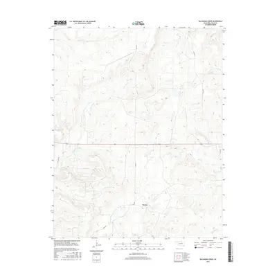
 2012 Baconrind Creek2012 Print · USGSCovers Strohm, including Osage County, United States, and other nearby areas
 - 2016 Map of Baconrind Creek, 2016 Print
 2016 Baconrind Creek2016 Print · USGSCovers Strohm, including Osage County, United States, and other nearby areas
 - 2018 Map of Baconrind Creek, 2018 Print
 2018 Baconrind Creek2018 Print · USGSCovers Strohm, including Osage County, United States, and other nearby areas
 - 2022 Map of Baconrind Creek, 2022 Print
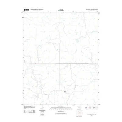
 2022 Baconrind Creek2022 Print · USGSOsage County's ranching landscape is documented here in the early twenty-first century, centered on the rural settlement of Strohm. Researchers can trace the winding paths of Baconrind Cr and Wild Horse Cr across several historic township boundaries.
End of results
Showing maps 1-10 of 10
Top cities near Strohm
- Pawhuska historical maps
- Hominy historical maps
- Fairfax historical maps
- Wynona historical maps
- Shidler historical maps
- Ralston historical maps
See more
Frequently asked questions
- What are the different types of historical maps available for Strohm?
- What is the oldest map of Strohm?
- Where can I purchase historical maps of Strohm for my home or office?
- Where can I download high-res historical maps of Strohm?
- Are there historical topographic maps available for Strohm?
- Is there historical aerial imagery available for Strohm?
- Where are historical maps of Strohm sourced from?