1950s Maps of Pontotoc County, Oklahoma
Explore 9 historic maps of Pontotoc County from the 1950s. These maps offer a rare glimpse into what life looked like during the 1950s — showing old roads, neighborhoods, homes, and landmarks that have changed or disappeared over time.
Whether you're researching your family's past, planning a metal detecting trip, or studying how Pontotoc County's landscape evolved across the 1950s, these high-resolution maps are a powerful tool for exploring the history of this region.
- Focus on a specific era: All maps on this page are from the 1950s, giving you a focused view of this time period.
- See what’s changed: Compare century-old streets, trails, and buildings to today's modern landscape using overlays and satellite layers.
- Research with precision: Use these maps for genealogy, historical research, land use analysis, or educational projects.
- View, download, or print: Maps are fully viewable online in high resolution, and can be downloaded or printed for your own records.
Start exploring Pontotoc County's history through authentic maps from the 1950s. This is your window into the past.
Pontotoc County, OK maps
(9)- 1957 Map of Stonewall, 1959 Print
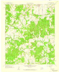
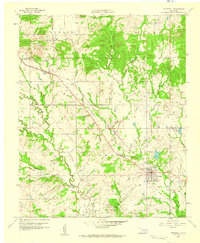 1957 Stonewall1959 Print · USGSThe town of Stonewall and the surrounding Pontotoc County landscape are documented here in the late fifties during a period of steady growth. Researchers can trace family sites at Highland Cem or locate rural landmarks like Ahloso Sch and the Fish Hatchery.2 unique versions available
 - 1957 Map of Ardmore, 1968 Print
 1957 Ardmore1968 Print · USGSSouth-central Oklahoma in the late fifties was a landscape of rising reservoir waters and expanding rail lines. Genealogists and historians can trace the foundations of Ardmore and Duncan or locate early recreation sites at Platt National Park and Lake Murray State Park.3 unique versions available
 - 1958 Map of Sasakwa, 1959 Print
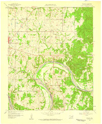
 1958 Sasakwa1959 Print · USGSThe borderlands of Seminole and Pontotoc counties are captured here in the late fifties, defined by the winding Canadian River and the St Louis San Francisco railroad. Researchers can locate many family-named landmarks and historical sites like Old Mission Cem, Gully Sch, and Sasakwa.3 unique versions available
 - 1958 Map of Lula, 1959 Print
 1958 Lula1959 Print · USGSCoal County prairie life in the late fifties centered on small rail-side settlements and rural parishes. Family historians can trace church communities at Rocky Point Ch and locate burial sites like Lula Cem along the Kansas Oklahoma and Gulf line.3 unique versions available
 - 1958 Map of Francis, 1959 Print
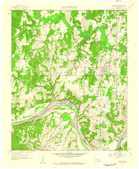
 1958 Francis1959 Print · USGSOklahoma's petroleum and rail history intersect here in the late fifties, centered on the railroad hub at Francis. Genealogists and local historians can trace family roots through numerous sites like Oakman Cem, Lovelady Ch, and Homer.3 unique versions available
 - 1958 Map of Steedman, 1959 Print
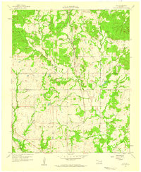
 1958 Steedman1959 Print · USGSPontotoc and Hughes counties appear here in the late fifties as a landscape of oil production and quiet rural communities. Researchers can trace the Old Indian Boundary and locate family landmarks like Black Rock Cem and Dawson Chapel.2 unique versions available
 - 1958 Map of Ada, 1959 Print
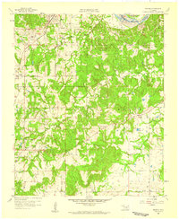
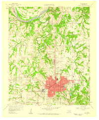 1958 Ada1959 Print · USGSOklahoma’s Pontotoc County in the late fifties shows the city of Ada as a bustling junction for three major railroads. Researchers can find numerous local institutions, from East Central State College to rural landmarks like Egypt Cemetery and Latta Sch.6 unique versions available
 - 1958 Map of Vamoosa, 1959 Print
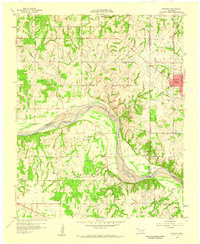
 1958 Vamoosa1959 Print · USGSSeminole and Pontotoc Counties are captured here in the late fifties, showing a rural landscape defined by the Canadian River. Genealogists can trace family history through sites like Tiger Cem, Konawa, and the Summers Chapel Sch.4 unique versions available
 - 1958 Map of Konawa, 1959 Print
 1958 Konawa1959 Print · USGSCentrally located in Oklahoma during the late fifties, this area showcases the intersection of oil exploration and rural settlement. Genealogists can trace family roots through sites like Sacred Heart, Antioch Ch, and the Vista Cem.3 unique versions available
End of results
Showing maps 1-9 of 9
Top cities of Pontotoc County
- Ada historical maps
- Byng historical maps
- Roff historical maps
- Stonewall historical maps
- Francis historical maps
- Fitzhugh historical maps
Frequently asked questions
- What are the different types of historical maps available for Pontotoc County?
- What is the oldest map of Pontotoc County?
- Where can I purchase historical maps of Pontotoc County for my home or office?
- Where can I download high-res historical maps of Pontotoc County?
- Are there historical topographic maps available for Pontotoc County?
- Is there historical aerial imagery available for Pontotoc County?
- Where are historical maps of Pontotoc County sourced from?